


Category: Conference Interviews
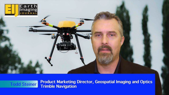
Trimble Expands UAS Fleet with Multirotor and High-Precision Systems
2.54K Views0 Comments0 Likes
The V1 Video team spoke to Todd Steiner, product marketing director for Trimble’s geospatial imaging and optics products (including UAVs). We talked about the new Trimble ZX5 multirotor system, which is complementary to the fixed-wing UAVs. Their new Trimble UX5-HP introduces a high-precision RTK system with reduced need for ground control.

Geospatial as an Integral Part of Information Management
2.53K Views0 Comments0 Likes
The V1 Video team interviewed Fred C. Collins, Ph.D., Distinguished Engineer and Bluemix Evangelist at IBM, at the ENVI Analytics Symposium in Boulder, Colo. Bluemix is the company’s platform-as-a-service that supports geospatial as a key component of the architecture. We spoke about the growing awareness and reliance on geospatial capabilities for data management and analysis, and the flexibility of the Bluemix cloud-based tools that can be extended with hundreds of services.
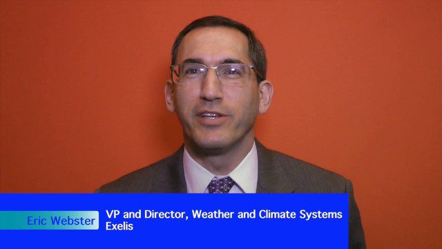
Weather-Observation Gap Over Middle East Causes Consternation
2.52K Views0 Comments0 Likes
Exelis makes the majority of the weather and climate instruments for the U.S. government as well as Japan and Korea, including those that monitor greenhouse gases. Earth Imaging Journal spoke with Eric Webster, vice president and director for weather and climate systems at Exelis. His team has been working with the U.S. Air Force to study weather capabilities over Centcom (the Middle East and the Indian Ocean) that have been provided by a European weather satellite. The other weather instruments are owned by Russia and China, so there’s some concern about the source of this sensing going forward.

Adapting Thermal Sensors for the Small-UAS Market
2.50K Views0 Comments0 Likes
The V1 Video team spoke to Bruce Cumming, marketing director for emerging products at FLIR Systems, about the company’s legacy of thermal infrared imaging and its use on unmanned aircraft systems. Thermography has been used in commercial workflows for building inspection, oil and gas, electric utilities, solar energy, and more. The flexibility of UAS aerial platforms has the potential to greatly expand accessibility to thermographic insight.
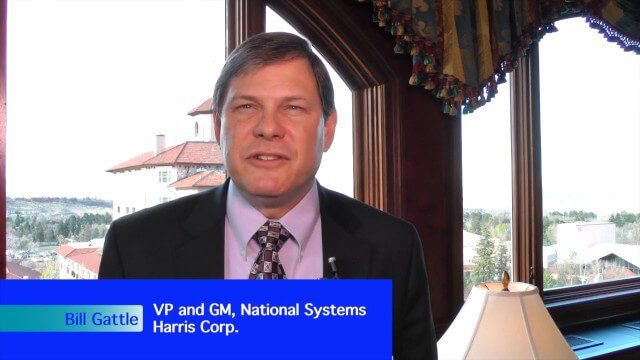
Harris Tracks and Responds to Earth Observing Transformations
2.49K Views0 Comments0 Likes
Earth Imaging Journal spoke with Bill Gattle, vice president and general manager of national systems at Harris, with responsibility for space and intel business (commercial and government) as well as geospatial, imagery and Earth-observing technologies. We spoke about sensing, processing and providing actionable information to the marketplace. The accessibility of space, commercialization of sensors and high-powered analytics is transforming the market and expanding the applications and insights.

2017 Be Inspired Awards Project Highlights
2.47K Views0 Comments0 Likes
Several members of the Bentley Systems team discuss the Be Inspired Awards projects from the 2017 Year In Infrastructure event held Oct. 10-12, 2017, in Singapore.

App Aids Satellite Imaging Awareness
2.46K Views0 Comments0 Likes
The V1 Video team interviewed Alex Herz, president of Orbit Logic, at the GEOINT Symposium in Washington, D.C. We talked about the company’s satellite imagery planning and scheduling capabilities as well as its new foray into apps to make satellite imagery more accessible to everyone. The SpyMeSat mobile application lets smartphone users know when imaging satellites are overhead, what their capabilities are, and has recently added tasking so users can order images directly from their phones.
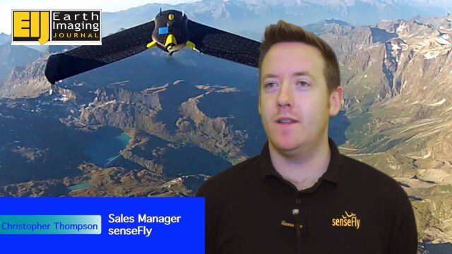
Getting Accurate Results Quickly and Cheaply with Unmanned Aircraft
2.44K Views0 Comments0 Likes
The V1 Video team spoke to Christopher Thompson, the sales manager for senseFly, the manufacturers of fixed-wing and rotary unmanned aircraft systems (UASs) for mapping. We talked about the broad range of applications and some interesting case studies. We also touched on the inspection capabilities of their new eXom rotary platform.

Trimble Dimensions Interview: Matt Delano
2.44K Views0 Comments0 Likes
At Trimble Dimensions 2014 in Las Vegas, V1 Media's Todd Danielson interviews Matt Delano, Business Director, Land Administration, Trimble. They discuss Trimble's overall Land Administration goals and strategy; how a variety of hardware, tools and services are combined to serve the Land Administration market; how personal computing devices are affecting data collection and use; Trimble's embrace of BIM technology; and more.

Airbus Defence and Space Brings Laser Communications to Earth Observation
2.42K Views0 Comments0 Likes
Earth Imaging Journal spoke with Jörg Herrmann, head of business development for the EDRS SpaceDataHighway Programme at Airbus Defence and Space, at the recent International Space Symposium. This laser-based data-relay system provides high-speed, near-real-time data transfer for Low Earth Orbit (LEO) satellites and airborne (unmanned/manned) platforms (UAS).


