


Category: Conference Interviews

Doug Smith Interview (Avenza Systems)
3.07K Views0 Comments0 Likes
Todd Danielson interviews Doug Smith, Director, Sales & Marketing, Avenza Systems, at the GEOINT Symposium in Tampa, Florida. They discuss Avenza's key products, including MAPublisher, Geographic Imager and its new PDF Maps app. All the products work with Adobe products for increased design functionality while maintaing location integrity.
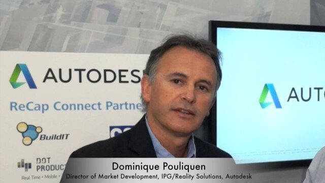
Dominique Pouliquen Interview (Autodesk)
3.73K Views0 Comments0 Likes
Matt Ball interviews Dominique Pouliquen, Director of Market Development, IPG/Reality Solutions, Autodesk, at SPAR International in Colorado Springs, Colo. They discuss reality computing, the scanning workflow, ReCap Connect, the new RCS format for point clouds, how plug-ins and Web APIs can help customers, and more.
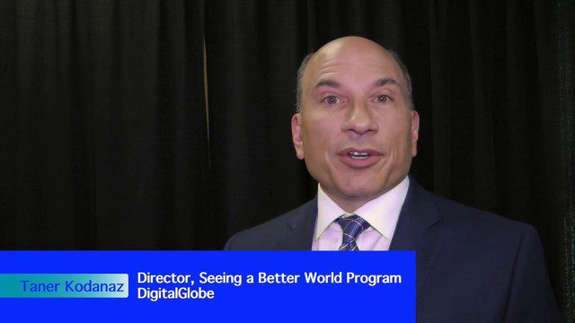
DigitalGlobe’s Seeing a Better World Program Focuses on Outcomes
3.32K Views0 Comments0 Likes
DigitalGlobe has expanded upon its theme of "Seeing a Better World," with a new program that focuses on themes aligned to the United Nations sustainable development objectives. Speaking with V1 Media, Taner Kodanaz, Director of DigitalGlobe's Seeing a Better World Program, describes how the company is leveraging its own imagery to provide greater context and outcome-oriented solutions around food and nutrition security, infrastructure development, sustainability, and human rights.
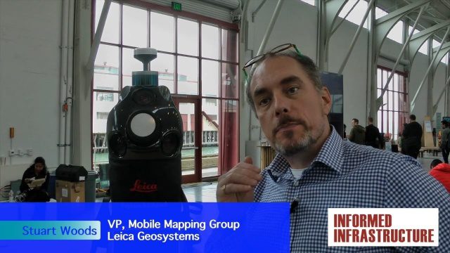
Digital Surveying Improves with Mobility and Multiple Sensors
3.50K Views0 Comments0 Likes
The V1 Video team interviewed Stuart Woods, VP, Mobile Mapping Group, Leica Geospatial, at the REAL 2016 event in San Francisco. He discussed the future of digital surveying, increased mobility in a variety of technologies, how multiple sensors help get the job done, and the company's new Pegasus Backpack product.
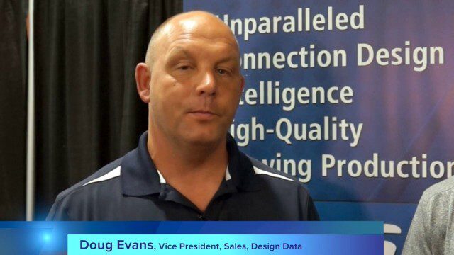
Design Data Adds Intelligence to Crane Modeling
3.60K Views0 Comments0 Likes
Todd Danielson interviews Doug Evans, Vice President, Sales, Design Data, at the HxGN LIVE event in Las Vegas, Nevada. They discuss sharing models with Intergraph software for production and manufacturing, its new SDS/2 Erector product that adds intelligence to crane modeling and building, and more.

Delivering Very-High-Resolution Imagery for Densely Populated Areas
3.10K Views0 Comments0 Likes
The V1 Video team interviewed Paul Peterson, senior vice president, Product & Engineering, nearmap, at the 2015 Esri User Conference in San Diego. The aerial imagery and visual analytics company provides timely, high-resolution and historic imagery that they recently imported to the United States from Australia. The unique sensing capacity and frequent revisits of major cities is accompanied by online analysis tools.
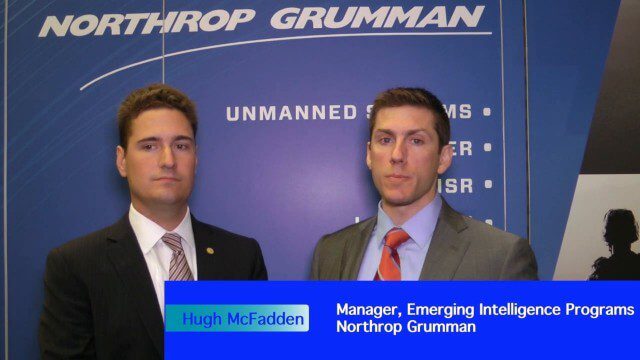
Decision Advantage through Data Analysis
1.98K Views0 Comments0 Likes
The V1 Video team interviewed Hugh McFadden, manager of Emerging Intelligence Programs, and Stephen Ryan, senior mission engineer with the Intelligence, Surveillance and Reconnaissance Division, both at Northrop Grumman, at the GEOINT Symposium in Washington, D.C. The pair work closely together on solutions to enhance intelligence gathering focused on threats. We discussed automation vs. human cognitive reasoning as well as conditioning sensor information—exploiting and integrating their inputs.
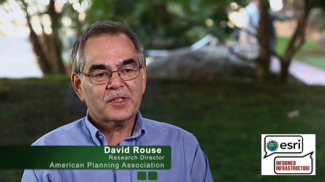
David Rouse Discusses Sustainable Places at the Geodesign Summit
5.46K Views0 Comments0 Likes
David Rouse, Research Director for the American Planning Association (APA), oversees the Planning Advisory Service and the three National Centers for Planning (Green Communities, Hazards Planning, and Planning and Community Health). On behalf of V1 Media, Informed Infrastructure and GeoSpatial Stream, Todd Danielson interviewed Rouse at the Geodesign Summit 2015 in Redlands, Calif.
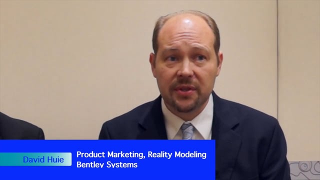
David Huie and David Burdick: Reality Capture and Modeling, LumenRT, and Visualization for Communication
3.95K Views0 Comments0 Likes
Informed Infrastructure interviewed Bentley Systems' David Huie, Product Marketing, Reality Modeling, and David Burdick, Market Development, Visualization, at the Year In Infrastructure Event held Nov. 1-3, 2017, at the Hilton London Metropole. They take turns discussing Bentley's latest advances in reality capture and modeling, including its LumenRT product, as well as how to best use visualization for communication with the expanding amount of "non-technical" stakeholders.
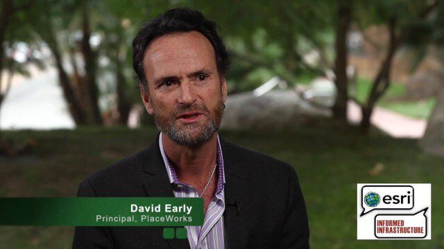
David Early Discusses Smart Growth at Geodesign Summit
9.00K Views2 Comments0 Likes
David Early, principal at PlaceWorks, is a renowned expert on smart growth. For more than 25 years, he has worked with communities and helped numerous clients prepare successful grant applications to help fund long-range planning efforts. On behalf of V1 Media, Informed Infrastructure and GeoSpatial Stream, Todd Danielson interviewed Early at the Geodesign Summit 2015 in Redlands, Calif.


