
Browse Archives

Placemeter Building Real-Time Dynamic Data Layer
3.13K Views0 Comments0 Likes
Placemeter collects and serves up-to-the-minute information such as how crowded a place is, how long the wait is, and whether it will get more or less crowded in the next hour. On behalf of V1 Media, Informed Infrastructure and GeoSpatial Stream, Todd Danielson interviewed Jason Novack, solutions architect at Placemeter, at the Geodesign Summit 2015 in Redlands, Calif.

Pioneering LiDAR Adoption in China
1.47K Views0 Comments0 Likes
Informed Infrastructure interviewed Yanjing Liu, CEO of Five Star Electronic Technology, at the RIEGL LiDAR Conference in Guangzhou, China. Liu left his academic position at Virginia Tech and companies he founded in the United States to pioneer the use of LiDAR in China. We spoke about the hard work needed to set up this capacity as well as some landmark projects, including 3-D mapping of the Great Wall.
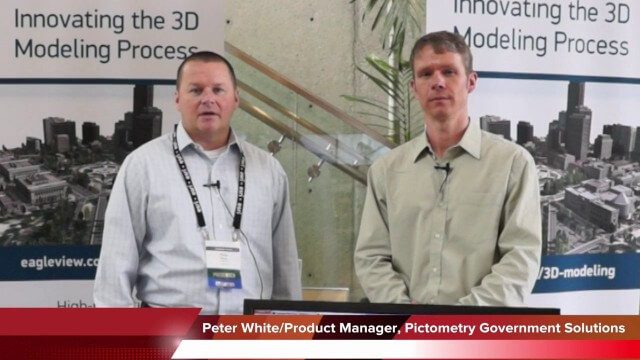
Pictometry/EagleView Interview at GeoDesign Summit
3.20K Views0 Comments0 Likes
Todd Danielson interviews Peter White, product manager and business analyst for Pictometry. They discuss how oblique imagery can help create better 3-D models as well as the future possibilities of a potential company acquisition.

Pictometry Developing 3D Models for Infrastructure Market
2.62K Views0 Comments0 Likes
The V1 Video team interviewed Jim Murray, Regional VP for Infrastructure at Pictometry (an EagleView company), at the 2015 Esri User Conference in San Diego. We spoke about the unique characteristics of high-resolution oblique imagery from Pictometry and an emerging ability to create detailed 3D models with oblique imagery data draped on buildings for a photorealistic model.

PEACE on Earth GPS Art
1.35K Views0 Comments0 Likes
I traveled over 65,700 miles to meet people from all around the world to help me create a GPS drawing that would express a simple message. This is my journey.

Patrick Collins Interview
3.55K Views0 Comments0 Likes
Matt Ball interviews Patrick Collins, Technical Solutions Engineer, Exelis Visual Information Solutions. They discuss the increasing size of LiDAR data and the tools to handle such volume as well as the variety of ways image data can be analyzed, including automated feature extraction.
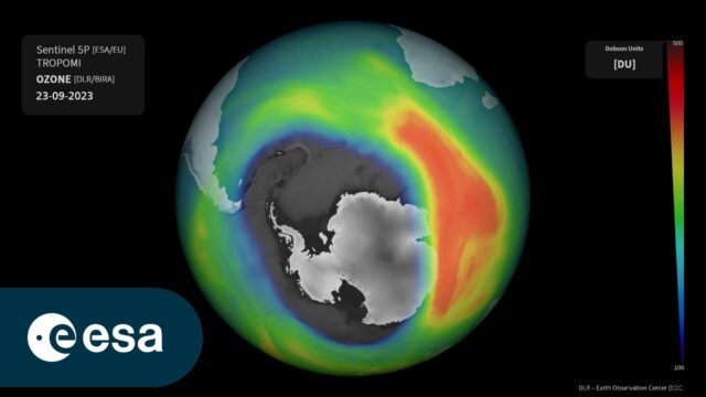
Ozone Hole as Monitored by the German Aerospace Center
0 Views0 Comments0 Likes
This animation uses Sentinel-5P total ozone measurements and shows the evolution of the ozone hole over the South Pole from Sept. 1-29, 2023. The Tropomi total ozone measurements are processed within the Sentinel-5...

Orion: Trial By Fire
2.10K Views0 Comments0 Likes
NASA’s newest spacecraft, Orion, will be launching into space for the first time in December 2014, on a flight that will take it farther than any spacecraft built to carry humans has gone in more than 40 years and through temperatures twice as hot as molten lava to put its critical systems to the test.

Ordnance Survey: Finding a Way
2.16K Views0 Comments0 Likes
Ordnance Survey is very proud to be introducing a refreshed visual identity. Take a look at how much we've changed in our 224 years.
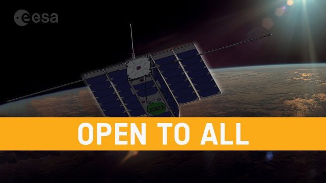
OPS-SAT: ESA’s Flying Lab, Open to All
682 Views0 Comments0 Likes
What would you do with a powerful computer based in space? At just 30 centimeters in height, OPS-SAT is a tiny CubeSat designed to serve as a large-scale software laboratory in orbit–containing one of the most powerfu...


