
Tag: NASA
NASA Earth at Night
2.56K Views0 Comments0 Likes
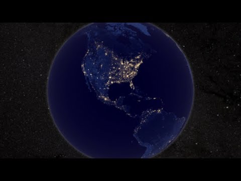
In daylight our big blue marble is all land, oceans and clouds. But the night - is electric. This view of Earth at night is a cloud-free view from space as acquired by the Suomi National Polar-orbiting Partnership Satellite (Suomi NPP).

NASA NIMBUS: Recovering the Past
2.30K Views0 Comments0 Likes
50 years ago, NASA launched Nimbus to study Earth from space. Now, experts at the National Snow and Ice Data Center (part of CIRES), are recovering valuable data and images from old, long-lost film, and expanding their understanding of sea ice in the Arctic and Antarctic. Learn more from CIRES on the 1-year anniversary of Nimbus' first image:

NASA Intro to LIDAR
2.30K Views0 Comments0 Likes
Want to know the 3D shape of terrain on another planet? Want to study the height and density of Earth's forests? An amazing tool called LIDAR can help! Learn more in this video.
NASA’s Earth Minute: Mission to Earth?
1.69K Views0 Comments0 Likes
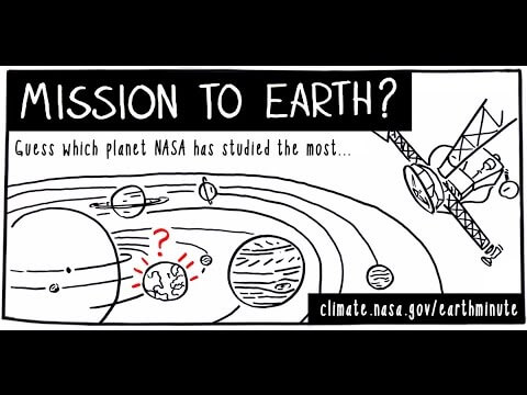
NASA doesn't just explore outer space! Since 1959, with the launch of the first weather satellite, NASA has been studying our home planet on a global scale. NASA monitors Earth's vital signs via satellites and airplanes, sends scientists to the far corners of the land and under the ocean, and develops computer models of Earth's climate processes. Why? Because Earth is the only planet that nearly eight billion people call "home sweet home."

OCO-2: NASA’s New Carbon Counter
1.92K Views0 Comments0 Likes
NASA's OCO-2 mission will shed new light on understanding carbon and its role in our planet's future.

7_10 Remote-Sensing Broadcast (NASA, UN and More)
45.75K Views0 Comments0 Likes
This remote-sensing themed GeoSpatial Stream broadcast discusses NASA's recently launched Orbiting Carbon Observatory-2 satellite as well as its upcoming ISS-RapidScat instrument; The Satellite Project created at New York University; UN Peacekeeping missions using unarmed UAVs; industry news from Fugro, exactEarth, SimActive and EOMAP; the upcoming Esri User Conference; the Climate Resilience App Challenge; and more.
6_12 HxGN LIVE Broadcast (Conference Recap, NASA News and More)
3.66K Views0 Comments0 Likes
This GeoSpatial Stream broadcast includes a recap of the recent HxGN LIVE conference in Las Vegas, and discusses NASA's upcoming carbon dioxide satellite; a deadly and massive Colorado mudslide; industry news from Skybox Imaging and Google, Sokkia, and Esri; Google's Tango Project; and more.

Exelis Discusses Climate Instrument Specialization and Demand
3.65K Views0 Comments0 Likes
Matt Ball spoke with Eric Webster, VP and Director, Environmental Intelligence, Geospatial Systems, Exelis, at the recent International Space Symposium. The conversation covered some recent sensor contract wins with NASA and JAXA as well as discussion about the evolution of sensors from hardware- to software-based, affording much greater on-orbit flexibility.

5_22 Remote-Sensing Broadcast (Space Symposium, WorldView-3 and More)
6.32K Views0 Comments0 Likes
This GeoSpatial Stream broadcast covers a variety of remote-sensing topics, such as the recent Space Symposium in Colorado; a preview of DigitalGlobe's WorldView-3 satellite; a special report on micro-satellites; industry news from Airbus Defence and Space, BAE Systems, Teledyne, and NASA; and more.

NASA/JAXA GMI Sensor for Precipitation Measurement
3.14K Views0 Comments0 Likes
On March 10, the Core Observatory passed over an extra-tropical cyclone On March 10, the Core Observatory passed over an extra-tropical cyclone about 1055 miles (1700 kilometers) due east of Japan's Honshu Island. Satellite data shows the full range of precipitation in the storm.


