
Tag: geospatial

Richard Humphrey Autodesk Interview (Short Version)
4.19K Views0 Comments0 Likes
In this condensed version, Todd Danielson interviews Richard Humphrey, senior director, Infrastructure Products, Autodesk. They discuss how technology can help "bridge the gaps" in infrastructure spending, simulation services, and large-scale modeling.

NASA/JAXA GMI Sensor for Precipitation Measurement
3.14K Views0 Comments0 Likes
On March 10, the Core Observatory passed over an extra-tropical cyclone On March 10, the Core Observatory passed over an extra-tropical cyclone about 1055 miles (1700 kilometers) due east of Japan's Honshu Island. Satellite data shows the full range of precipitation in the storm.
Dominique Pouliquen Interview (Autodesk)
3.73K Views0 Comments0 Likes
Matt Ball interviews Dominique Pouliquen, Director of Market Development, IPG/Reality Solutions, Autodesk, at SPAR International in Colorado Springs, Colo. They discuss reality computing, the scanning workflow, ReCap Connect, the new RCS format for point clouds, how plug-ins and Web APIs can help customers, and more.

Jon Skiffington Interview (LizardTech)
3.19K Views0 Comments0 Likes
Todd Danielson interviews Jon Skiffington, Director, Product Management, LizardTech, at the GEOINT Symposium in Tampa, Florida. They discuss LizardTech's MrSID product and how it compresses imagery and other large datasets, GEOINT imagery users, GeoExpress and Express Server 9, and the company Web site.
Nick Palatiello Interview
3.43K Views0 Comments0 Likes
Matt Ball interviews Nick Palatiello, Assistant Executive Director for External Affairs, MAPPS. They discuss the lobbying organization's history, agenda and how it works with government officials to advocate for the geospatial profession.
Exploring InfraWorks, Vegas Style Event (Full-Length Version)
3.29K Views0 Comments0 Likes
This full-length video summarizes the Exploring InfraWorks, Vegas Style event that took place during Autodesk University on Dec. 4, 2014. A bus trip explored the use of Autodesk technology to model the infrastructure of the city of Las Vegas. VTN Consulting is the main contractor on the project.

2_12 Roger Tomlinson Broadcast (GeoDesign Summit, Tomlinson Tribute, Landsat 8 and More)
7.75K Views1 Comments0 Likes
This GeoSpatial Stream broadcast discusses Esri's GeoDesign Summit; the recent passing of Roger Tomlinson, "The Father of GIS"; Landsat 8's birthday; climate change and national security; woodland conservation; geospatial gaming technology; and more.

3_6 ILMF Broadcast (Conference Recap, USGS News, Aerial Imagery Market and More)
3.00K Views0 Comments0 Likes
This GeoSpatial Stream broadcast discusses the recent International LiDAR Mapping Forum, important USGS news, the future of the aerial imagery market, a map contest, and more.
SmallSats are the Next Big Thing
1.49K Views0 Comments0 Likes
NASA is about to launch six new next-generation Earth-observing small satellites — some as small as a loaf of bread. These tiny spacecraft are helping to foster creative and cost-effective approaches to studying our planet.
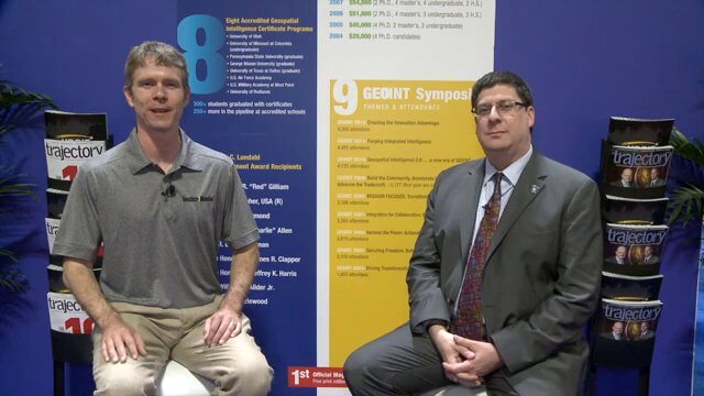
Keith Masback Interview (USGIF CEO at GEOINT)
2.98K Views0 Comments0 Likes
Todd Danielson interviews Keith Masback, CEO of the U.S. Geospatial Intelligence Foundation (USGIF), at the GEOINT Symposium in Tampa, Florida. They discuss highlights of the event, the effect of the show's unexpected delay from fall 2013 to spring 2014 and what has changed since then, where and when the next event will be held, how technologies start at GEOINT and "trickle down" into the larger industry, industry integration, the wide range of companies in attendance, and more.


