
Tag: geospatial

Esri’s Geotrigger Service Explained
0 Views1 Comments0 Likes
Matt Ball spoke with Amber Case, director of Esri's R&D Center in Portland, at the Local Data Summit in Denver on Feb. 25, 2014. The conversation ranges from accessible geospatial technology, the ubiquity of mobile devices, and the connections that are made with location awareness and location-based alerts.

Exploring InfraWorks Vegas Style! Event (Short Version)
0 Views0 Comments0 Likes
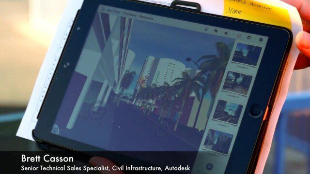
This video is a short trailer of the full video recapping the Exploring InfraWorks (Vegas Style!) event that took place during Autodesk University 2013. A bus trip explored the use of Autodesk technology to model the infrastructure of the city of Las Vegas. VTN Consulting is the main contractor on the project.
Exploring InfraWorks, Vegas Style Event (Full-Length Version)
0 Views0 Comments0 Likes
This full-length video summarizes the Exploring InfraWorks, Vegas Style event that took place during Autodesk University on Dec. 4, 2014. A bus trip explored the use of Autodesk technology to model the infrastructure of the city of Las Vegas. VTN Consulting is the main contractor on the project.

Google Geospatial Technologist Talks Trends
0 Views0 Comments0 Likes
INTERGEO TV interviews Ed Parsons, geospatial technologist at Google, about his thoughts on the future of the map and related technology.

Jon Skiffington Interview (LizardTech)
0 Views0 Comments0 Likes
Todd Danielson interviews Jon Skiffington, Director, Product Management, LizardTech, at the GEOINT Symposium in Tampa, Florida. They discuss LizardTech's MrSID product and how it compresses imagery and other large datasets, GEOINT imagery users, GeoExpress and Express Server 9, and the company Web site.
Keith Masback Interview (USGIF CEO at GEOINT)
0 Views0 Comments0 Likes
Todd Danielson interviews Keith Masback, CEO of the U.S. Geospatial Intelligence Foundation (USGIF), at the GEOINT Symposium in Tampa, Florida. They discuss highlights of the event, the effect of the show's unexpected delay from fall 2013 to spring 2014 and what has changed since then, where and when the next event will be held, how technologies start at GEOINT and "trickle down" into the larger industry, industry integration, the wide range of companies in attendance, and more.
Letitia Long (Director, NGA) Keynote at 30th Space Symposium
0 Views0 Comments0 Likes
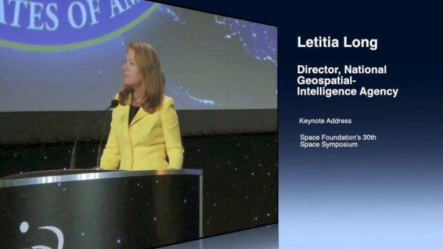
Letitia A. Long, Director of the National Geospatial-Intelligence Agency (NGA), delivered an important and powerful keynote address at the 30th Space Symposium in Colorado Springs, Colo., on May 20, 2014. Topics include the future of space programs and the space industry, their roles in intelligence, the changing nature of worldwide threats, and how space-based platforms can help predict new challenges.
Matt Zbysenski Interview (IES Engineering)
0 Views0 Comments0 Likes
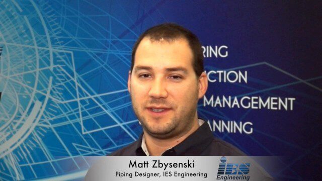
Matt Ball interviews Matt Zbysenski, Piping Designer, IES Engineering, at SPAR International in Colorado Springs, Colo. They discuss LiDAR in the construction workflow, safety mitigation, cost/time savings, pre-fabricated construction, and oil & gas uses.

Mike Tully Interview (Aerial Services Inc.)
0 Views0 Comments0 Likes
Matt Ball interviews Mike Tully, President and CEO, Aerial Services Inc., at SPAR International in Colorado Springs, Colo. They discuss remote sensing and airborne LiDAR in a variety of industries, sensor diversity, streamlining data delivery, and industry disruption due to unmanned aerial systems.

NASA/JAXA GMI Sensor for Precipitation Measurement
0 Views0 Comments0 Likes
On March 10, the Core Observatory passed over an extra-tropical cyclone On March 10, the Core Observatory passed over an extra-tropical cyclone about 1055 miles (1700 kilometers) due east of Japan's Honshu Island. Satellite data shows the full range of precipitation in the storm.


