


Category: Found on the Internet
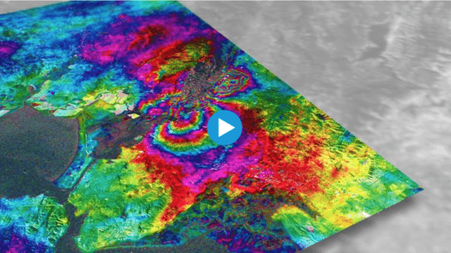
Earthquake Monitoring with Radar Satellites
2.25K Views0 Comments0 Likes
Radar satellite missions can measure millimetre-scale changes in Earth’s surface following an earthquake. On 24 August 2014, an earthquake struck California’s Napa Valley. By processing two images from the Sentinel-1A radar satellite, which were acquired on 7 August and 31 August 2014 over this wine-producing region, an 'interferogram' was generated showing ground deformation.
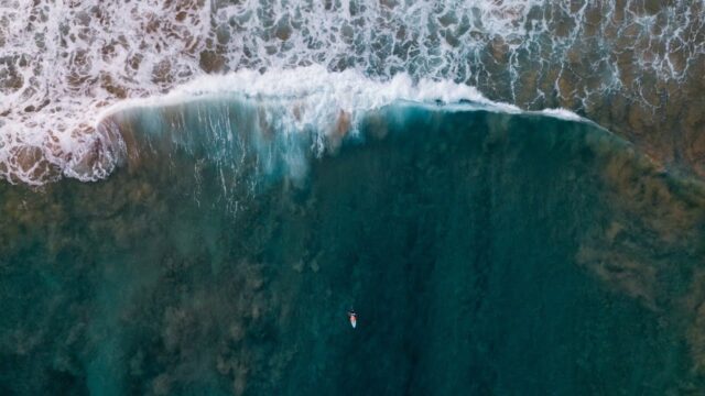
Earth’s Iconic Waves, Observed by Landsat
0 Views0 Comments0 Likes
The broad perspective from satellites shows the landscapes and seascapes surrounding some of the world's tallest, longest, fastest, and heaviest waves.
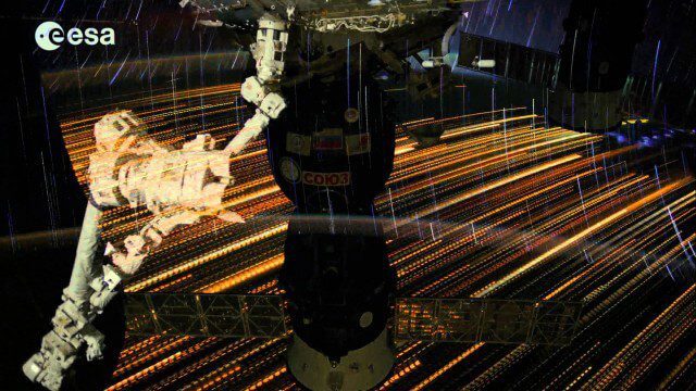
Earth Images from ESA Astronaut Alexander Gerst
3.07K Views0 Comments0 Likes
This timelapse video was made from images taken by ESA astronaut Alexander Gerst orbiting Earth on the International Space Station. The video is offered in Ultra High Definition, the highest available to consumers. Be sure to change the settings in YouTube if your computer or television can handle it for the full effect. The montage is made from a long sequence of still photographs taken at a resolution of 4256 x 2832 pixels at a rate of one every second. The high resolution allowed the ESA production team to create a 3840 x 2160 pixel movie, also known as Ultra HD or 4K. Playing these sequences at 25 frames per second, the film runs 25 times faster than it looks for the astronauts in space. The artistic effects of the light trails from stars and cities at night are created by superimposing the individual images and fading them out slowly. Alexander Gerst is a member of the International Space Station Expedition 40 crew. He is spending five and a half months living and working on the ISS for his Blue Dot mission.
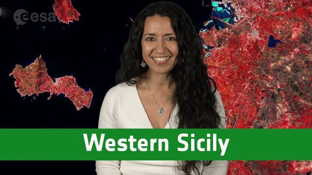
Earth from Space: Western Sicily
802 Views0 Comments0 Likes
In this week's edition of the Earth from Space program, the Copernicus Sentinel-2A satellite takes us over western Sicily and the islands of Favignana and Levanzo in Italy.
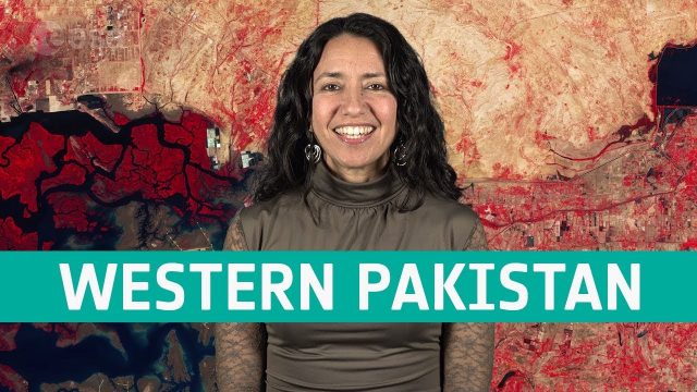
Earth from Space: Western Pakistan
798 Views0 Comments0 Likes
In this week's edition of the Earth from Space program, Copernicus Sentinel-2 takes us over western Pakistan and an important wetland area.

Earth from Space: Uruguay River Wetlands
1.07K Views0 Comments0 Likes
In this week's edition of the Earth from Space program, the Copernicus Sentinel-2B satellite takes us along the lower reaches of the Uruguay River.
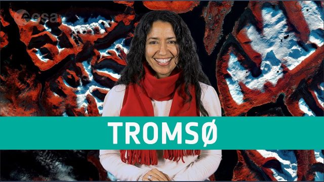
Earth from Space: Tromsø
648 Views0 Comments0 Likes
The Copernicus Sentinel-2 mission takes us over Tromsø, the largest city in northern Norway, in this week's edition of the Earth from Space program.
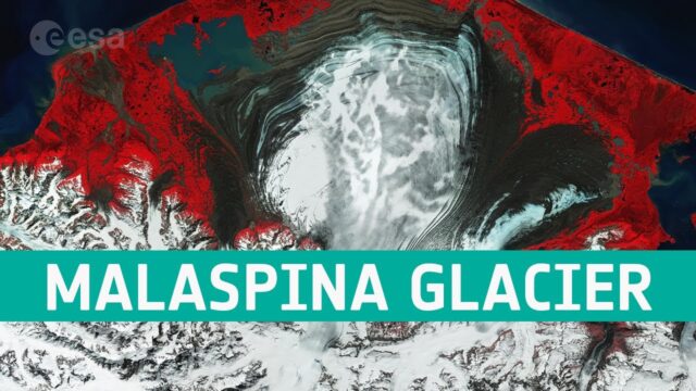
Earth from Space: The Moraines of Malaspina
0 Views0 Comments0 Likes
In this week’s edition of the Earth from Space program, we take a look at the remarkable moraine patterns of Malaspina Glacier – the largest piedmont glacier in the world – through the eyes of Copernicus Sentinel-...
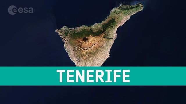
Earth from Space: Tenerife, Canary Islands, Spain
20 Views0 Comments0 Likes
This week's edition of the Earth from Space program features a Copernicus Sentinel-2 image of Tenerife, the largest of Spain’s Canary Islands.
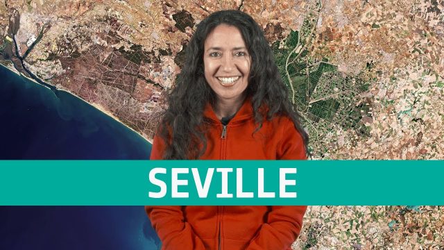
Earth from Space: Seville
736 Views0 Comments0 Likes
The Copernicus Sentinel-2 mission takes us over Seville in southern Spain, where ESA's next Ministerial Council will soon take place, in this week's edition of the Earth from Space program.


