


Category: Found on the Internet
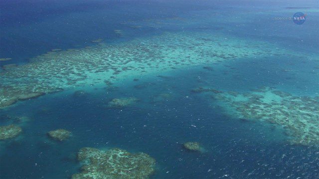
A New View of Coral Reefs
0 Views0 Comments0 Likes
A three-year NASA field expedition to examine Earth’s coral reefs is now underway, giving scientists the opportunity to study reef ecology and conditions.
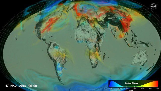
Following Carbon Dioxide Through the Atmosphere
0 Views0 Comments0 Likes
Using observations from NASA's Orbiting Carbon Observatory (OCO-2) satellite, scientists developed a model of the behavior of carbon in the atmosphere.

IceBridge Flies 300 Hours of Antarctic Science Flights
0 Views0 Comments0 Likes
Operation IceBridge is wrapping up its eighth consecutive field season of mapping the ice sheet and glaciers of Antarctica as well as the surrounding sea ice.
CORAL Probes Great Barrier Reef
0 Views0 Comments0 Likes
The three-year COral Reef Airborne Laboratory (CORAL) mission will survey a portion of the world's coral reefs to assess the condition of these threatened ecosystems and understand their relation to the environment, including physical, chemical and human factors.

Launch of Trimble Ag Software
0 Views0 Comments0 Likes
Ben Allen, enterprise solutions lead for Trimble Agriculture, explains how Trimble’s new farm data management platform—Trimble Ag Software—simplifies management of data and helps farmers make informed, timely decisions.

AFL-CIO Building Investment Trust Presents Wolf Point West
0 Views0 Comments0 Likes
The AFL-CIO Building Investment Trust (BIT), which re-invests union retirement plans and pensions in real estate projects, poured $34 million into the $160 million Wolf Point West tower that opened earlier this year. BIT produced a new video highlighting their involvement in the Hines Interests and Joseph P. Kennedy Enterprises joint venture.
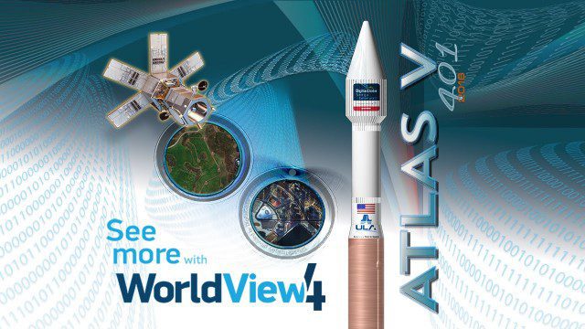
Atlas V WorldView Launch Broadcast Replay
0 Views0 Comments0 Likes
Watch a replay as the ULA's Atlas V launches the WorldView-4 launch for DigitalGlobe.
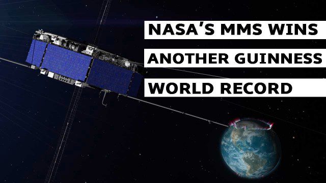
NASA’s MMS Satellite Breaks World GPS Record
0 Views0 Comments0 Likes
NASA's MMS mission now holds the Guinness World Record for highest altitude GPS fix: 43,500 miles above Earth’s surface.

Proposed Bus Terminal in NYC
0 Views0 Comments0 Likes
Pelli Clarke Pelli Architects proposed a relatively compact terminal to be built exclusively on Port Authority-owned land just west of the current facility between West 38th and West 40th streets that would cost $3.7 billion to construct.
SmallSats are the Next Big Thing
0 Views0 Comments0 Likes
NASA is about to launch six new next-generation Earth-observing small satellites — some as small as a loaf of bread. These tiny spacecraft are helping to foster creative and cost-effective approaches to studying our planet.


