


Category: Daily Digests
6_25 Infrastructure Broadcast (London’s Crossrail, DOT Grants and More)
3.61K Views0 Comments0 Likes
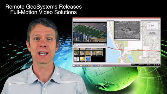
This infrastructure-themed GeoSpatial Stream broadcast discusses London's massive Crossrail project, Bentley's involvement in its BIM practices, and the completion of its tunnel boring; U.S. DOT grants to reduce traffic congestion; Canada's massive New Champlain Bridge project; an interview with HOK's Patrick MacLeamy; industry news from Remote GeoSystems, Esri, IMAGINiT Technologies, Pix4D, Innovyze, Flightline Geographics and Tablerock Land Survey; thoughts on Crossrail and the world's longest tunnel; and more.
7_9 Earth Imaging Broadcast (California Fires, Drone Mayhem and More)
3.96K Views0 Comments0 Likes
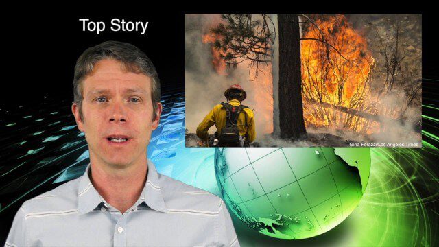
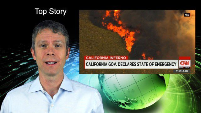
This Earth Imaging-themed GeoSpatial Stream broadcast discusses the California Lake Fire and its mapping by satellites as well as amateur drone use that disrupted firefighting; NASA's work to develop drones with sense-and-avoid systems; satellite sensors using gravity to detect depleting groundwater basins; electromagnetic survey data for geology; industry news from Orbit Logic, 4D Mapper and Lockheed Martin; thoughts on amateur drone use; and more.

7_16 Asia Pacific Broadcast (New Satellites, Drones Catching Tax Cheats and More)
3.20K Views0 Comments0 Likes
This Asia Pacific-themed GeoSpatial Stream broadcast discusses new Asian geospatial satellites from India, China and Japan; V1 Media's upcoming Webcast on Earthquake safety; laser scanning to map and preserve Japanese castles and Malaysian caves; drones used in Indonesia to catch tax cheats; industry news from MDA and Google; thoughts on digital preservation; and more.

7_23 Infrastructure Broadcast (AEC Market Reports, Smart Cities and More)
3.64K Views0 Comments0 Likes
This Infrastructure-themed GeoSpatial Stream broadcast discusses an optimistic AEC market report; a $16 billion commitment from the state of Washington for transportation improvements; a new LADOT public Web map for smart communities; laser scanning in Mexico; industry news from SmarterBetterCities, Topcon Positioning Group and PaveXpress; thoughts on seeing Informed Infrastructure in action in Chicago; and more.
7_30 Spatial Broadcast (Esri UC Highlights, NASA News and More)
4.14K Views0 Comments0 Likes
This GeoSpatial Stream broadcast discusses highlights from the Esri User Conference; NASA news from the Kepler mission and a near-Earth-sized planet as well as satellite data noting plankton's effects on clouds and climate; industry news from SAP, Esri, Nepal and LizardTech; thoughts on the Kepler mission and the possibilities of life beyond Earth; and more.
8_6 Wildfire Broadcast (Updates from California and Alaska, NASA and UN News, and More)
3.27K Views0 Comments0 Likes
This GeoSpatial Stream broadcast discusses the wildfires raging in California, the Pacific Northwest and especially Alaska; a NASA program to inventory Earth's surface waters; the Geovation startup hub; industry news from Esri, URISA and VisionMap; a UN video on the power of geospatial technology; and more.
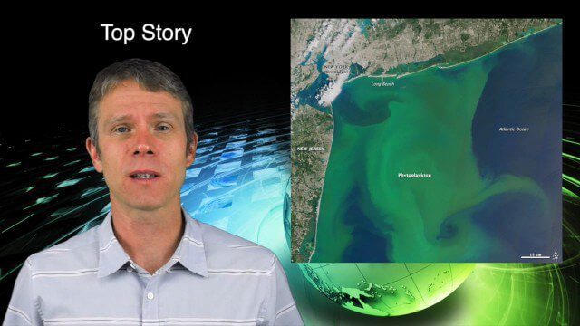
8_13 Earth Imaging Broadcast (Toxic Phytoplankton, Climate Change and More)
3.56K Views0 Comments0 Likes
This GeoSpatial Stream broadcast discusses the massive phytoplankton blooms along both U.S. coasts and the damage they are doing; NOAA reporting record high temperatures across the globe; NASA's CubeSat Launch Initiative; industry news from Bluesky Esri, ESA, Airbus and Harris Corp.; thoughts on toxic phytoplankton and climate change; and more.

8_20 Infrastructure Broadcast (Smart Cities, Nepal Recovery and More)
3.81K Views0 Comments0 Likes
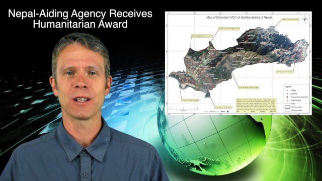
This Infrastructure-themed GeoSpatial Stream broadcast discusses Smart Cities initiatives and reports to help urban areas become more sustainable and livable; updates from engineers concerning Nepal's earthquake recovery; industry news from Topcon Positioning Group, Woolpert, gViz and IMAGINiT; thoughts on the growing Smart Cities industry; and more.
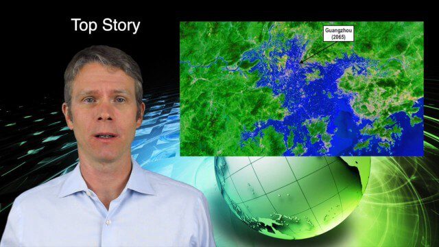
8_27 Asia-Pacific Broadcast (Rising Seas, Pollution, Drones and More)
3.49K Views0 Comments0 Likes
This Asia-Pacific-themed GeoSpatial Stream broadcast discusses rising sea levels in coastal cities; decreased air pollution in the Middle East; Australian researchers using drones to track wildlife; images of Typhoon Goni over Japan; industry news from Esri, Abu Dhabi, Korea Aerospace Research and Maptek; thoughts on urban population explosions in China and personal travel experiences; and more.
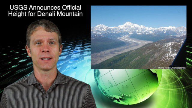
9_3 Environment Broadcast (Ocean Monitoring, Habitat Protection, Denali and More)
3.56K Views0 Comments0 Likes
This GeoSpatial Stream broadcast discusses ocean monitoring by the European Commission's NeXOS project; ocean-habitat monitoring off of Costa Rica, with the help of DigitalGlobe satellite imagery; a new official height for Denali Mountain; industry news from Trimble, Spatial Dimension, TerraGo, Esri, FlightAware and SimActive; a video from the EPA; and more.


