


Category: Daily Digests

4_2 Infrastructure Broadcast (Landsat and Flood Risk, Cloud-Based Tools, and More)
0 Views0 Comments0 Likes
This infrastructure-focused GeoSpatial Stream broadcast discusses how Landsat is helping with flood risk to infrastructure; North Carolina using cloud-based property data; a Regional Road Construction Map in Spokane; industry news from Columbia Pipeline Group, Synergis, Cityworks and Bentley Systems; surveying in the British Virgin Islands; the Technology of Walking; and more.
4_8 Precision-Agriculture Broadcast (Food and Fluorescence, Sentinel Launch, and More)
0 Views0 Comments0 Likes
This GeoSpatial Stream broadcast discusses how food production can be tracked via satellites; the launch of Sentinel-1A; maps of extractive industries and agriculture in Peru and Ghana; a satellite competition; industry news from URISA, Ordnance Survey, Open Geospatial Consortium and Leica Geosystems; and more.

4_10 GEOINT Broadcast (Special Ops Data, New Weather Satellite, GPS III and More)
0 Views0 Comments0 Likes
This GeoSpatial Stream broadcast discusses geospatial intelligence, its legacy and the upcoming GEOINT Symposium; a recently launched U.S. military weather satellite; GPS III developments; industry news from Headwall, Thermopylae Sciences and Technology, Trimble, Esri, DigitalGlobe, and Riegl; and more.

4_14 Infrastructure Broadcast (Transportation Asset Management, Water Infrastructure Needs, and More)
0 Views0 Comments0 Likes
This infrastructure-focused GeoSpatial Stream broadcast discusses Transportation Asset Management; a report on water infrastructure; designs to protect against hurricanes; public-transit ridership; historical map archives; private infrastructure funding; news from Bluesky and Bentley Systems; rainwater-capturing infrastructure in Rotterdam, The Netherlands; and more.

4_22 GEOINT Broadcast (Keynote Highlights, Major News and Developments, and More)
0 Views0 Comments0 Likes
This GeoSpatial Stream broadcast from the GEOINT Symposium in Tampa, Fla., recaps the major highlights and news from the event, including keynote addresses from James R. Clapper, Director of National Intelligence; Letitia A. Long, Director, National Geospatial-Intelligence Agency; and Lt. Gen. Michael T. Flynn, U.S. Army, Director of the Defense Intelligence Agency. The broadcast also covers major news announcements from the U.S. Geospatial Intelligence Foundation, Boeing, Surrey Satellite Technology U.S., Airbus Defense & Space, and more.
4_28 Asia-Pacific Broadcast (Great Barrier Reef, Asian Satellites, CityNext and More)
0 Views0 Comments0 Likes
This Asia-Pacific-focused GeoSpatial Stream broadcast discusses a new way to monitor the Great Barrier Reef from space, GLONASS updates, a new Indian navigation satellite, CityNext in Surat, the latest industry headlines, and more.

5_8 Infrastructure Broadcast (ETOD, Global Smart City Rankings and More)
0 Views0 Comments0 Likes
This infrastructure-focused GeoSpatial Stream broadcast discusses Equitable Transit-Oriented Development (ETOD); a Global Smart City Ranking; the King County Multi-Family Residential Parking Calculator; historic Denver Union Station's transit makeover; GEOSS; news from Bentley Systems, Esri, Leica Geosystems and Agency9; and more.

5_15 Asia-Pacific Broadcast (Sri Lanka Transit GIS, China World Map and More)
0 Views0 Comments0 Likes
This Asia-Pacific-focused GeoSpatial Stream broadcast discusses a train accident in Sri Lanka and how a new GIS may prevent future collisions; India's groundwater mapping; China's World Map online; Australia's 2014 Esri Young Scholars Award winner; industry headlines from Trimble, Tencent and NavInfo, and NZ Aerial Mapping; the World Under Water Web site; and more.

5_22 Remote-Sensing Broadcast (Space Symposium, WorldView-3 and More)
0 Views0 Comments0 Likes
This GeoSpatial Stream broadcast covers a variety of remote-sensing topics, such as the recent Space Symposium in Colorado; a preview of DigitalGlobe's WorldView-3 satellite; a special report on micro-satellites; industry news from Airbus Defence and Space, BAE Systems, Teledyne, and NASA; and more.
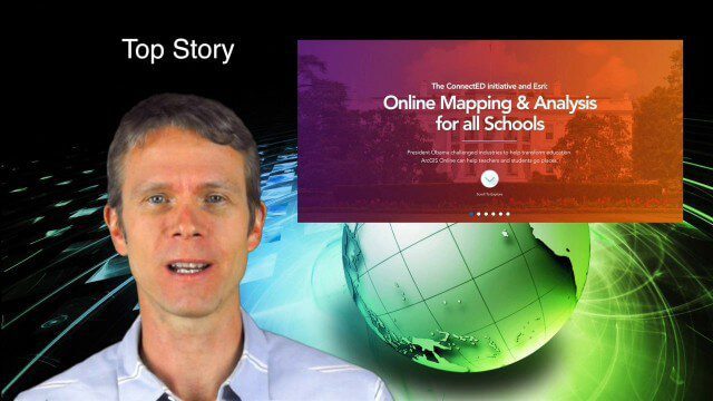
5_29 Education Broadcast (Esri ConnectED, Greenland Glaciers and More)
0 Views0 Comments0 Likes
This GeoSpatial Stream broadcast discusses Esri's billion-dollar donation to Obama's ConnectED program for K-12 students; new NASA data showing Greenland's glaciers will have more impact on sea-level rise than originally thought; a report on the global space economy; industry news from Raytheon and Blue Marble Geographics; a video showing the power of geospatial tools in young students' hands; and more.


