


Category: Daily Digests
3_5 Earth Imaging Broadcast (DigitalGlobe, LiDAR and More)
4.76K Views0 Comments0 Likes
This GeoSpatial Stream broadcast discusses the public release of 30-centimeter-resolution satellite imagery from DigitalGlobe and the company's partnership with the United Nations; the National Ecological Observation Network's new LiDAR data; an award for the Orion Space mission; industry news from exactEarth, Esri, Google, and the U.S. EPA and NOAA; a recap of the recent International LiDAR Mapping Forum in Denver; and more.
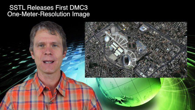
9_17 Europe Broadcast (INTERGEO, Market Reports and More)
2.93K Views0 Comments0 Likes
This European-themed GeoSpatial Stream broadcast discusses the INTERGEO conference in Stuttgart, Germany; a market report on the European Earth-observation industry; EU flood-disaster simulations using UAS technology; an OGC smart city pilot project; industry news from Surrey Satellite Technology, Euroconsult, PCI Geomatics, Applanix and Intergraph; and more.

7_23 Infrastructure Broadcast (AEC Market Reports, Smart Cities and More)
3.64K Views0 Comments0 Likes
This Infrastructure-themed GeoSpatial Stream broadcast discusses an optimistic AEC market report; a $16 billion commitment from the state of Washington for transportation improvements; a new LADOT public Web map for smart communities; laser scanning in Mexico; industry news from SmarterBetterCities, Topcon Positioning Group and PaveXpress; thoughts on seeing Informed Infrastructure in action in Chicago; and more.
Asia-Pacific Broadcast (Remote-Sensing Satellites, East Asia Agreements, Greenhouse Mapping and More)
8.06K Views1 Comments0 Likes
This GeoSpatial Stream focuses on the Asia-Pacific region. Topics covered include China's failed CBERS-3 remote-sensing satellite, a joint agreement to monitor air pollution, Greenhouse mapping in India, precision agriculture in Australia and more.

8_4 Infrastructure Broadcast (TIGER Grants, Transit Tech and More)
2.29K Views0 Comments0 Likes
This Infrastructure-themed GeoSpatial Stream broadcast discusses $500 million in grants from the USDOT's TIGER program; highlights from the latest issue of Informed Infrastructure magazine; new virtual reality technology to promote transit; industry news from Pix4D, Thinkbox Software and the Global Infrastructure Hub; a video from the Mississippi Watershed Management Organization about a stormwater filtration system recently installed near Minneapolis; and more.
Thanksgiving Broadcast 11_25 (Science on a Sphere, JFK maps and video, nanosatellites and more)
6.91K Views0 Comments0 Likes
This Daily Digest from 11/25 covers topics such as Science on a Sphere, JFK memorial maps and video, U.S. Air Force launching 29 nanosatellites, Malaysian news and more.

4_2 Infrastructure Broadcast (Landsat and Flood Risk, Cloud-Based Tools, and More)
2.73K Views0 Comments0 Likes
This infrastructure-focused GeoSpatial Stream broadcast discusses how Landsat is helping with flood risk to infrastructure; North Carolina using cloud-based property data; a Regional Road Construction Map in Spokane; industry news from Columbia Pipeline Group, Synergis, Cityworks and Bentley Systems; surveying in the British Virgin Islands; the Technology of Walking; and more.
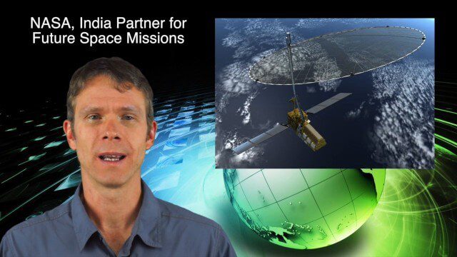
10_16 Asia-Pacific Broadcast (Tsunami Preparedness, NASA/India Partnerships and More)
4.77K Views0 Comments0 Likes
This Asia-Pacific-focused GeoSpatial Stream broadcast discusses several reports indicating that tsunami preparedness is improving in the region; a space-mission partnership between NASA and India's ISRO; the first images from China's Gaofen-2; a video from the University of South Australia's Global Sensor Network; industry news from MDA Information Systems, Esri, Xiaomi, Careland, Innovyze and Nobel Systems; and more.

10_15 Earth Imaging Broadcast (Hurricanes, Wildfire Mapping and More)
7.27K Views0 Comments0 Likes
This Earth Imaging-themed GeoSpatial Stream broadcast discusses satellite imagery used to track and understand hurricanes, including the Atlantic's Joaquin and the Pacific's triplet hurricanes of Kilo, Ignacio and Jimena; remote sensing used to map and characterize capuchin monkey habitat; a Re/Code video news story about smallsats helping with wildfires; industry news from MDA, Blue Water Satellite, NASA and Esri; clips from a V1 Media video interview of Patrick Meier, founder of the Humanitarian UAV Network; and more.

4_16 Drones/UAS Broadcast (Earth Day, Mysterious Methane and More)
3.97K Views0 Comments0 Likes
This GeoSpatial Stream broadcast discusses important FAA practices impacting drone/UAS use; an article that digs deeper into the many possible consequences of FAA's actions; a mysterious methane hotspot in the U.S. Four Corners area; industry news from Hexagon, Airbus Defence and Space, and SimActive; Earth Day; and more.


