


Category: Conference Interviews
Analytics, Ease of Use and Accessibility at Esri
1.87K Views0 Comments0 Likes
The V1 Video team interviewed Brian Lehman, director of Defense Business Development at Esri, at the GEOINT Symposium in Washington, D.C. We spoke about task-driven workflows that streamline multi-step processes, incorporating automation to ease the tedious nature of some lengthy geospatial processing and analysis functions. The company has developed a number of analytic tools that also ease integration, harnessing the power of geography to integrate intelligence data.
Harnessing a New Set of Hyperspectral Eyes
1.92K Views0 Comments0 Likes
The V1 Video team interviewed Chris Van Veen, who handles marketing for Headwall Photonics, at the GEOINT Symposium in Washington, D.C. The company focuses on hyperspectral imaging to discern details and features such as vegetation health. The company is now deploying their sensors on Unmanned Aircraft Systems for cheaper and more-automated sensing and monitoring.
Earth Observation Industry Alliance Looks Forward to Further Proliferation
1.97K Views0 Comments0 Likes
The Earth Observation Industry Alliance (EOIA) was at the International Space Symposium talking to commercial space companies about the future of Earth observation. Earth Imaging Journal spoke with Dennis Jones, chairman and president of EOIA, about the outlook for Earth observation. The goals are to promote favorable policy, a corresponding regulatory environment that's less restricting and more supportive of new companies, and a larger government budget to support observation missions.
Decision Advantage through Data Analysis
1.98K Views0 Comments0 Likes
The V1 Video team interviewed Hugh McFadden, manager of Emerging Intelligence Programs, and Stephen Ryan, senior mission engineer with the Intelligence, Surveillance and Reconnaissance Division, both at Northrop Grumman, at the GEOINT Symposium in Washington, D.C. The pair work closely together on solutions to enhance intelligence gathering focused on threats. We discussed automation vs. human cognitive reasoning as well as conditioning sensor information—exploiting and integrating their inputs.

The Farm Forum Event 2013: Matt Ball Interview
2.05K Views0 Comments0 Likes
Matt Ball is the founder and editor of Vector1 Media, with publications Sensors & Systems, Informed Infrastructure and Asian Surveying & Mapping. He has been promoting the application of sensors, systems, models and simulation for the better stewardship of our planet for the past 15 years. The first ten years of that span were as editor of GeoWorld magazine and show manager of the GeoTec Event, Canada's largest GIS conference.
Fusing Data through Automation to Provide Insight
2.08K Views0 Comments0 Likes
The V1 Video team interviewed Keith Johnson, technical director for Analysis & Mission Solutions at Lockheed Martin, at the GEOINT Symposium in Washington, D.C. We spoke about making sense of imagery; wide-area full-motion video; and textual, social, civil, signals and cyber inputs for decision makers. Lockheed Martin is focused on automation to deliver the right type of data to the analyst as well as providing next-generation sensors with on-board processing that complement other expanding sensors.
Autodesk Enabling Automated UAV Data Processing in the Cloud
2.09K Views0 Comments0 Likes
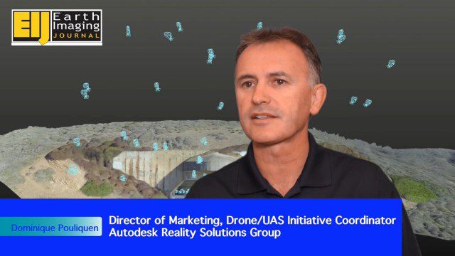
The V1 Video team spoke to Dominique Pouliquen, director of marketing and Drone/UAS Initiative Coordinator for Autodesk’s Reality Systems Group, about his group’s focus on bridging sensor inputs with the company’s extensive line of design and engineering software. They are breaking down the barrier for UAV users to process and create products that are aligned to specific applications such as construction monitoring, mining and cultural heritage.

RIEGL Creating 3D Data for Improved Disaster Response
2.09K Views0 Comments0 Likes
The V1 Video team interviewed James Van Rens, CEO of RIEGL USA, at the 2015 Esri User Conference in San Diego. We spoke at the 3D Mapping Forum, focusing on the need to map the shoreline for improved disaster response. The company also showcased its new RiCOPTER mapping drone.
Ball Aerospace Delivers Science-Driven Sensors
2.09K Views0 Comments0 Likes
Ball Aerospace is a unique entity that delivers imaging instruments as well as full satellites, bringing scientists and engineers together to optimize sensor and spacecraft design. Earth Imaging Journal spoke with Tim Holden, director of advanced systems at Ball Aerospace, about sensor development, the commercialization of space and opportunities in remote sensing with increased temporal revisits.
Value Engineering for Site Planning and Preparation
2.10K Views0 Comments0 Likes
Informed Infrastructure spoke with Michael Kissinger, senior engineer and Land Development Division Manager at Pennoni Associates, and Steve Lewis, single point of contact for Pennoni’s Bentley SITEOPS business. We touched on their creative use of the SITEOPS site-planning tool on a variety of projects to win and retain business.


