
Browse Archives

European Space Agency (ESA) 2022 Preview
0 Views0 Comments0 Likes
As always, a new year brings new and exciting missions and launches for ESA. In science the world looks forward to the first image releases of the recently launched James Webb Space Telescope and the third data relea...
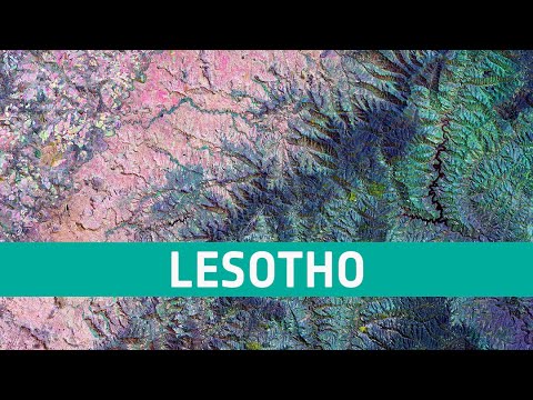
Earth from Space: Lesotho
0 Views0 Comments0 Likes
In this week's edition of the Earth from Space program, the Copernicus Sentinel-2 mission takes us over northwest Lesotho, a small, land-locked country surrounded entirely by South Africa. Credit: ESA - European S...
Tom Zelibor State of Space 2022 Abbreviated Remarks
0 Views0 Comments0 Likes
In an annual State of Space 2022 commentary and video, Thomas Zelibor, CEO of Space Foundation, a nonprofit advocate organization founded in 1983 for the global space ecosystem, speaks to business and government lead...
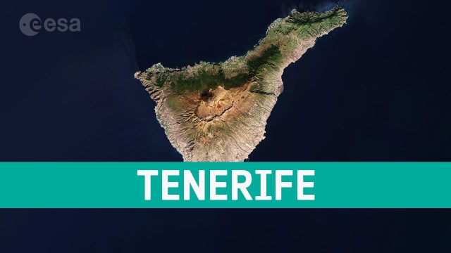
Earth from Space: Tenerife, Canary Islands, Spain
0 Views0 Comments0 Likes
This week's edition of the Earth from Space program features a Copernicus Sentinel-2 image of Tenerife, the largest of Spain’s Canary Islands.

NASA and Agriculture: From Seeds to Satellites
0 Views0 Comments0 Likes
NASA satellites, data, missions and programs have been put to use for decades to strengthen food security, track droughts and flooding, determine plant and soil health, and otherwise support agriculture decision maki...
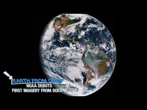
NOAA Debuts First Imagery from GOES-19
0 Views0 Comments0 Likes
On Sept. 18, 2024, NOAA shared the first images of the Western Hemisphere from its GOES-19 satellite. The satellite’s Advanced Baseline Imager (ABI) instrument recently captured stunning views of Earth. GOES-19, N...
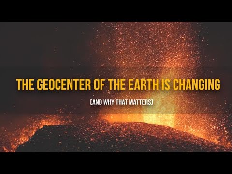
The Geocenter of the Earth Is Changing (And Why That Matters)
0 Views0 Comments0 Likes
At the foundation of virtually all airborne, space-based and ground-based Earth observations is the TRF, or Terrestrial Reference Frame.
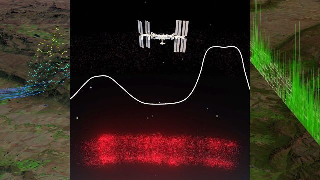
Meet GEDI! The Global Ecosystem Dynamics Investigation Sensor Aboard the ISS
0 Views0 Comments0 Likes
The Global Ecosystem Dynamics Investigation (GEDI) is a full-waveform lidar instrument that produces detailed observations of the three-dimensional structure of the Earth’s surface. GEDI precisely measures forest can...
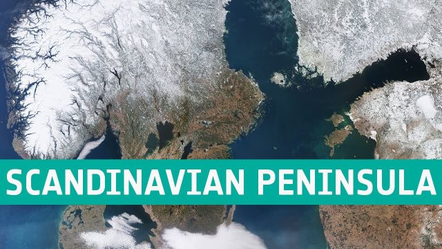
Earth from Space: Scandinavian Peninsula
0 Views0 Comments0 Likes
This week's edition of the Earth from Space program features an impressive shot of the almost cloud-free Scandinavian Peninsula captured by the Copernicus Sentinel-3 mission.
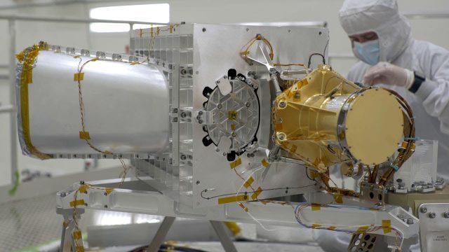
What Is NASA’s Earth Surface Mineral Dust Source Investigation (EMIT)? (Mission Overview)
0 Views0 Comments0 Likes
Soon to be operating from the International Space Station, NASA’s Earth Surface Mineral Dust Source Investigation (EMIT) mission will comprehensively measure the mineral composition of Earth’s mineral dust source reg...


