
Browse Archives
Integrating Geospatial Technology with Business Intelligence
2.59K Views0 Comments0 Likes
The V1 Video team interviewed Joe Francica, managing director, Geospatial Industry Solutions at Pitney Bowes, at the GEOINT Symposium in Washington, D.C. We spoke about the launch of MapInfo Pro Raster that uses new Multi-Resolution Raster technology to enable fast processing, visualization and analysis of large high-resolution imagery datasets. We also spoke about the MapInfo Pro 64 bit, which speeds up productivity.
Simon Kresser and Markus Mettenleiter (Z+F) Interview
3.01K Views0 Comments0 Likes
Matt Ball interviews Zoller and Fröhlich's Simon Kresser, Marketing, and Markus Mettenleiter, Team Leader, Laserscanner Development, at SPAR International in Colorado Springs, Colo. They discuss Z+F's new laserscanner features and accessories, company goals, a product tour, thermal cameras and uses, and more.
SpaceCurve Introduces Spatial at the Speed of Reality
3.59K Views0 Comments0 Likes
GeoSpatial Stream's Todd Danielson conducted an Internet Interview with SpaceCurve's CEO Dane Coyer and Founder Andrew Rogers. They spoke about the company's inception, Big Data, spatial indexing and business applications as well as how SpaceCurve created new technologies to integrate these varied components.
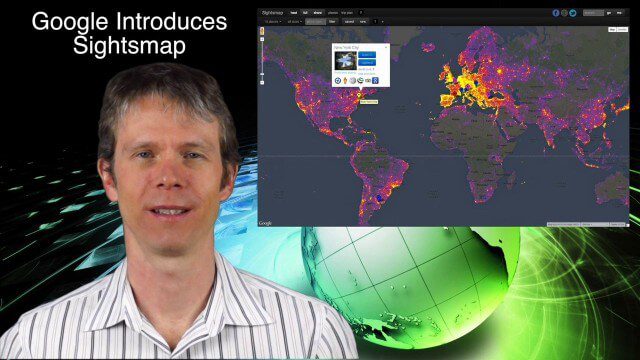
1_23 Commercial Satellite Broadcast (Google Sightsmap, Road Safety Map, Rhino Poaching and More)
4.58K Views0 Comments0 Likes
This GeoSpatial Stream broadcast investigates the commercial satellite imagery market; Google's Sightsmap; the WHO Road Safety map; Rhino poaching; business dealings of GRAPHISOFT, Trimble, Sputnik Enterprises; and more.
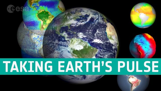
Taking the Pulse of Our Planet
719 Views0 Comments0 Likes
We are all facing the consequences of a rapidly changing world, but thanks to the satellite era we are better placed to understand the complexities of our planet, particularly with respect to global change.

BeetleCam Project
2.08K Views0 Comments0 Likes
New video footage from BeetleCam in the Serengeti, plus announcing the new BeetleCam Hybrid!
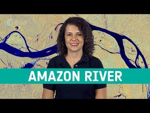
Earth from Space: Amazon River
452 Views0 Comments0 Likes
The Copernicus Sentinel-1 mission takes us over the Amazon River meandering through one of the most vital ecosystems in the world: the Amazon rainforest in South America, in this week's edition of the Earth from Space program.
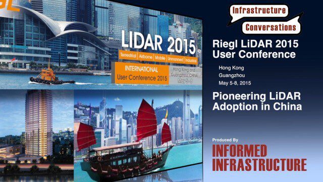
Pioneering LiDAR Adoption in China
1.47K Views0 Comments0 Likes
Informed Infrastructure interviewed Yanjing Liu, CEO of Five Star Electronic Technology, at the RIEGL LiDAR Conference in Guangzhou, China. Liu left his academic position at Virginia Tech and companies he founded in the United States to pioneer the use of LiDAR in China. We spoke about the hard work needed to set up this capacity as well as some landmark projects, including 3-D mapping of the Great Wall.
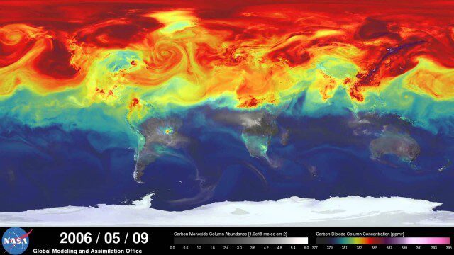
A Year in the Life of Earth’s CO2
2.02K Views0 Comments0 Likes
An ultra-high-resolution NASA computer model has given scientists a stunning new look at how carbon dioxide in the atmosphere travels around the globe.
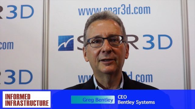
Greg Bentley Talks Reality Modeling and the Future of 3D Tech
4.74K Views0 Comments0 Likes
The V1 Video team interviewed Greg Bentley, CEO of Bentley Systems, at the 2016 SPAR 3D Expo and Conference, held April 11-14 in The Woodlands, Texas. In Part I, he provides his insight into reality modeling, the differences between a reality mesh and a point cloud, new tools for improved engineering and the future of 3D technology.


