
Browse Archives

Airbus Defence and Space Launches WorldDEM DTM
0 Views0 Comments0 Likes
Airbus Defence and Space released its global elevation model that was captured by the twin TerraSAR-X and TanDEM-X radar satellites in 2014 and now is producing Digital Terrain Models based on this dataset. The 12-meter-resolution pole-to-pole elevation data are a major improvement upon the commonly used 30-meter USGS SRTM data. Earth Imaging Journal spoke with Gertrud Riegler, WorldDEM Product Manager, Airbus Defence and Space, at the International Space Symposium about this new dataset and its many uses.
Airbus Defence and Space Brings Laser Communications to Earth Observation
0 Views0 Comments0 Likes
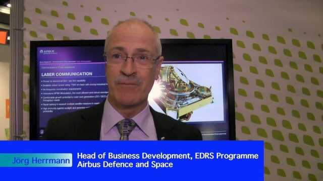
Earth Imaging Journal spoke with Jörg Herrmann, head of business development for the EDRS SpaceDataHighway Programme at Airbus Defence and Space, at the recent International Space Symposium. This laser-based data-relay system provides high-speed, near-real-time data transfer for Low Earth Orbit (LEO) satellites and airborne (unmanned/manned) platforms (UAS).
Miyamoto Relief’s Kit Miyamoto Assesses Infrastructure After Nepal Earthquake
0 Views0 Comments0 Likes
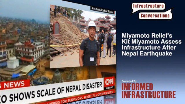
Kit Miyamoto, the CEO of Miyamoto International and nonprofit Miyamoto Relief, reports from Khatmandu, Nepal, where he has been assessing the earthquake's damage to local infrastructure.
Improving the Economics of Space through Greater Access
0 Views0 Comments0 Likes
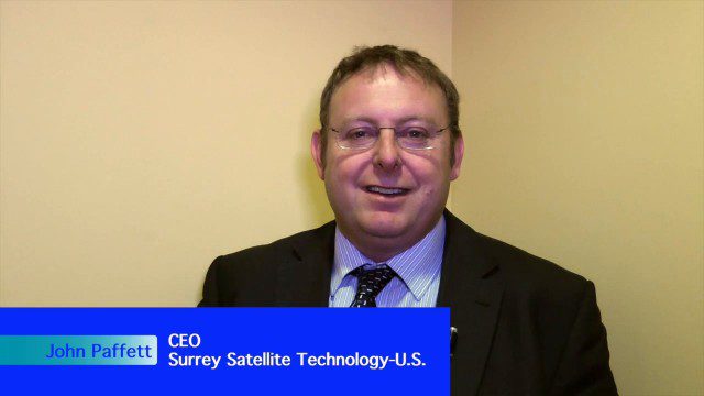
Surrey Satellite Technology U.S. (SST-US) is an offshoot of the UK-based company that has now begun manufacturing satellites in its Denver-based offices to more efficiently address the U.S. market. Earth Imaging Journal spoke with John Paffett, CEO of Surrey Satellite U.S., about its continued mission to change the economics of space. Their recent development of the FeatherCraft platform, alongside partners NanoRacks and Aerojet Rocketdyne, takes advantage of the ease of deploying satellites from the International Space Station, adding propellant to increase the utility and life expectancy of a 100-kilogram-class satellite platform.

After Quake, Engineer in Khatmandu Describes What Fell Down, or Didn’t, and Why
0 Views0 Comments0 Likes
Kit Miyamoto, a structural engineer fresh from five years rebuilding Haiti, spoke with Andy Revkin of The New York Times Dot Earth blog after a day inspecting Kathmandu damage zones.

4_30 Earthquake Broadcast (Nepal Mapping, Drone Video and More)
0 Views0 Comments0 Likes
This GeoSpatial Stream broadcast focuses entirely on the Nepal earthquake of April 25, 2015, that killed more than 5,000 people. News and video cover the scope of the destruction; how governments and relief organizations are helping through mapping; industry aid from Esri, DigitalGlobe and Airbus Defence & Space; an article on how Nepal was mapped in 48 hours; a video of the Mt. Everest avalanche; and more.
Weather-Observation Gap Over Middle East Causes Consternation
0 Views0 Comments0 Likes
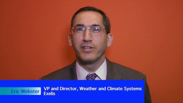
Exelis makes the majority of the weather and climate instruments for the U.S. government as well as Japan and Korea, including those that monitor greenhouse gases. Earth Imaging Journal spoke with Eric Webster, vice president and director for weather and climate systems at Exelis. His team has been working with the U.S. Air Force to study weather capabilities over Centcom (the Middle East and the Indian Ocean) that have been provided by a European weather satellite. The other weather instruments are owned by Russia and China, so there’s some concern about the source of this sensing going forward.
Bentley’s Ron Gant Discusses Roads and Recent Acquisitions
0 Views0 Comments0 Likes
Ron Gant is the Director of Transportation Marketing at Bentley Systems, and he spoke with V1 Media's Todd Danielson at SPAR International, which was held March 30-April 2, 2015, in Houston, Texas. They discussed the transportation industry and Bentley's role there, asset management, Bentley's acquisition of Acute3D, the value of hosting an event in Houston, and more.

4_23 Infrastructure Broadcast (Transportation, AASHTO and More)
0 Views0 Comments0 Likes
This Infrastructure-themed GeoSpatial Stream broadcast highlights an Earth Day video from the American Association of State Highway and Transportation Officials (AASHTO); news on infrastructure from the United States, Canada and Saudi Arabia; industry news from Topcon Positioning Group, Esri and Autodesk; a clip from an infrastructure-related interview at SPAR International; and more.
Trimble Announces Partnership with DotProduct
0 Views0 Comments0 Likes
Bryan Williams, Segment Manager, GCCM, Trimble Navigation, joined Tom Greaves, Chief Marketing Officer, DotProduct, to discuss a recent partnership between the two companies. In an interview with V1 Media's Todd Danielson at SPAR International, which was held March 30-April 2, 2015, in Houston, Texas, they discussed DotProduct and its products as well as how they fit into Trimble's plans. Williams also discusses vertical construction and additional new Trimble technologies.


