
Browse Archives
Intergraph Integrates Public-Safety Technology
0 Views0 Comments0 Likes
V1 Media and GeoSpatial Stream attended HxGN Live, Hexagon's annual user conference, at the MGM Grand in Las Vegas from June 1-4, 2015. They interviewed Kalyn Sims, Chief Technology Officer at Intergraph, who discussed modern computer-aided dispatch, Intergraph's public-safety technology ecosystem, Big Data challenges, evolving patrol work and the rise of UAVs.
Hexagon Mining Creating Solutions for “Life of Mine”
0 Views0 Comments0 Likes
V1 Media and GeoSpatial Stream attended HxGN Live, Hexagon's annual user conference, at the MGM Grand in Las Vegas from June 1-4, 2015. They interviewed Hélio Samora, President of Hexagon Mining, who discussed the company's "life of mine" strategy, sensor and system integration, mine safety and synergy at Hexagon.
Hexagon Geospatial Unveils Cloud Strategy
0 Views0 Comments0 Likes
V1 Media and GeoSpatial Stream attended HxGN Live, Hexagon's annual user conference, at the MGM Grand in Las Vegas from June 1-4, 2015. They interviewed Mladen Stojic, President of Hexagon Geospatial, who discussed the evolution of geospatial data and introduced the company's three-pronged strategy for cloud implementation.
Value Engineering for Site Planning and Preparation
0 Views0 Comments0 Likes
Informed Infrastructure spoke with Michael Kissinger, senior engineer and Land Development Division Manager at Pennoni Associates, and Steve Lewis, single point of contact for Pennoni’s Bentley SITEOPS business. We touched on their creative use of the SITEOPS site-planning tool on a variety of projects to win and retain business.
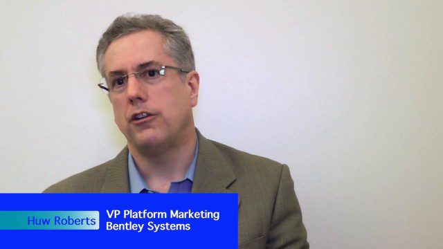
Platform Interoperability for Project Improvement
0 Views0 Comments0 Likes
Informed Infrastructure spoke to Huw Roberts, vice president of platform marketing at Bentley Systems, at the company’s CONNECTION Event roadshow kickoff in Philadelphia. We touched on the next era of project workflows, with greater integration across processes and analytics for better outcomes.
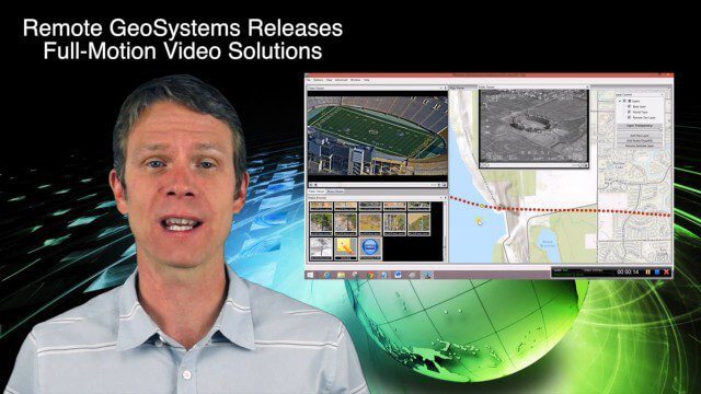
6_25 Infrastructure Broadcast (London’s Crossrail, DOT Grants and More)
0 Views0 Comments0 Likes
This infrastructure-themed GeoSpatial Stream broadcast discusses London's massive Crossrail project, Bentley's involvement in its BIM practices, and the completion of its tunnel boring; U.S. DOT grants to reduce traffic congestion; Canada's massive New Champlain Bridge project; an interview with HOK's Patrick MacLeamy; industry news from Remote GeoSystems, Esri, IMAGINiT Technologies, Pix4D, Innovyze, Flightline Geographics and Tablerock Land Survey; thoughts on Crossrail and the world's longest tunnel; and more.

Everything that Happens, Happens Somewhere
0 Views0 Comments0 Likes
As our planet is becoming more crowded, the demand for diminishing natural resources is growing. Income gaps are widening,and people are being left behind. Geographic location -- and information about these locations – shows us where social, environmental and economic conditions occur. Reliable and authoritative geographic information provides the framework for measuring, monitoring and achieving the sustainable development goals, improving people’s lives and protecting the planet. The United Nations initiative on Global Geospatial Information Management (UN-GGIM) aims at playing a leading role in setting the agenda for the development of global geospatial information and to promote its use to address key global challenges. It provides a forum to liaise and coordinate among Member States, and between Member States and international organizations.
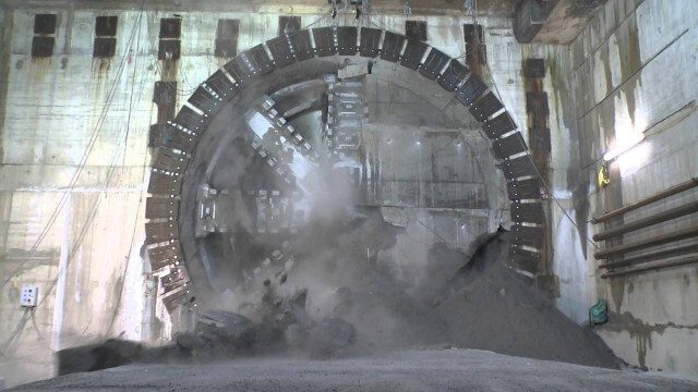
Crossrail Tunnelling: Drone’s Eye View of Crossrail’s Completed Rail Tunnels
0 Views0 Comments0 Likes
The Prime Minister and Mayor of London Boris Johnson celebrated the completion of Crossrail’s tunnels by going 40 metres below the capital to thank the men and women who are constructing the new £14.8 billion east-west railway.
The Algorithm Marketplace
0 Views0 Comments0 Likes
The Algorithm Marketplace provides automated analysis of aerial data acquired by UAVs (Unmanned Aerial Vehicles). Using sophisticated algorithms, drone operators no longer need a background in geographic information system (GIS) or remote sensing to interpret their aerial data; instead, the marketplace provides an action-based report to improve management of assets.
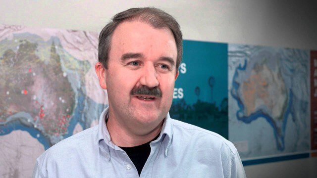
Translating Airborne Electromagnetic Data into Geological Understanding
0 Views0 Comments0 Likes
In this Geoscience Australia Snapshot video, Dr Ian Roach from Geoscience Australia gives an overview of the benefits of using airborne electromagnetic (AEM) survey data. This survey technique is a key tool for mapping geology undercover and has potential implications for understanding the energy, minerals and regional geology of the survey area.


