
Browse Archives
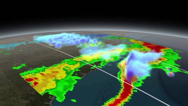
NASA Scanning a Snow Storm
2.30K Views0 Comments0 Likes
On March 17, 2014, the Global Precipitation Measurement (GPM) mission's Core Observatory flew over the East coast's last snow storm of the 2013-2014 winter season.
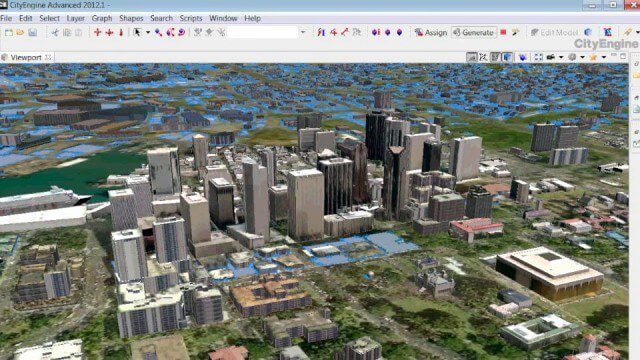
The Power of Geodesign
9.82K Views0 Comments0 Likes
GeoSpatial Stream created this fast-paced music video that quickly summarizes the power of geodesign, based on footage and ideas found at Esri's annual Geodesign Summit.

Make It Wearable Finalists: Meet Team Nixie
2.32K Views0 Comments0 Likes
Team Nixie (http://flynixie.com) is developing the first wearable drone camera, which can be worn around your wrist. The team will be presenting their prototype for the Intel Make It Wearable Challenge Finale on November 3, 2014 in San Francisco. Learn more about Make It Wearable and follow the race to the finish line at http://makeit.intel.com. To find out more about Team Nixie, see their work at http://flynixie.com or follow them on https://www.facebook.com/flynixie.
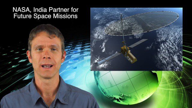
10_16 Asia-Pacific Broadcast (Tsunami Preparedness, NASA/India Partnerships and More)
4.77K Views0 Comments0 Likes
This Asia-Pacific-focused GeoSpatial Stream broadcast discusses several reports indicating that tsunami preparedness is improving in the region; a space-mission partnership between NASA and India's ISRO; the first images from China's Gaofen-2; a video from the University of South Australia's Global Sensor Network; industry news from MDA Information Systems, Esri, Xiaomi, Careland, Innovyze and Nobel Systems; and more.

Fully Integrated RiCOPTER UAV in Flight
3.19K Views0 Comments0 Likes
RiCOPTER is a high-performance UAV which can be equipped with the RIEGL VUX-1 survey-grade LiDAR sensor to offer a fully integrated turnkey solution and marks the first complete UAS LiDAR solution from one manufacturer.
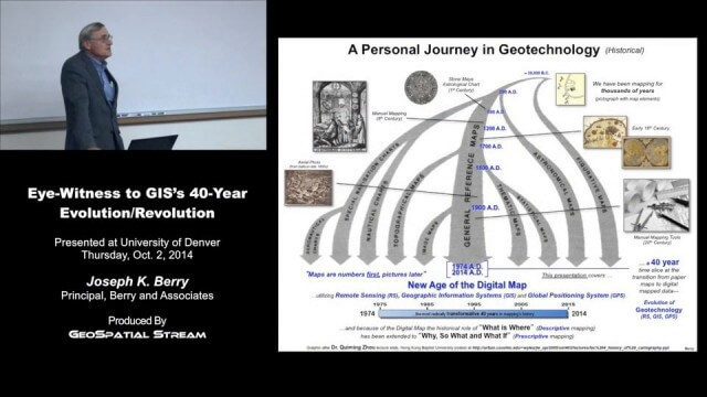
Joe Berry’s “Eye-Witness to GIS’s 40-Year Evolution/Revolution” Presentation
3.25K Views0 Comments0 Likes
In the 40 years since the development of the digital map, what a map is (and isn’t) has greatly evolved. This presentation describes Joe Berry’s personal journey in geotechnology as a student, professor, consultant, software developer and entrepreneur. The insight is as relevant for the next generation of GIS’ers as it is to GIS cohorts who moved beyond mapping to “thinking with maps” and the boundless opportunities for integrating the new spatial paradigm into science, workplaces and daily lives.

Kleinfelder Interview – Bill Siegel, CEO
5.11K Views0 Comments0 Likes
Informed Infrastructure spoke with Bill Siegel, CEO of Kleinfelder, at the opening of the company’s new office in downtown Denver. The conversation touched on the company’s growth through the recession, the trend toward mega-mergers in the AEC industry, and the need to address aging infrastructure.
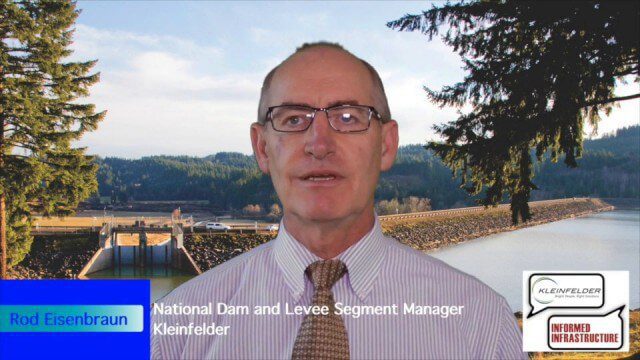
Kleinfelder Interview – Rod Eisenbraun, National Dam and Levee Segment Manager
10.78K Views2 Comments0 Likes
Informed Infrastructure spoke with Rod Eisenbraun, national dam and levee segment manager, at the opening of Kleinfelder’s new office in downtown Denver. The conversation covered dam creation and rehabilitation, the need for more storage with increasing droughts, the more environmentally friendly approaches these days, and hydro power as a clean power source.
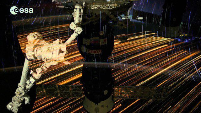
Earth Images from ESA Astronaut Alexander Gerst
3.07K Views0 Comments0 Likes
This timelapse video was made from images taken by ESA astronaut Alexander Gerst orbiting Earth on the International Space Station. The video is offered in Ultra High Definition, the highest available to consumers. Be sure to change the settings in YouTube if your computer or television can handle it for the full effect. The montage is made from a long sequence of still photographs taken at a resolution of 4256 x 2832 pixels at a rate of one every second. The high resolution allowed the ESA production team to create a 3840 x 2160 pixel movie, also known as Ultra HD or 4K. Playing these sequences at 25 frames per second, the film runs 25 times faster than it looks for the astronauts in space. The artistic effects of the light trails from stars and cities at night are created by superimposing the individual images and fading them out slowly. Alexander Gerst is a member of the International Space Station Expedition 40 crew. He is spending five and a half months living and working on the ISS for his Blue Dot mission.
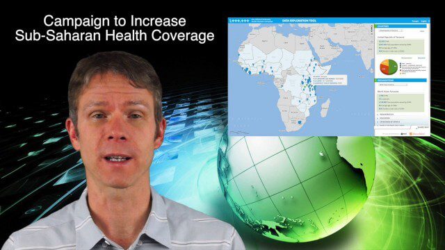
10_23 Europe/Africa Broadcast (INTERGEO, African Health Coverage and More)
4.05K Views0 Comments0 Likes
This GeoSpatial Stream broadcast discusses geospatial news and videos related to Europe and Africa, including the recent INTERGEO conference in Berlin; the One Million Community Health Workers Campaign in Sub-Saharan Africa; a European Commission commitment to invest in the data sector; industry news from Gfk, Euroconsult, Airbus Defence and Space and Spectrum Geo, and Headwall Photonics; images from the International Space Station; and more.


