
Browse Archives

Interview with CEOs of Bentley Systems and Topcon Positioning Systems
1.26K Views0 Comments0 Likes
In October 2019, Informed Infrastructure Editorial Director Todd Danielson went to Bentley Systems’ Year In Infrastructure conference in Singapore. While there as an award juror for the Buildings and Campuses category, he was able to interview Greg Bentley and Ray O'Connor, the CEOs of Bentley Systems and Topcon Positioning Systems, respectively, about their companies and the joint venture they launched at the event: Digital Construction Works Incorporated (DCW).

The 2018 World Monuments Watch
3.77K Views0 Comments0 Likes
Every two years, the World Monuments Watch issues a call to action for treasured cultural sites around the globe. Since 1996, when the Watch was founded with support from American Express, it has recognized 790 sites that face daunting threats or present compelling conservation opportunities, and it has catalyzed over $240 million of investment in their protection and conservation. The 2018 Watch brings attention to 25 sites facing diverse threats.
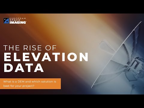
The Rise of Elevation Data – What Is a DEM and Which Solution Is Best for You?
109 Views0 Comments0 Likes
The world exists in three dimensions and often, so does satellite imagery. But with so many types of Digital Elevation Models, each created via different collection and processing methods and sold in a variety of for...

European Space Agency (ESA) 2022 Preview
22 Views0 Comments0 Likes
As always, a new year brings new and exciting missions and launches for ESA. In science the world looks forward to the first image releases of the recently launched James Webb Space Telescope and the third data relea...
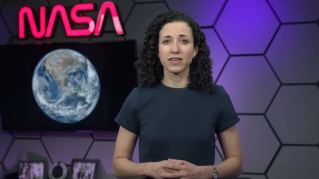
Air Quality in Washington, D.C.
0 Views0 Comments0 Likes
A video production for NASA's Earth Information Center about air quality in Washington, D.C. Air pollution in DC has declined by 50% in the last two decades. NASA uses sensors aboard satellites and aircraft to obta...

2015 Audubon Medal Awardees: Jack and Laura Dangermond
3.29K Views0 Comments0 Likes
Jack and Laura Dangermond launched Environmental Systems Research Institute (Esri) in 1969 with a vision of how maps and geographic sciences could promote deeper understanding of our world and enable us to design a better future. The Dangermonds have since donated more than a billion dollars in geo-spatial, analytical, and visualization technology to research institutions, schools, and nonprofit organizations, equipping these groups with the same GIS tools that drive the strategies of Fortune 500 companies.

6_11 Innovation Broadcast (Hexagon Conference, Iceberg Tracking and More)
3.35K Views0 Comments0 Likes
This GeoSpatial Stream broadcast discusses the latest innovation seen at the HxGN Live conference hosted by industry powerhouse Hexagon; a Canadian team tracking icebergs to understand how they drift; industry news from GeoDecisions, Esri, exactEarth, Harris Corp, FlightlineGeo and LizardTech; concluding thoughts and opinions from the Hexagon conference; singing with Elvis; and more.
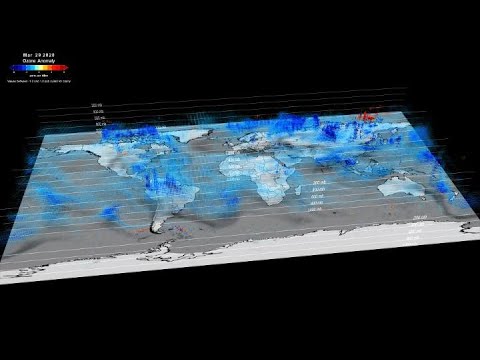
NASA Tracks COVID-19’s Atmospheric Fingerprint
0 Views0 Comments0 Likes
The COVID-19-related lockdowns granted scientists an unexpected and detailed glimpse as to how human activities impact atmospheric composition. Two recent studies, one focusing on nitrogen oxide and the other examinin...

Aeolus Liftoff Replay
875 Views0 Comments0 Likes
ESA’s Earth Explorer Aeolus satellite lifted off on a Vega rocket from Europe’s Spaceport in Kourou, French Guiana, on Aug. 22, 2018.

2_19 Infrastructure Broadcast (NSDI, Sustainable Cities and More)
4.21K Views0 Comments0 Likes
This Infrastructure-themed GeoSpatial Stream broadcast discusses the National Spatial Data Infrastructure (NSDI) Report Card; a Center for Environmental Health map concerning lead-contaminated fuel near airports; industry news from Hexagon, Trimble, Viametris, Apple and Bentley Systems; a video concerning the 2015 ARCADIS Sustainable Cities Index; and more.


