
Tag: video

Harris Sensors Monitor Urban Environments
3.34K Views0 Comments0 Likes
The V1 Video team interviewed Eric Webster, Vice President and General Manager of Environmental Solutions at Harris Corp., at the 32nd Space Symposium held April 11-14, 2016, in Colorado Springs, Colo. He discusses the company's GreenLITE carbon dioxide monitoring system and how it can monitor an entire city, an example of the technology being used in Paris, and the benefits of a multi-sensor platform for environmental analysis.

PEACE on Earth GPS Art
1.35K Views0 Comments0 Likes
I traveled over 65,700 miles to meet people from all around the world to help me create a GPS drawing that would express a simple message. This is my journey.

Get Ready for the 2017 Solar Eclipse
5.12K Views0 Comments0 Likes
On Monday, August 21, 2017, our nation will be treated to a total eclipse of the sun.
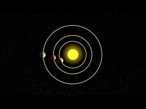
AI and NASA Data Used to Discover Eighth Planet Circling Distant Star
4.13K Views0 Comments0 Likes
Our solar system now is tied for most number of planets around a single star, with the recent discovery of an eighth planet circling Kepler-90, a Sun-like star 2,545 light years from Earth. The planet was discovered in data from NASA’s Kepler space telescope.
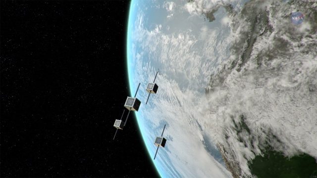
ScienceCasts: NASA Embraces Small Satellites
5.93K Views0 Comments0 Likes
NASA is embracing small satellite designs, from tiny CubeSats to micro-satellites. These miniature marvels are providing many ways to collect science data and to demonstrate new technologies.

TOPEX/JASON Sees 22-Year Sea Level Rise
1.45K Views0 Comments0 Likes
This visualization shows total sea level change between 1992 and 2014, based on data collected from the TOPEX/Poseidon, Jason-1, and Jason-2 satellites. Blue regions are where sea level has gone down, and orange/red regions are where sea level has gone up. Since 1992, seas around the world have risen an average of nearly 3 inches. The color range for this visualization is -7 cm to +7 cm (-2.76 inches to +2.76 inches), though measured data extends above and below 7cm(2.76 inches). This particular range was chosen to highlight variations in sea level change. Download the visualization: http://svs.gsfc.nasa.gov/cgi-bin/deta....
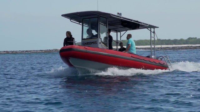
CORAL Probes Great Barrier Reef
1.58K Views0 Comments0 Likes
The three-year COral Reef Airborne Laboratory (CORAL) mission will survey a portion of the world's coral reefs to assess the condition of these threatened ecosystems and understand their relation to the environment, including physical, chemical and human factors.
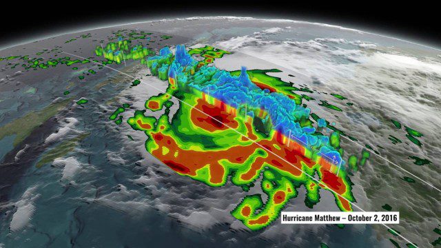
NASA’s 3D View Shows Hurricane Matthew’s Intensity
1.34K Views0 Comments0 Likes
NASA scientists used satellite data to peer into Hurricane Matthew, learning how and why the massive storm changed throughout its course.
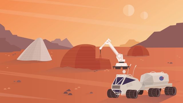
NASA’s 3-D Printed Habitat Challenge
2.14K Views0 Comments0 Likes
NASA Centennial Challenges wants YOUR help building a 3-D printed habitat on Mars. NASA and its partners are holding a $2.5 million competition to build a 3D printed habitat for deep space exploration, including the agency’s journey to Mars.

8_4 Infrastructure Broadcast (TIGER Grants, Transit Tech and More)
2.29K Views0 Comments0 Likes
This Infrastructure-themed GeoSpatial Stream broadcast discusses $500 million in grants from the USDOT's TIGER program; highlights from the latest issue of Informed Infrastructure magazine; new virtual reality technology to promote transit; industry news from Pix4D, Thinkbox Software and the Global Infrastructure Hub; a video from the Mississippi Watershed Management Organization about a stormwater filtration system recently installed near Minneapolis; and more.


