
Tag: Internet

TOPEX/JASON Sees 22-Year Sea Level Rise
0 Views0 Comments0 Likes
This visualization shows total sea level change between 1992 and 2014, based on data collected from the TOPEX/Poseidon, Jason-1, and Jason-2 satellites. Blue regions are where sea level has gone down, and orange/red regions are where sea level has gone up. Since 1992, seas around the world have risen an average of nearly 3 inches. The color range for this visualization is -7 cm to +7 cm (-2.76 inches to +2.76 inches), though measured data extends above and below 7cm(2.76 inches). This particular range was chosen to highlight variations in sea level change. Download the visualization: http://svs.gsfc.nasa.gov/cgi-bin/deta....
Tracking California Rains During El Niño
0 Views0 Comments0 Likes
This winter, areas across the globe experienced a shift in rain patterns due to the natural weather phenomenon known as El Niño. New NASA visualizations of rainfall data show the various changes to California. According to the National Oceanic and Atmospheric Administration, El Niño was expected to produce wetter-than-average conditions from December 2015 to February 2016. Scientists refer to historical weather patterns and to look at trends of where precipitation normally occurs during El Niño events. Also, several factors—not just El Niño—can contribute to unusual weather pattern.

Can the Next Generation of Satellites Help Predict and Battle Wildfires?
0 Views0 Comments0 Likes
Re/code visits NASA's Silicon Valley research center, where a pair of startups are working together to democratize satellite data. Aquila Space is building a fleet of satellites while its partner Astro Digital is developing software tools that allow anyone to process and analyze the data. Among other things, the information could be used to help inform policy and responses for ecological disasters, including the droughts and wildfires plaguing California.
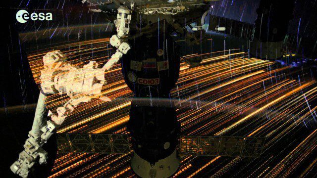
Earth Images from ESA Astronaut Alexander Gerst
0 Views0 Comments0 Likes
This timelapse video was made from images taken by ESA astronaut Alexander Gerst orbiting Earth on the International Space Station. The video is offered in Ultra High Definition, the highest available to consumers. Be sure to change the settings in YouTube if your computer or television can handle it for the full effect. The montage is made from a long sequence of still photographs taken at a resolution of 4256 x 2832 pixels at a rate of one every second. The high resolution allowed the ESA production team to create a 3840 x 2160 pixel movie, also known as Ultra HD or 4K. Playing these sequences at 25 frames per second, the film runs 25 times faster than it looks for the astronauts in space. The artistic effects of the light trails from stars and cities at night are created by superimposing the individual images and fading them out slowly. Alexander Gerst is a member of the International Space Station Expedition 40 crew. He is spending five and a half months living and working on the ISS for his Blue Dot mission.

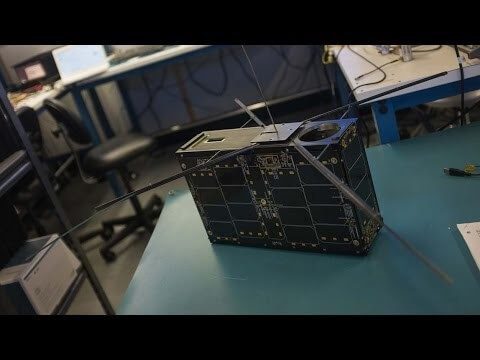
Make It Wearable Finalists: Meet Team Nixie
0 Views0 Comments0 Likes
Team Nixie (http://flynixie.com) is developing the first wearable drone camera, which can be worn around your wrist. The team will be presenting their prototype for the Intel Make It Wearable Challenge Finale on November 3, 2014 in San Francisco. Learn more about Make It Wearable and follow the race to the finish line at http://makeit.intel.com. To find out more about Team Nixie, see their work at http://flynixie.com or follow them on https://www.facebook.com/flynixie.
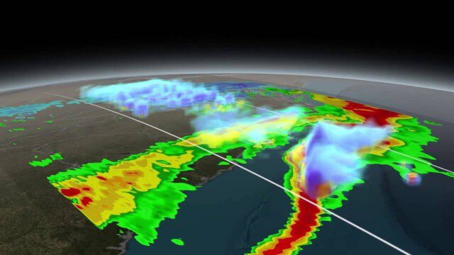
NASA Scanning a Snow Storm
0 Views0 Comments0 Likes
On March 17, 2014, the Global Precipitation Measurement (GPM) mission's Core Observatory flew over the East coast's last snow storm of the 2013-2014 winter season.
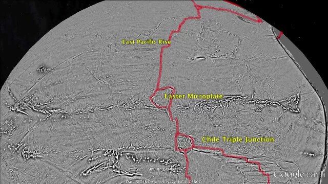
Draining the Ocean Basins with CryoSat-2
0 Views0 Comments0 Likes
This is the supplementary video for the scientific article "New global marine gravity model from CryoSat-2 and Jason-1 reveals buried tectonic structure". The full paper is available at: sciencemag.org/content/346/6205/65
The Global Sensor Network – University of South Australia
0 Views0 Comments0 Likes
Australia has a combined land and sea territory of more than 8 million square kilometers. Yet most of this is currently out of the reach of affordable communication. Now the University of South Australia's Institute for Telecommunications Research has turned this on its head, with the development of the Global Sensor Network. The Global Sensor Network is an innovative signal processing system which provides low cost, two-way, simultaeneous satellite communications to multiple users.

Unleashing the Power of Earth Observations
0 Views0 Comments0 Likes
What do we see when we look at the Earth, and what do these observations mean for the years ahead? Barbara Ryan, secretariat director of the Intergovernmental Group on Earth Observations (GEO), discusses this Geneva-based, voluntary partnership of governments and organizations dedicated to coordinated, comprehensive, and sustained Earth observations and information — sharing what scientific observers worldwide are learning about the state and health of planet Earth.


