
Tag: Earth Imaging
Asia-Pacific Broadcast (Remote-Sensing Satellites, East Asia Agreements, Greenhouse Mapping and More)
8.06K Views1 Comments0 Likes
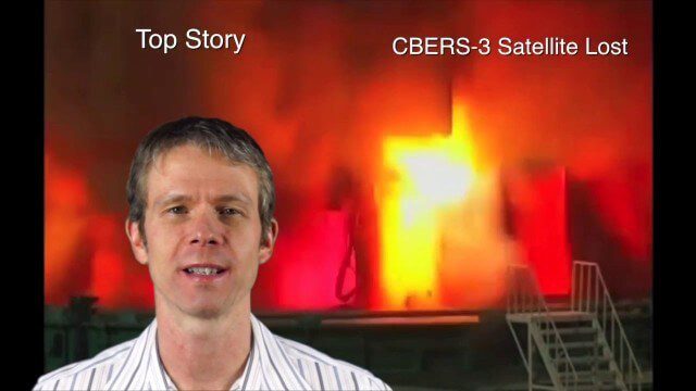
This GeoSpatial Stream focuses on the Asia-Pacific region. Topics covered include China's failed CBERS-3 remote-sensing satellite, a joint agreement to monitor air pollution, Greenhouse mapping in India, precision agriculture in Australia and more.

6_2 GPS Broadcast (Topo Maps, Napoleon, HxGN LIVE, More)
3.86K Views0 Comments0 Likes
This GeoSpatial Stream broadcast includes a tribute to the "founder of GPS," Roger Easton, and discusses new USGS Topo maps; cloud computing frameworks; a book featuring the famous Minard Map of Napoleon's Russian Campaign of 1812; BlackBridge financing; World Cup Stadium images from Airbus; and an upcoming trip to HxGN LIVE in Las Vegas, Nevada.


