


Category: Vendor Videos

Year in Infrastructure 2017
6.29K Views0 Comments0 Likes
See presentations that inspire, including what’s next in Bentley software, thought-provoking guest keynotes, and this year’s industry advancements.

Why You Should Attend Geodesign Summit 2016
5.16K Views0 Comments0 Likes
This faced-paced music video from GeoSpatial Stream highlights some of the best moments of the 2015 event, illustrating why you should register for and attend the next event, being held Jan. 27-28, 2016, in Redlands, Calif. For more information and to register, visit www.geodesignsummit.com.

Why Attend Bentley Systems YII 2016
3.72K Views0 Comments0 Likes
This video from Bentley Systems shows highlights of the 2015 event and what attendees can expect if they convene in London in 2016.
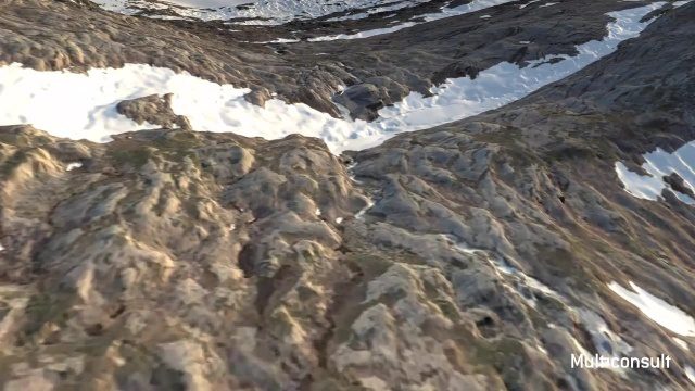
Use of InfraWorks and the Infrastructure Design Suite for a Hydropower Project in Norway
3.35K Views0 Comments0 Likes
Designing successful infrastructure projects is one thing. Communicating and demonstrating those designs to clients and other stakeholders before construction is another. Bringing a design to life for people without a civil engineering background is always a challenge, whether your goal is to sell the design or communicate its impact. - See more at: https://informedinfrastructure.com/20253/creating-real-time-navigable-3d-infrastructure-models/

Urban Heat Risk Explorer
3.58K Views0 Comments0 Likes
Helping cities prepare for, respond to, and recover from extreme heat events, the app provides users with a better understanding of heat risks in cities and communicates with users on ways they can protect themselves during extreme heat events.
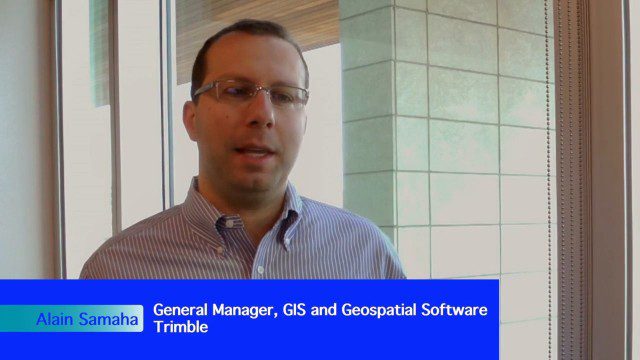
Trimble Expands Hardware and Software Integration, Focus on Solutions
4.19K Views0 Comments0 Likes
Trimble announced an expanded portfolio of geospatial solutions for surveyors, engineers and GIS professionals. V1 Media spoke with Alain Samaha, Business Area Director for Trimble's Geospatial Software Solutions and GIS businesses, about these solutions, the ability to automate and add efficiency, and other trends that are impacting data collection.

The Algorithm Marketplace
2.55K Views0 Comments0 Likes
The Algorithm Marketplace provides automated analysis of aerial data acquired by UAVs (Unmanned Aerial Vehicles). Using sophisticated algorithms, drone operators no longer need a background in geographic information system (GIS) or remote sensing to interpret their aerial data; instead, the marketplace provides an action-based report to improve management of assets.

Spike Kickstarter Video from ikeGPS
3.86K Views0 Comments0 Likes
Spike is the world’s first laser accurate Smartphone measurement solution enabling you to safely and accurately measure an object up to 600 feet (200 m) away. With a simple snap from your Smartphone, you can measure height, width, and area from a photo, and capture target location. Measurement and location are saved with the picture, and can be easily shared via email as a PDF or Spike File (XML).


SpaceCurve Introduces Spatial at the Speed of Reality
3.59K Views0 Comments0 Likes
GeoSpatial Stream's Todd Danielson conducted an Internet Interview with SpaceCurve's CEO Dane Coyer and Founder Andrew Rogers. They spoke about the company's inception, Big Data, spatial indexing and business applications as well as how SpaceCurve created new technologies to integrate these varied components.


