


Category: Found on the Internet
Tracking Ocean Heat with Magnetic Fields
3.39K Views0 Comments0 Likes
Scientists at NASA’s Goddard Space Flight Center are developing a new way to use satellite observations of magnetic fields to measure heat stored in the ocean.

GEOINT Keynote: Parag Khanna, Author on Mapping
3.37K Views0 Comments0 Likes
The U.S. Geospatial Intelligence Foundation (USGIF) recorded the keynote speech of Parag Khanna, author, “Connectography: Mapping the Future of Global Civilization," at the 2016 GEOINT Symposium on May 16, 2016, in Orlando, Fla.
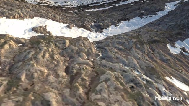
Use of InfraWorks and the Infrastructure Design Suite for a Hydropower Project in Norway
3.35K Views0 Comments0 Likes
Designing successful infrastructure projects is one thing. Communicating and demonstrating those designs to clients and other stakeholders before construction is another. Bringing a design to life for people without a civil engineering background is always a challenge, whether your goal is to sell the design or communicate its impact. - See more at: https://informedinfrastructure.com/20253/creating-real-time-navigable-3d-infrastructure-models/

Fujisawa Sustainable Smart Town Goes Into Full-Scale Operation
3.30K Views0 Comments0 Likes
Fujisawa SST begins full-scale operation, following the completion of “Fujisawa SST SQUARE,” its core facility.

PortMaps – Kaarten en Havenbedrijf Rotterdam
3.30K Views0 Comments0 Likes
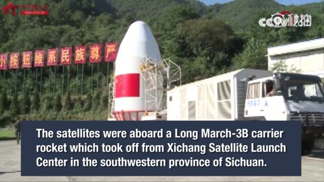
China Launches Two BeiDou-3 Navigation Satellites
3.25K Views0 Comments0 Likes
China launched two BeiDou-3 satellites into space via a single carrier rocket to support its global navigation and positioning network at 7:45 p.m. on Nov. 5, 2017.
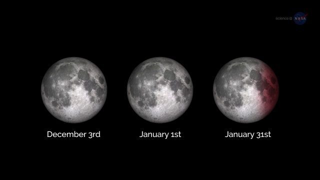
ScienceCasts: A Supermoon Trilogy
3.20K Views0 Comments0 Likes
A series of three supermoons will appear on the celestial stage on Dec. 3, 2017, Jan. 1, 2018, and Jan. 31, 2018.

NASA/JAXA GMI Sensor for Precipitation Measurement
3.14K Views0 Comments0 Likes
On March 10, the Core Observatory passed over an extra-tropical cyclone On March 10, the Core Observatory passed over an extra-tropical cyclone about 1055 miles (1700 kilometers) due east of Japan's Honshu Island. Satellite data shows the full range of precipitation in the storm.
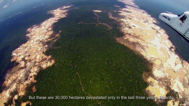
Shocking Images of Environmental Devastation in Peruvian Rainforest
3.12K Views0 Comments0 Likes
Güido Lombardi, a Peruvian journalist, tells in his news radio program at RPP Noticias the impressions that he got after overflying the affected areas by the illegal mining in Madre de Dios, in the Peruvian rainforest. These images where captured by the Carnegie Airborne Observatory.

“National Geographic” Time Scanners Jerusalem
3.09K Views0 Comments0 Likes


