


Category: Found on the Internet
ACEC Colorado Award Winner: Data Fusion Predicts Habitat Quality
1.65K Views0 Comments0 Likes
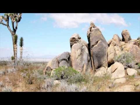
Edwards Air Force Base is located in California’s Mojave Desert, which is home to unique and threatened species such as the desert tortoise, the Joshua tree and desert springparsley. The Air Force monitors impacts of its operations on habitats using multispectral satellite imagery and traditional aerial and field approaches. Hyperspectral imagery and Light Detection and Ranging (LiDAR) remotesensing technologies are being used as more cost-effective methods to collect and analyze spatial data related to habitat quality. Merrick & Company, the primary mapping consultant, was responsible for overall technical implementation, aviation coordination, sensor integration, LiDAR acquisition and point cloud post-processing. Fusing and modeling discreet remotely sensed data from several digital sensors is used to assess habitat quality for inventory and preservation of unique desert species, enabling systematic comparisons to be made over time for effective management of the desert ecosystem. The data also helps to substantiate that operations on Edwards Air Force Base do not degrade habitat quality that may result in the loss of sensitive species in the region.
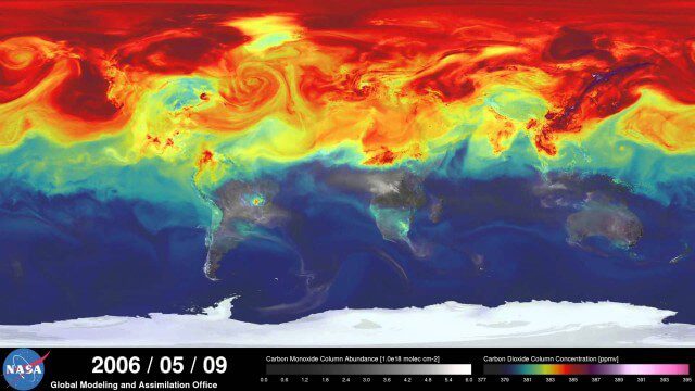
A Year in the Life of Earth’s CO2
2.02K Views0 Comments0 Likes
An ultra-high-resolution NASA computer model has given scientists a stunning new look at how carbon dioxide in the atmosphere travels around the globe.

A Trip Through Time With Landsat 9
61 Views0 Comments0 Likes
For half a century, the Landsat mission has shown us Earth from space. Now, come along with us on a "roadtrip" through the decades to see how the technology on this NASA and U.S. Geological Survey partnership has evo...
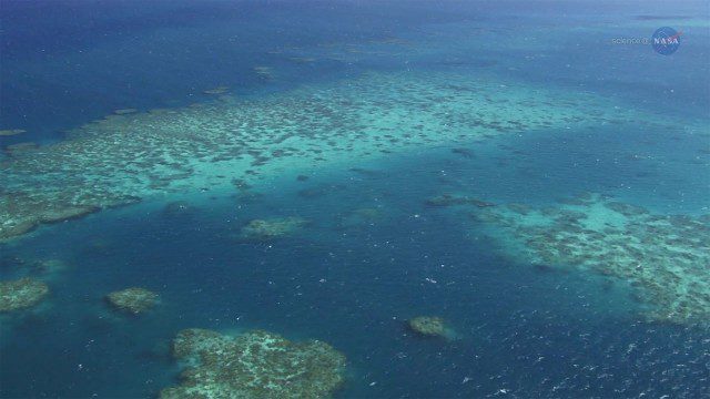
A New View of Coral Reefs
1.33K Views0 Comments0 Likes
A three-year NASA field expedition to examine Earth’s coral reefs is now underway, giving scientists the opportunity to study reef ecology and conditions.

A New Satellite to Understand How Earth Is Losing Its Cool
784 Views0 Comments0 Likes
ESA’s Earth Explorer FORUM mission will provide new insight into the planet’s radiation budget and how it is controlled.
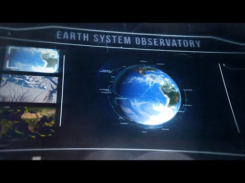
A New Era of Earth Science (NASA Trailer)
0 Views0 Comments0 Likes
For more than 50 years, NASA has been collecting and providing data about Earth’s land, water, ice and atmosphere. Now, a new era of Earth Science has begun. NASA will launch a fleet of state-of-the-art satellites for...

A Month at Sea: Scientists Prepare to Set Sail for NASA’s S-MODE Mission
0 Views0 Comments0 Likes
In early October, the research vessel Bold Horizon set sail from Newport, Oregon, and joined a small fleet of planes, drones, and other high-tech craft chasing the ocean’s shapeshifting physics. NASA’s Sub-Mesoscale O...
A Look Back: 2022’s Temperature Record
0 Views0 Comments0 Likes
2022 effectively tied for Earth’s 5th warmest year since 1880, and the last nine consecutive years have been the warmest nine on record. NASA looks back at how heat was expressed in different ways around the world in ...

A Colorful ‘Landing’ on Pluto
4.76K Views0 Comments0 Likes
What would it be like to actually land on Pluto? This movie was made from more than 100 images taken by NASA’s New Horizons spacecraft over six weeks of approach and close flyby in the summer of 2015.
A Celebration of Clouds
4.40K Views0 Comments0 Likes
Clouds can be a nuisance when scientists are trying to observe features on Earth's surface. But at other times, clouds are exactly what they want to see. These images highlight some of the more unusual and beautiful...


