


Category: Found on the Internet
Sentinel-2B Prepared for Liftoff
5.39K Views0 Comments0 Likes
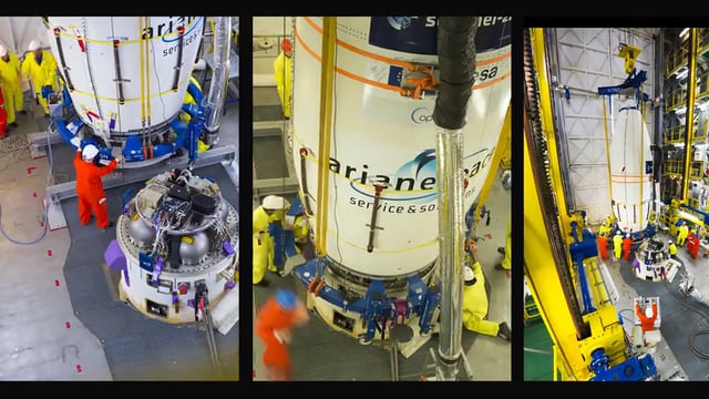
This timelapse video shows Sentinel-2B satellite, from final preparations to liftoff on a Vega launcher, flight VV09, from Europe’s Spaceport in French Guiana, on 7 March 2017.
Soyuz Rocket Deploys 73 Satellites
5.34K Views0 Comments0 Likes
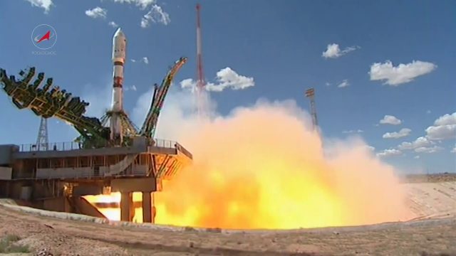
On July 14, 2017, a Russian Soyuz booster lifted off from Kazakhstan on a complex mission to deploy 73 satellites into three different orbits, including a Russian spacecraft to locate forest fires, 48 CubeSats for Planet’s global Earth observation fleet, and eight nanosatellites for Spire Global’s commercial weather network.
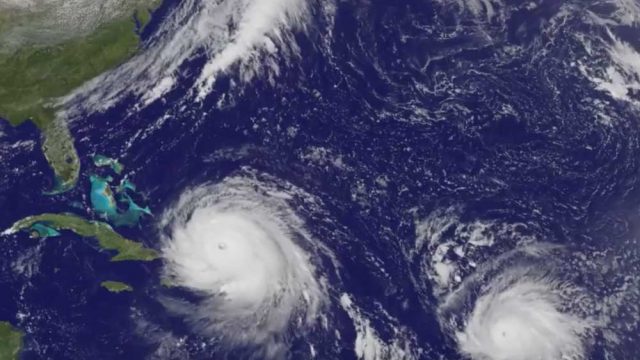
Satellite Animation Sees Hurricanes Katia, Irma and Jose
5.30K Views0 Comments0 Likes
This animation of NOAA's GOES East satellite imagery from Sept. 5 at 7:45 a.m. EDT (1145 UTC) to Sept. 8 ending at 7:45 a.m. EDT (1145 UTC) shows Category 4 Hurricane Irma approach the Bahamas, followed by Hurricane Jose approaching the Leeward Islands. Hurricane Katia continues to spin in the southwestern Gulf of Mexico.

Inside the International Space Station with Google Street View
5.27K Views0 Comments0 Likes
The International Space Station is a marvel of modern science and engineering. Astronauts have occupied the pressurized modules for over 16 years, and now you can explore their work and living spaces in Google Street View. From the research, to the "orbital outhouse" to the inspirational views back down to Earth from the cupola, take a look at the images here: google.com/streetview
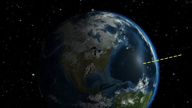
2017 Solar Eclipse Shadow Seen from Million Miles Away
5.22K Views0 Comments0 Likes
The moon's shadow (umbra) crossed the continental United States on Aug. 21, 2017 and NASA's DSCOVR satellite's Earth Polychromatic Imaging Camera (EPIC) captured imagery.
NASA Looks to Solar Eclipse to Help Understand Earth’s Energy System
5.21K Views0 Comments0 Likes
During the August 21, 2017 total solar eclipse, scientists will use the Earth Polychromatic Imaging Camera (EPIC) on the Deep Space Climate Observatory satellite (DSCOVR), along with measurements taken from within the moon's shadow on the ground, to test a new model of Earth's energy budget.

After Quake, Engineer in Khatmandu Describes What Fell Down, or Didn’t, and Why
5.19K Views0 Comments0 Likes
Kit Miyamoto, a structural engineer fresh from five years rebuilding Haiti, spoke with Andy Revkin of The New York Times Dot Earth blog after a day inspecting Kathmandu damage zones.
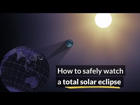
How to Safely Watch a Solar Eclipse
5.18K Views0 Comments0 Likes
It is never safe to look directly at the sun's rays - even if the sun is partly obscured. When watching a partial eclipse you must wear eclipse glasses at all times if you want to face the sun, or use an alternate indirect method. This also applies during a total eclipse up until the time when the sun is completely and totally blocked.
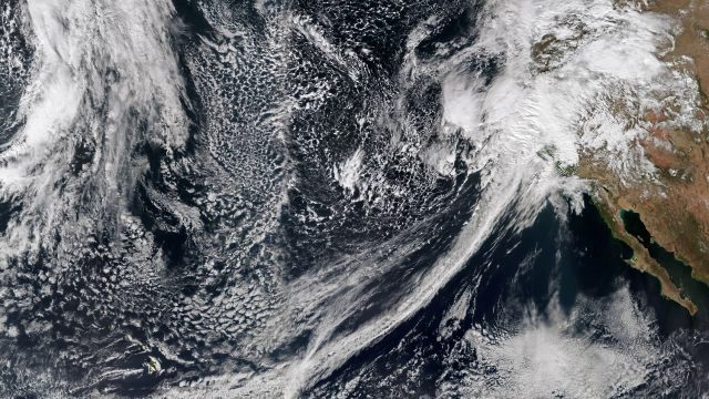
Recent Rains Drench California
5.17K Views0 Comments0 Likes
Recent rainfalls have drenched the state of California. Imagery from NASA satellites show the result of several atmospheric rivers, known as the Pineapple Express, which carry moisture from as far away as the Hawaiian Islands.
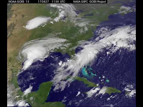
Satellite Animation Shows Harvey Moving into Gulf
5.15K Views0 Comments0 Likes
This animation of NOAA's GOES East satellite imagery from 9:15 a.m. CDT, Aug. 26, 2017, to 9:30 a.m. CDT, Aug. 28, 2017, shows Hurricane Harvey transitioning to a tropical storm at 1 p.m. CDT on Aug. 26, 2017, and slowly emerging in the Gulf of Mexico on Aug. 28.


