


Category: Daily Digests
12_10 Earth Imaging Broadcast (Satellite News, Space Station Videos and More)
2.79K Views0 Comments0 Likes
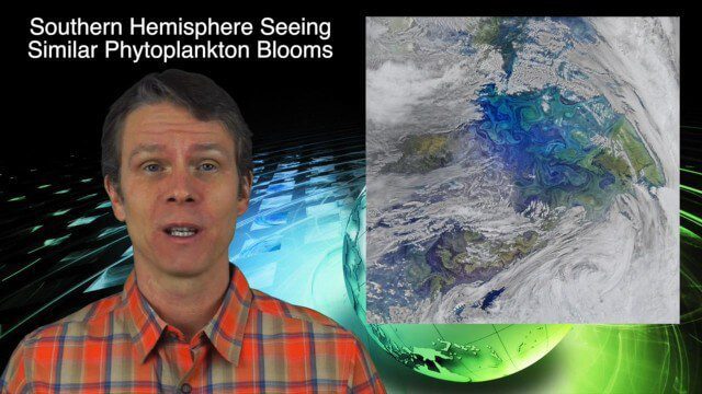
This Earth Imaging-based GeoSpatial Stream broadcast discusses several stories related to satellites, including a video about the International Space Station's Servir Project; spring phytoplankton blooms imaged in the southern hemisphere; the anniversary of the Solar and Heliospheric Observatory (SOHO); industry news from Descartes Labs, exactEarth, Orbit Logic and SimActive; a video of satellites making the seas safer for humans; and more.
4_28 Asia-Pacific Broadcast (Great Barrier Reef, Asian Satellites, CityNext and More)
3.64K Views0 Comments0 Likes
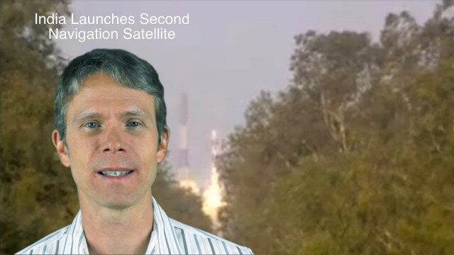
This Asia-Pacific-focused GeoSpatial Stream broadcast discusses a new way to monitor the Great Barrier Reef from space, GLONASS updates, a new Indian navigation satellite, CityNext in Surat, the latest industry headlines, and more.

6_9 Earth Imaging Broadcast (Satellite Success, Asteroid Mining and More)
2.47K Views0 Comments0 Likes
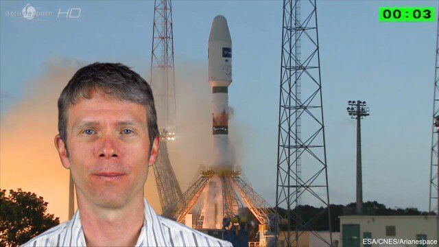
This Earth Imaging-themed GeoSpatial Stream broadcast discusses the recent streak of success at the European Space Agency, including its Sentinel and Galileo launches as well as a demonstration of the SpaceDataHighway; a NASA video about its North Atlantic Aerosols and Marine Ecosystems Study (NAAMES) mission; industry news from Merrick-Surdex Joint Venture, TerraGo, Earth-i, Teledyne Optech and Siteco Informatica; thoughts on asteroid mining and related benefits to Earth sensing; and more.
8_11 Water Resources Broadcast (Massive Groundwater Loss, Algal Blooms and More)
4.30K Views0 Comments0 Likes
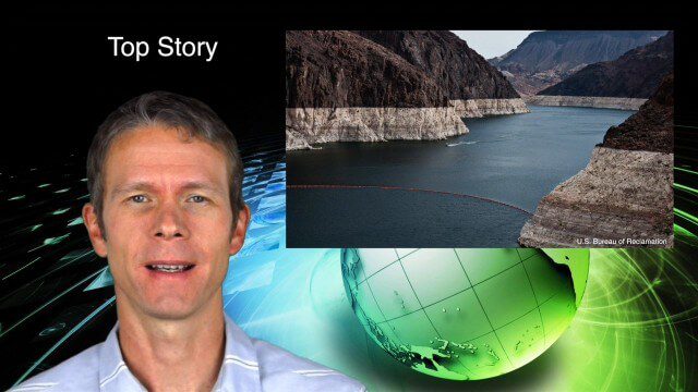
This GeoSpatial Stream broadcast discusses a NASA study on massive groundwater loss in the Colorado River Basin; remote sensing to study algal blooms in Lake Erie; the USGS National Map Corps' latest addition; an Esri Story Map on the Football Hall of Fame; industry news from Pelydryn, Airborne Hydrography, Leica Geosystems, Geographic Technologies Group, URISA and Lockheed Martin; river pollution; and more.
10_1 Science Broadcast (Mars Water, Neutrino and Tree Maps, and More)
2.92K Views0 Comments0 Likes
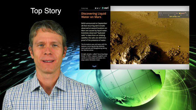
This GeoSpatial Stream broadcast discusses several intersections of science and geospatial technology, including NASA's announcement that Mars has liquid water; a map showing Earth's neutrinos; a video showing how scientists estimated the number of trees on Earth; industry news from exactEarth, US Topo maps, Teledyne Optech and Intergraph Government Solutions; opinions on the impact of the news from Mars; and more.
4_8 Precision-Agriculture Broadcast (Food and Fluorescence, Sentinel Launch, and More)
4.05K Views0 Comments0 Likes
This GeoSpatial Stream broadcast discusses how food production can be tracked via satellites; the launch of Sentinel-1A; maps of extractive industries and agriculture in Peru and Ghana; a satellite competition; industry news from URISA, Ordnance Survey, Open Geospatial Consortium and Leica Geosystems; and more.

7_1 Drones Broadcast (SPOT 7, Minerals Cadastre and More)
3.43K Views0 Comments0 Likes
This GeoSpatial Stream broadcast discusses the banning of drones from U.S. National Parks; the launch of SPOT 7; a Tanzanian effort to improve its mining cadastre; the first private Russian remote-sensing satellite; industry news from IMAGINiT Technologies, GeoVille, CartoDB, Esri and Boundless; an article in Sensors & Systems; and more.
5_29 Education Broadcast (Esri ConnectED, Greenland Glaciers and More)
4.03K Views0 Comments0 Likes
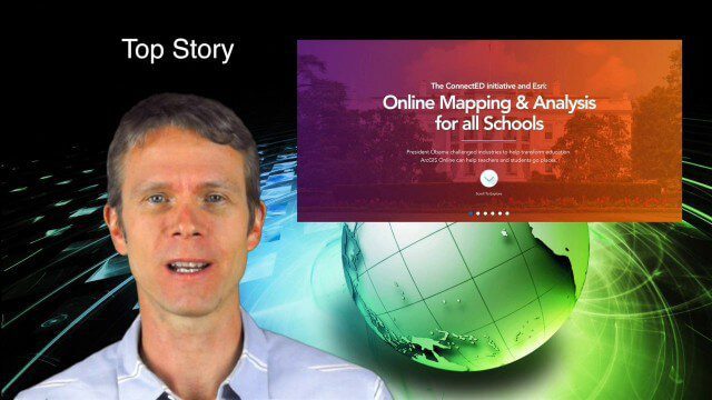
This GeoSpatial Stream broadcast discusses Esri's billion-dollar donation to Obama's ConnectED program for K-12 students; new NASA data showing Greenland's glaciers will have more impact on sea-level rise than originally thought; a report on the global space economy; industry news from Raytheon and Blue Marble Geographics; a video showing the power of geospatial tools in young students' hands; and more.

7_16 Asia Pacific Broadcast (New Satellites, Drones Catching Tax Cheats and More)
3.20K Views0 Comments0 Likes
This Asia Pacific-themed GeoSpatial Stream broadcast discusses new Asian geospatial satellites from India, China and Japan; V1 Media's upcoming Webcast on Earthquake safety; laser scanning to map and preserve Japanese castles and Malaysian caves; drones used in Indonesia to catch tax cheats; industry news from MDA and Google; thoughts on digital preservation; and more.
3_26 Infrastructure Broadcast (Urban Sprawl, Climate Change and More)
11.41K Views0 Comments0 Likes
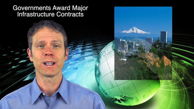
This Infrastructure-themed GeoSpatial Stream broadcast discusses a new report on the varied negative impacts of urban sprawl; an article in Informed Infrastructure about the effects of climate change on aging infrastructure; a summary of recent infrastructure spending; industry news from Esri, Topcon Positioning Group, Digi-Star, Space Foundation, Taylor Devices and Trimble; efforts from URISA's GISCorp in disaster-stricken Vanuatu; and more.


