


Category: Infrastructure

4_30 Earthquake Broadcast (Nepal Mapping, Drone Video and More)
9.52K Views0 Comments0 Likes
This GeoSpatial Stream broadcast focuses entirely on the Nepal earthquake of April 25, 2015, that killed more than 5,000 people. News and video cover the scope of the destruction; how governments and relief organizations are helping through mapping; industry aid from Esri, DigitalGlobe and Airbus Defence & Space; an article on how Nepal was mapped in 48 hours; a video of the Mt. Everest avalanche; and more.
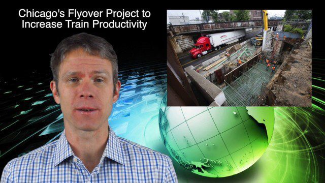
10_30 Infrastructure Broadcast (Green Buildings, Bridge Construction and More)
4.35K Views0 Comments0 Likes
This GeoSpatial Stream broadcast discusses infrastructure news and videos, including a report on Green Buildings; the new Englewood Flyover train project in Chicago; a smart traffic-light network; accelerated bridge construction in Rhode Island; industry news from Esri Canada, Innovyze, Maptek and Autodesk; the upcoming Trimble Dimensions conference in Las Vegas; and more.

6_16 Infrastructure Broadcast (PDH Credit, HxGN Live and More)
2.49K Views0 Comments0 Likes
This Infrastructure-themed GeoSpatial Stream broadcast discusses the latest issue of Informed Infrastructure, including an article on Treasure Island bridge design, PDH credit for an Autodesk benchmark study, and new Web site features and interviews; video clips from the recent HxGN Live event covering Hexagon's latest technologies and direction; industry news from Hexagon, CINTEC America, Contech Engineered Solutions and CoreLogic; thoughts on an upcoming road trip across America's infrastructure; and more.
4_23 Infrastructure Broadcast (Transportation, AASHTO and More)
3.35K Views0 Comments0 Likes
This Infrastructure-themed GeoSpatial Stream broadcast highlights an Earth Day video from the American Association of State Highway and Transportation Officials (AASHTO); news on infrastructure from the United States, Canada and Saudi Arabia; industry news from Topcon Positioning Group, Esri and Autodesk; a clip from an infrastructure-related interview at SPAR International; and more.

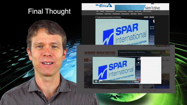
7_23 Infrastructure Broadcast (AEC Market Reports, Smart Cities and More)
3.64K Views0 Comments0 Likes
This Infrastructure-themed GeoSpatial Stream broadcast discusses an optimistic AEC market report; a $16 billion commitment from the state of Washington for transportation improvements; a new LADOT public Web map for smart communities; laser scanning in Mexico; industry news from SmarterBetterCities, Topcon Positioning Group and PaveXpress; thoughts on seeing Informed Infrastructure in action in Chicago; and more.
11_30 Bentley London Broadcast (Event Highlights, Commentary and More)
2.98K Views0 Comments0 Likes
This Infrastructure-themed GeoSpatial Stream broadcast reports from the Bentley Systems Year In Infrastructure 2015 event in London, presenting video highlights; special commentary and opinion; and top news from Bentley and the conference.
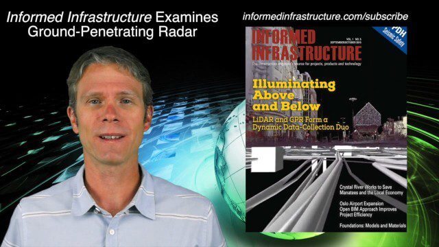
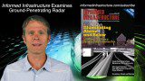
9_24 Infrastructure Broadcast (Federal Initiatives, Ground-Penetrating Radar and More)
12.57K Views0 Comments0 Likes
This Infrastructure-themed GeoSpatial Stream broadcast discusses U.S. federal government action to accelerate infrastructure projects; ground-penetrating radar featured in Informed Infrastructure magazine; industry news from Autodesk, Topcon Positioning Group, Esri, 3D Laser Mapping and RIEGL; a video showing how UAVs are being used to map Mongolian infrastructure; and more.

4_2 Infrastructure Broadcast (Landsat and Flood Risk, Cloud-Based Tools, and More)
2.73K Views0 Comments0 Likes
This infrastructure-focused GeoSpatial Stream broadcast discusses how Landsat is helping with flood risk to infrastructure; North Carolina using cloud-based property data; a Regional Road Construction Map in Spokane; industry news from Columbia Pipeline Group, Synergis, Cityworks and Bentley Systems; surveying in the British Virgin Islands; the Technology of Walking; and more.
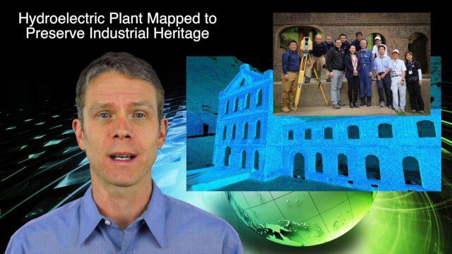
5_14 Infrastructure Broadcast (Nepal Update, 3-D Mapping and More)
3.79K Views0 Comments0 Likes
This Infrastructure-based GeoSpatial Stream broadcast provides an update from the latest earthquake in Nepal as well as related maps from Caltech and JPL concerning the area's geology and effects; 3-D mapping of an industrial heritage site in Japan; industry news from Trimble, Leica Geosystems and IMAGINiT; Nepal relief work geared toward rebuilding the area; and more.

3_19 Infrastructure Broadcast (NYC Gas Explosion, Canada vs. U.S. Infrastructure and More)
3.42K Views0 Comments0 Likes
This infrastructure-focused GeoSpatial Stream broadcast discusses the gas-leak explosion in New York City; the state of the U.S. infrastructure; Canadian investment; announcements from the Smart Grid Innovation Hub, Bentley Systems, Esri, Oracle and Topcon Positioning Group; and more.


