


Category: Conference Interviews
Greg Bentley: Extending the Intelligent Model
0 Views0 Comments0 Likes
Informed Infrastructure spoke to Greg Bentley, CEO of Bentley Systems, at the company’s CONNECTION roadshow kickoff in Philadelphia. We spoke about the company’s announcements at the event as well as their continued extension of intelligent modeling to better-performing assets and projects.
Bentley Looks to Leverage the Cloud Across Projects
0 Views0 Comments0 Likes
Informed Infrastructure spoke to Bhupindher Singh, senior vice president of Bentley Software, at the company’s CONNECTION roadshow kickoff in Philadelphia. We touched on the launch of the company’s CONNECT Edition to use the cloud to collaborate and provide value across the enterprise.
Intergraph Integrates Public-Safety Technology
0 Views0 Comments0 Likes
V1 Media and GeoSpatial Stream attended HxGN Live, Hexagon's annual user conference, at the MGM Grand in Las Vegas from June 1-4, 2015. They interviewed Kalyn Sims, Chief Technology Officer at Intergraph, who discussed modern computer-aided dispatch, Intergraph's public-safety technology ecosystem, Big Data challenges, evolving patrol work and the rise of UAVs.
Hexagon Mining Creating Solutions for “Life of Mine”
0 Views0 Comments0 Likes
V1 Media and GeoSpatial Stream attended HxGN Live, Hexagon's annual user conference, at the MGM Grand in Las Vegas from June 1-4, 2015. They interviewed Hélio Samora, President of Hexagon Mining, who discussed the company's "life of mine" strategy, sensor and system integration, mine safety and synergy at Hexagon.
Hexagon Geospatial Unveils Cloud Strategy
0 Views0 Comments0 Likes
V1 Media and GeoSpatial Stream attended HxGN Live, Hexagon's annual user conference, at the MGM Grand in Las Vegas from June 1-4, 2015. They interviewed Mladen Stojic, President of Hexagon Geospatial, who discussed the evolution of geospatial data and introduced the company's three-pronged strategy for cloud implementation.
Value Engineering for Site Planning and Preparation
0 Views0 Comments0 Likes
Informed Infrastructure spoke with Michael Kissinger, senior engineer and Land Development Division Manager at Pennoni Associates, and Steve Lewis, single point of contact for Pennoni’s Bentley SITEOPS business. We touched on their creative use of the SITEOPS site-planning tool on a variety of projects to win and retain business.
Platform Interoperability for Project Improvement
0 Views0 Comments0 Likes
Informed Infrastructure spoke to Huw Roberts, vice president of platform marketing at Bentley Systems, at the company’s CONNECTION Event roadshow kickoff in Philadelphia. We touched on the next era of project workflows, with greater integration across processes and analytics for better outcomes.

App Aids Satellite Imaging Awareness
0 Views0 Comments0 Likes
The V1 Video team interviewed Alex Herz, president of Orbit Logic, at the GEOINT Symposium in Washington, D.C. We talked about the company’s satellite imagery planning and scheduling capabilities as well as its new foray into apps to make satellite imagery more accessible to everyone. The SpyMeSat mobile application lets smartphone users know when imaging satellites are overhead, what their capabilities are, and has recently added tasking so users can order images directly from their phones.
Integrating Geospatial Technology with Business Intelligence
0 Views0 Comments0 Likes
The V1 Video team interviewed Joe Francica, managing director, Geospatial Industry Solutions at Pitney Bowes, at the GEOINT Symposium in Washington, D.C. We spoke about the launch of MapInfo Pro Raster that uses new Multi-Resolution Raster technology to enable fast processing, visualization and analysis of large high-resolution imagery datasets. We also spoke about the MapInfo Pro 64 bit, which speeds up productivity.
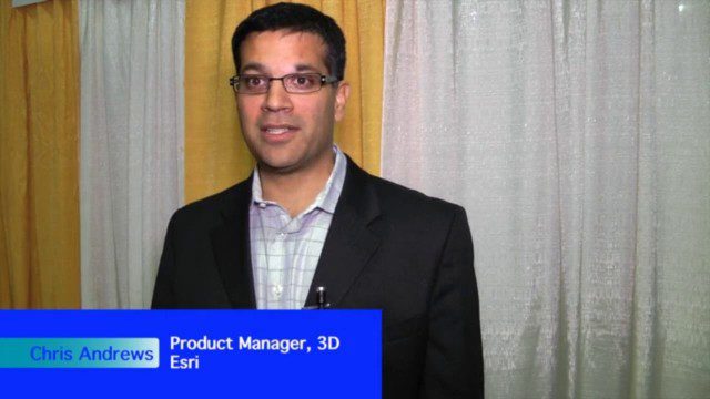
The Unveiling of ArcGIS Earth
0 Views0 Comments0 Likes
The V1 Video team interviewed Chris Andrews, product manager for 3D at Esri, at the GEOINT Symposium in Washington, D.C. We spoke about the new ArcGIS Earth immersive global viewer as well as how 3D is being delivered across Esri’s product line. We spoke about the distinction between desktop and apps, and how an incredible wave of 3D data capture will extend the value of visualization.


