


Category: Conference Interviews
Harris Geospatial’s Geiger-Mode LiDAR Changing Industry
3.14K Views0 Comments0 Likes
The V1 Video team spoke with Mark Romano, Senior Product Manager, Harris Commercial Geospatial, at the ILMF 2016 event held in Denver in February 2016. He spoke about the major differences between traditional LiDAR and Geiger-Mode LiDAR acquisition and data, Harris acquiring Exelis, and the new types of customers and projects that Geiger-Mode LiDAR allows.
Placemeter Building Real-Time Dynamic Data Layer
3.13K Views0 Comments0 Likes
Placemeter collects and serves up-to-the-minute information such as how crowded a place is, how long the wait is, and whether it will get more or less crowded in the next hour. On behalf of V1 Media, Informed Infrastructure and GeoSpatial Stream, Todd Danielson interviewed Jason Novack, solutions architect at Placemeter, at the Geodesign Summit 2015 in Redlands, Calif.
Profile Soil Solutions Software (PS3) Explained
3.11K Views0 Comments0 Likes
The V1 Video team spoke with Matthew Welch, Technical Manager, Profile Products, at the International Erosion Control Association (IECA) Environmental Connection 2016 event held in San Antonio in February 2016. He explained the five key components of a PS3 implementation, the importance of having quality scientific data, value engineering and more.

Delivering Very-High-Resolution Imagery for Densely Populated Areas
3.10K Views0 Comments0 Likes
The V1 Video team interviewed Paul Peterson, senior vice president, Product & Engineering, nearmap, at the 2015 Esri User Conference in San Diego. The aerial imagery and visual analytics company provides timely, high-resolution and historic imagery that they recently imported to the United States from Australia. The unique sensing capacity and frequent revisits of major cities is accompanied by online analysis tools.

Valarm Interview at GeoDesign Summit
3.09K Views0 Comments0 Likes
Todd Danielson interviews a team from Valarm, including Lorenzo Gonzalez, CEO and Software Architect, and Edward Pultar, President and Spatial Scientist. They discuss the company's vision, its clients and how its software assimilates sensor information.
NPMap Pioneers Open and Flexible Platform
3.09K Views0 Comments0 Likes
The V1 Video team interviewed Nate Irwin, head of the NPMap team for the National Park Service, at the USFWS/USNPS Geospatial Training Workshop. NPMap is an innovative online mapping platform that helps park visitors navigate the details of national parks as well as providing a platform for parks to customize and share maps for park management.
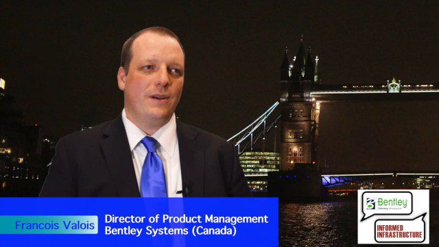
Introducing a Completely New Civil Conceptual Design Tool
3.08K Views0 Comments0 Likes
The V1 Video team interviewed Francois Valois at the 2015 Bentley Year in Infrastructure Conference in London in early November. Valois is director of product management at Bentley Systems, working on their new OpenRoads ConceptStation software, and he spoke about the workflow and the software's capabilities with its new easy-to-use interface, rules-based design tools, cost-based analysis and rich visualization.

Doug Smith Interview (Avenza Systems)
3.07K Views0 Comments0 Likes
Todd Danielson interviews Doug Smith, Director, Sales & Marketing, Avenza Systems, at the GEOINT Symposium in Tampa, Florida. They discuss Avenza's key products, including MAPublisher, Geographic Imager and its new PDF Maps app. All the products work with Adobe products for increased design functionality while maintaing location integrity.
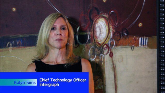
Intergraph Integrates Public-Safety Technology
3.01K Views0 Comments0 Likes
V1 Media and GeoSpatial Stream attended HxGN Live, Hexagon's annual user conference, at the MGM Grand in Las Vegas from June 1-4, 2015. They interviewed Kalyn Sims, Chief Technology Officer at Intergraph, who discussed modern computer-aided dispatch, Intergraph's public-safety technology ecosystem, Big Data challenges, evolving patrol work and the rise of UAVs.
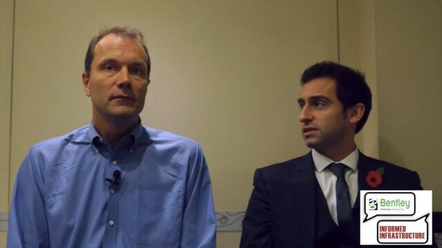
3D City Modeling Coming of Age through Innovation
3.01K Views0 Comments0 Likes
The V1 Video team interviewed Bob Mankowski and Aidan Mercer at the 2015 Bentley Year in Infrastructure Conference in London in early November. Mankowski is vice president of Bentley Software, and Mercer is senior marketing manager for Bentley Systems, and they discussed 3D city modeling, reality meshes, ContextCapture and their thoughts on the Year In Infrastructure 2015 event.


