
tdanielson / Added Videos
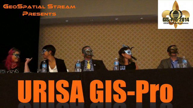
URISA’s GIS-Pro 2014: Big Results in Big Easy
11.14K Views2 Comments0 Likes
URISA's GIS-Pro 2014 was held Sept. 8-11, 2014, in New Orleans. Todd Danielson, GeoSpatial Stream publisher, was at the event and created this video recap.

Jack Dangermond Discusses User Conference Highlights, GIS “Critical Mass” (1 of 4)
11.26K Views0 Comments0 Likes
In the first of four installments, Todd Danielson interviews Jack Dangermond, President and Founder, Esri, at the 2014 Esri User Conference in San Diego. Jack covers event highlights such as GIS aiding the fight against polio in Africa, new technologies introduced, and reaching a "critical mass" of development and use in the industry.
3_26 Infrastructure Broadcast (Urban Sprawl, Climate Change and More)
11.41K Views0 Comments0 Likes
This Infrastructure-themed GeoSpatial Stream broadcast discusses a new report on the varied negative impacts of urban sprawl; an article in Informed Infrastructure about the effects of climate change on aging infrastructure; a summary of recent infrastructure spending; industry news from Esri, Topcon Positioning Group, Digi-Star, Space Foundation, Taylor Devices and Trimble; efforts from URISA's GISCorp in disaster-stricken Vanuatu; and more.
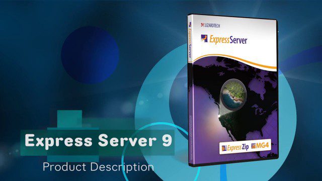
LizardTech’s Express Server 9
11.59K Views0 Comments0 Likes
Jon Skiffington, director of Product Management for LizardTech, describes and demonstrates the latest features and additions to the company's Express Server 9 product, "the fastest, most stable, and easiest way to distribute compressed, high-resolution raster imagery via standard protocols."
9_24 Infrastructure Broadcast (Federal Initiatives, Ground-Penetrating Radar and More)
12.57K Views0 Comments0 Likes
This Infrastructure-themed GeoSpatial Stream broadcast discusses U.S. federal government action to accelerate infrastructure projects; ground-penetrating radar featured in Informed Infrastructure magazine; industry news from Autodesk, Topcon Positioning Group, Esri, 3D Laser Mapping and RIEGL; a video showing how UAVs are being used to map Mongolian infrastructure; and more.
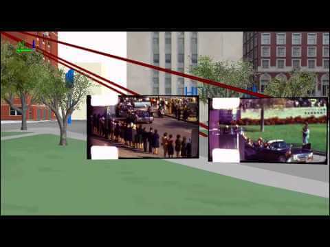
Geography and the Assassination of President Kennedy
12.98K Views0 Comments0 Likes

Jack Dangermond Discusses Large Enterprise Adoption of GIS and the Role of Apps (2 of 4)
13.83K Views0 Comments0 Likes
In the second of four installments, Todd Danielson interviews Jack Dangermond, President and Founder, Esri, at the 2014 Esri User Conference in San Diego. Jack notes how large enterprises are increasingly using GIS, such as Starbucks, Walgreens and the Port of Rotterdam, among others. He also discusses the growing geographical user interface and the role of apps in the marketplace.

Jack Dangermond Implores GIS Community to Get Involved to Make a Difference (4 of 4)
16.75K Views0 Comments0 Likes
In the final of four installments, Todd Danielson interviews Jack Dangermond, President and Founder, Esri, at the 2014 Esri User Conference in San Diego. Jack talks about his passion to solve problems, sometimes at a global scale, and enabling the next generation to help tackle the world's problems. He also encourages the GIS community to "move out and play at 100 percent."

1_21 Open Data Broadcast (Value of Open GeoData, Bee Sensors, GPS/Silicon Valley and More)
18.06K Views1 Comments0 Likes
This GeoSpatial Stream broadcast discusses the need for governments to make geospatial data open, sensors placed on bees to improve pollination, a GPS/Silicon Valley partnership, new avalanche-monitoring software and more.
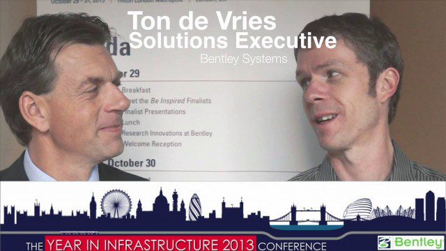
Ton de Vries Interview
23.54K Views0 Comments0 Likes
Todd Danielson interviews Ton de Vries, solutions executive, Bentley Systems. They talk about 3D City Models, Hypermodeling and the importance of Standards.


