
tdanielson / Added Videos
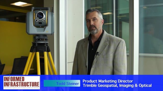
Trimble SX10 Scanning Total Station Brings “Both Worlds” to Surveyors
4.10K Views0 Comments0 Likes
Informed Infrastructure and V1 Media interviewed Todd Steiner, Product Marketing Director, Trimble Geospatial, Imaging & Optical Division, at the corporate launch of the company's new SX10 scanning total station. He discussed how combining a laser scanner with a total station is expected to be a "game changer" for surveyors who will no longer need to decide on one or the other technology before heading to the field.
QuestUAV Parachute Landing
4.09K Views0 Comments0 Likes
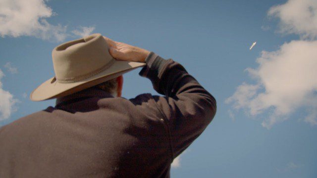
Introducing Google’s Project Wing
4.09K Views0 Comments0 Likes
Project Wing is a Google[x] project that is developing a delivery system that uses self-flying vehicles. As part of our research, we built a vehicle and traveled to Queensland, Australia for some test flights. There, we successfully delivered a first aid kit, candy bars, dog treats, and water to a couple of Australian farmers. We’re only just beginning to develop the technology to make a safe delivery system possible, but we think that there’s tremendous potential to transport goods more quickly, safely and efficiently.

A CEO’s Perspective on the Year in Infrastructure: Greg Bentley, CEO, Bentley Systems
4.05K Views0 Comments0 Likes
The Year in Infrastructure event, which includes the Be Inspired Awards, is a unique event that brings together leading infrastructure companies from around the globe to showcase projects and process improvement. Informed Infrastructure spoke with Greg Bentley, CEO of Bentley Systems, about the evolving role of "software at your service." We spoke about engineering as an outcome-based service, the Chinese adoption of BIM technology, the UK government's commitment to BIM, and improved process outcomes.
4_8 Precision-Agriculture Broadcast (Food and Fluorescence, Sentinel Launch, and More)
4.05K Views0 Comments0 Likes
This GeoSpatial Stream broadcast discusses how food production can be tracked via satellites; the launch of Sentinel-1A; maps of extractive industries and agriculture in Peru and Ghana; a satellite competition; industry news from URISA, Ordnance Survey, Open Geospatial Consortium and Leica Geosystems; and more.
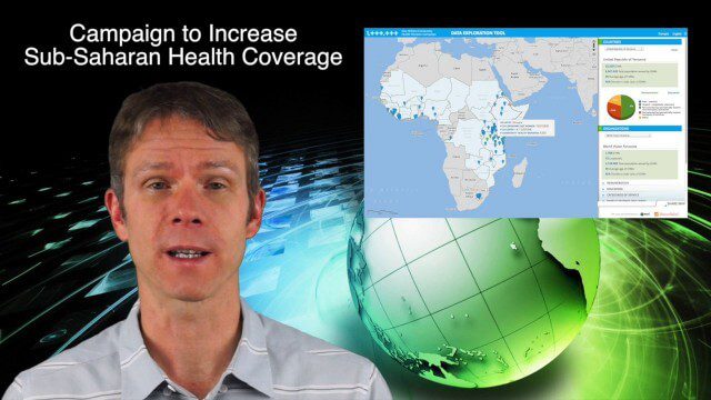
10_23 Europe/Africa Broadcast (INTERGEO, African Health Coverage and More)
4.05K Views0 Comments0 Likes
This GeoSpatial Stream broadcast discusses geospatial news and videos related to Europe and Africa, including the recent INTERGEO conference in Berlin; the One Million Community Health Workers Campaign in Sub-Saharan Africa; a European Commission commitment to invest in the data sector; industry news from Gfk, Euroconsult, Airbus Defence and Space and Spectrum Geo, and Headwall Photonics; images from the International Space Station; and more.
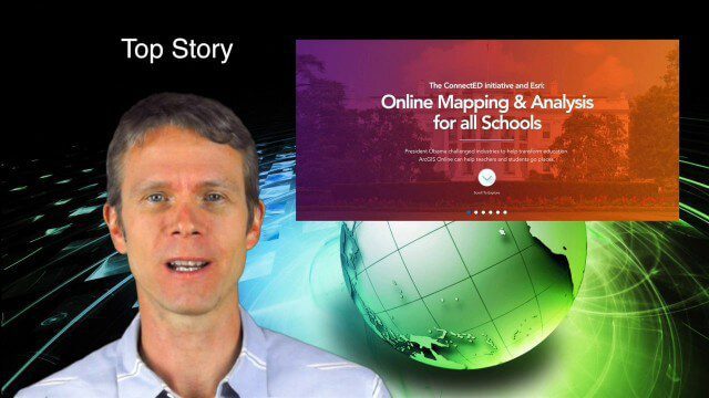
5_29 Education Broadcast (Esri ConnectED, Greenland Glaciers and More)
4.03K Views0 Comments0 Likes
This GeoSpatial Stream broadcast discusses Esri's billion-dollar donation to Obama's ConnectED program for K-12 students; new NASA data showing Greenland's glaciers will have more impact on sea-level rise than originally thought; a report on the global space economy; industry news from Raytheon and Blue Marble Geographics; a video showing the power of geospatial tools in young students' hands; and more.

ikeGPS Demonstrates New Spike Device at Esri UC
4.03K Views0 Comments0 Likes
Brian Soliday, Senior VP of Sales, ikeGPS, demonstrates the company's new Spike measurement device at the 2014 Esri User Conference in San Diego. Featuring a laser, accelerometer and 3-D compass, combined with a camera and GPS, Spike provides and quick and easy way to "measure the world around you."
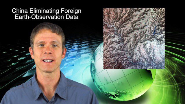
9_25 Asia-Pacific Broadcast (South China Sea, Earth Observation Data and More)
4.03K Views0 Comments0 Likes
This Asia-Pacific-focused GeoSpatial Stream broadcast discusses ongoing land and sea disputes in the South China Sea and how mapping is playing a role; China achieving its goal of decreasing foreign-sourced Earth-observation data; a near-miss for Vietnam's first Earth-Observation satellite; industry news from Supergeo, Esri and JSC Russian Space Systems; opinions on territorial disputes; and more.
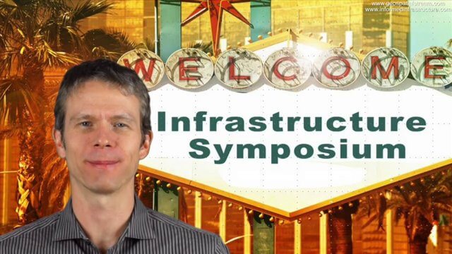
Autodesk Infrastructure Symposium (Short Trailer Version)
4.01K Views0 Comments0 Likes
This video is a short trailer of the full video recapping the Autodesk Infrastructure Symposium held on Dec. 2, 2013, in Las Vegas, Nevada. Events covered include the General Session, a BIM Best Practices Roundtable, a Technology Showcase, a Transportation and Wet Infrastructure session and more.


