
Monthly Archives: August 2014
8_11 Water Resources Broadcast (Massive Groundwater Loss, Algal Blooms and More)
0 Views0 Comments0 Likes
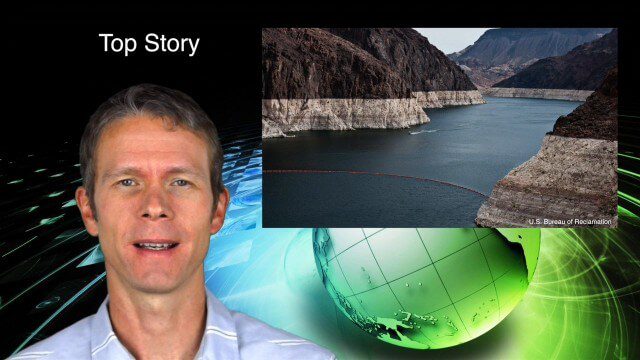
This GeoSpatial Stream broadcast discusses a NASA study on massive groundwater loss in the Colorado River Basin; remote sensing to study algal blooms in Lake Erie; the USGS National Map Corps' latest addition; an Esri Story Map on the Football Hall of Fame; industry news from Pelydryn, Airborne Hydrography, Leica Geosystems, Geographic Technologies Group, URISA and Lockheed Martin; river pollution; and more.
8_14 Remote-Sensing Broadcast (WorldView-3 Launch, NASA Satellites and More)
0 Views0 Comments0 Likes
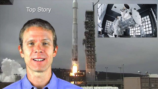
This remote-sensing themed GeoSpatial Stream broadcast discusses the launch of DigitalGlobe's WorldView-3 satellite and its implications; NASA's carbon dioxide- and weather-monitoring satellites; an award for NGA Director Letitia Long; industry news from Esri and CartoDB; the Center for Satellite-Based Crisis Information; and more.
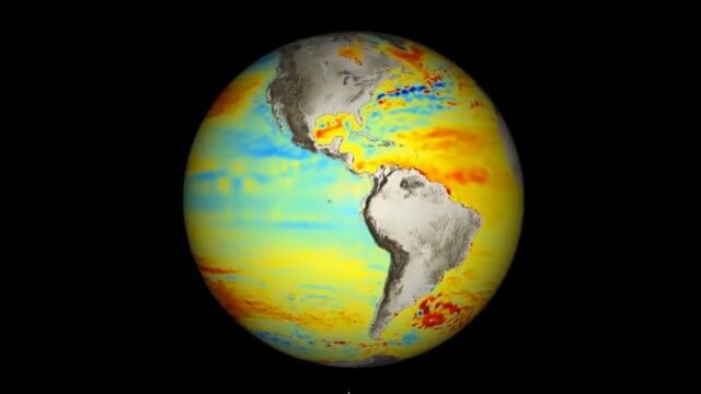
8_21 Climate Change Broadcast (New NASA Instruments, Ice Sheets and More)
0 Views0 Comments0 Likes
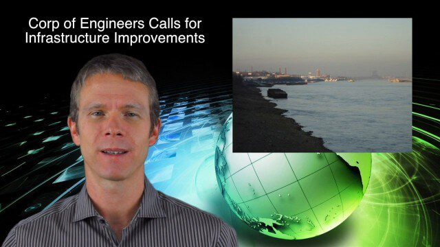
This GeoSpatial Stream broadcast discusses the latest news on climate change, including new NASA monitoring instruments for the International Space Station and ESA's CryoSat mission to measure ice-sheet loss; a U.S. Army Corps of Engineers call for infrastructure improvements in the Mississippi River Watershed; Maps.com and its new Field Trip Library educational series; industry news from American Sentinel University, Nokia HERE and Apple; a LiDAR video from the National Ecological Observatory Network on monitoring trees; and more.
8_27 Asia-Pacific Broadcast (Infrastructure, Alibaba and More)
0 Views0 Comments0 Likes
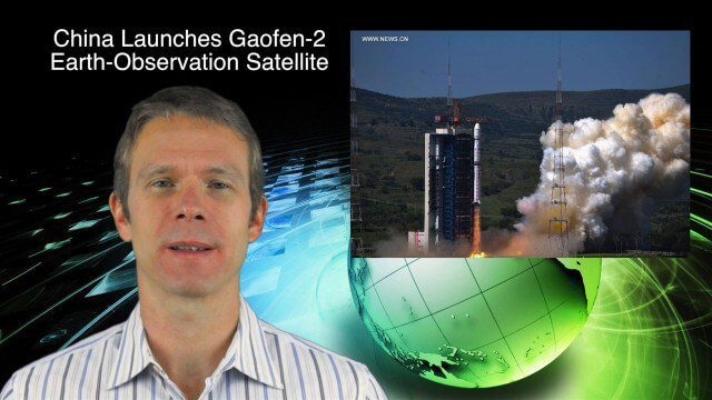
This Asia-Pacific-focused GeoSpatial Stream broadcast discusses infrastructure topics such as new financing in India, water monitoring in China, and a Chinese offer to help upgrade U.S. transportation systems; an urban-renewal project in Melbourne; China's successful launch of the Gaofen-2 Earth-observation satellite; industry news from Alibaba, Google, Maestro Wireless Solutions and CSR; drones helping China recover from an earthquake; Japanese microsatellites; and more.
Arctic Death Spiral and the Methane Time Bomb
0 Views0 Comments0 Likes
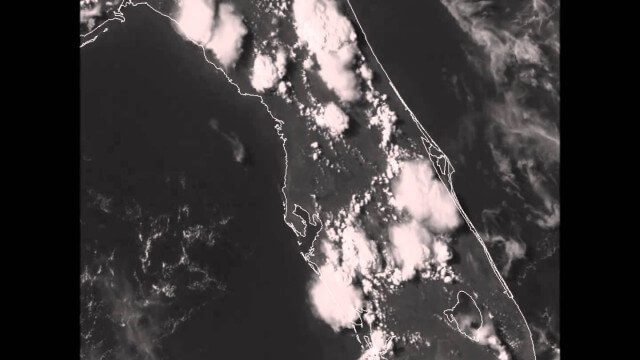
GOES-14 VIS Imagery over Florida
0 Views0 Comments0 Likes
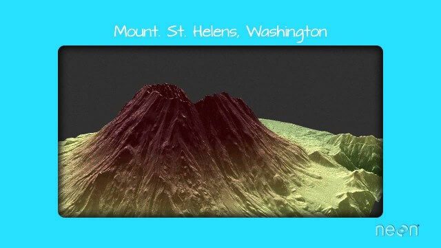
LiDAR – Introduction to Light Detection and Ranging
0 Views0 Comments0 Likes
This video presents LiDAR of light detection and ranging, an active remote sensing system that uses laser energy, to measure the heights of objects like trees and buildings and even the ground. This video was developed by the National Ecological Observatory Network (www.neoninc.org).
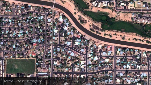
Satellite Imagery to Catch Environmental Changes
0 Views0 Comments0 Likes
How governments are using high-resolution satellite imagery to catch environmental issues before they become health hazards - and EPA fines.
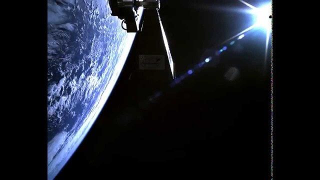
TechDemoSat-1 in Orbit Video
0 Views0 Comments0 Likes
Video taken in-orbit on 8 July 2014 using an inspection camera on-board the TechDemoSat-1 satellite starting about 30 seconds after separation from the launcher. At 6 seconds the Sun appears at the top of the frame as a very bright white flare, before the rotation of the satellite reveals a view of Earth below, of the Pacific Ocean south of French Polynesia.

Traisr Makes Asset Management Simple, Safe and Secure
0 Views0 Comments0 Likes
Todd Danielson interviews John DePalma, Principal, and Brian Berdel, Chief Information Officer, McMahon Associates Inc., at the 2014 Esri User Conference in San Diego. They discuss the company's new product, Traisr, which integrates with multiple platforms to monitor fixed and mobile assets as well as deliver consumer Web portals.


