
Monthly Archives: July 2014
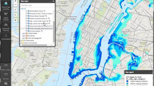
Coastal Resilience 2.0
0 Views0 Comments0 Likes
Providing tools to reduce ecological and socioeconomic risks of coastal hazards, the app enables users to assess such risks, including those to current and future storms, as well as sea level rise scenarios; identify solutions to reduce risks across socio-ecological systems; take action to help communities develop nature-based solutions; and measure effectiveness to ensure efforts are successful.

ikeGPS Demonstrates New Spike Device at Esri UC
0 Views0 Comments0 Likes
Brian Soliday, Senior VP of Sales, ikeGPS, demonstrates the company's new Spike measurement device at the 2014 Esri User Conference in San Diego. Featuring a laser, accelerometer and 3-D compass, combined with a camera and GPS, Spike provides and quick and easy way to "measure the world around you."

RideAmigos UNITY
0 Views0 Comments0 Likes
Uniting entities that create the data needed to provide rich visualizations and insights into commuter habits globally, Unity enables unlimited public and private networks within a region to create behavioral changes and eliminate traffic by allowing users to sync data to Esri ArcGIS software for modal analysis. Users can also explore how each mode contributes to greenhouse gas emissions and climate change.

7_10 Remote-Sensing Broadcast (NASA, UN and More)
0 Views0 Comments0 Likes
This remote-sensing themed GeoSpatial Stream broadcast discusses NASA's recently launched Orbiting Carbon Observatory-2 satellite as well as its upcoming ISS-RapidScat instrument; The Satellite Project created at New York University; UN Peacekeeping missions using unarmed UAVs; industry news from Fugro, exactEarth, SimActive and EOMAP; the upcoming Esri User Conference; the Climate Resilience App Challenge; and more.

OCO-2: NASA’s New Carbon Counter
0 Views0 Comments0 Likes
NASA's OCO-2 mission will shed new light on understanding carbon and its role in our planet's future.
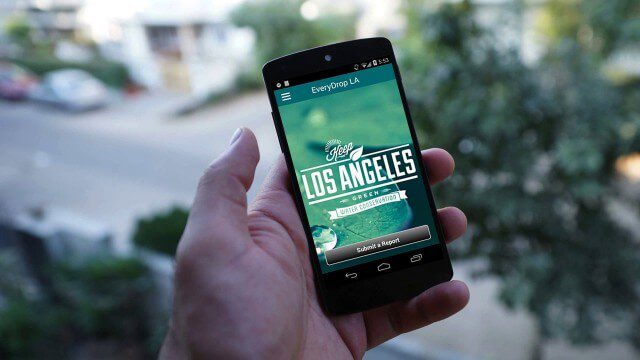
EveryDropLA
0 Views0 Comments0 Likes
Encouraging water conservation, the app allows users to identify and directly report water waste, view instances of water waste around them, receive alerts to conserve when essential, educate themselves on water conservation, and engage the water community through social media.

Minnesota Solar Suitability Analysis
0 Views0 Comments0 Likes
This app enables users to identify the suitability of a location for solar panel installations by locating their home or current location and querying solar analysis data.
Flood Forecast
0 Views0 Comments0 Likes
When users register their address, they receive push alerts notifying them when that address is in danger of flooding. This app analyzes National Oceanic and Atmospheric Administration (NOAA) flood advisories, identifies specific properties affected by floods, consumes forecast information to provide accurate weather reports based on the user's location, and sends flood alerts via Twilio and the location of the nearest Disaster Assistance Center.
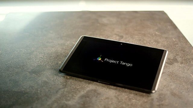
Google’s Project Tango – Journey
0 Views0 Comments0 Likes
Over the past 18 months, Project Tango has been collaborating with robotics laboratories from around the world to concentrate the past decade of research and computer vision into a new class of mobile device.
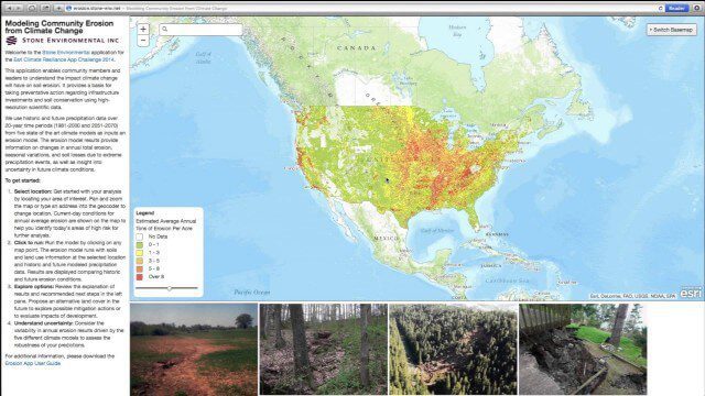
Modeling Community Erosion from Climate Change
0 Views0 Comments0 Likes
Based on modeling current and future soil erosion with high-resolution scientific data, the app allows users to locate sites that are vulnerable to erosion, predicts soil loss driven by climate change, and enables users to investigate erosion risks for future land covers.


