
Monthly Archives: April 2014

Mike Tully Interview (Aerial Services Inc.)
3.36K Views0 Comments0 Likes
Matt Ball interviews Mike Tully, President and CEO, Aerial Services Inc., at SPAR International in Colorado Springs, Colo. They discuss remote sensing and airborne LiDAR in a variety of industries, sensor diversity, streamlining data delivery, and industry disruption due to unmanned aerial systems.

Years of Living Dangerously Trailer #2
1.75K Views0 Comments0 Likes
Hollywood's brightest stars and today's most respected journalists explore the issues of climate change and bring you intimate accounts of triumph and tragedy. YEARS OF LIVING DANGEROUSLY takes you directly to the heart of the matter in this awe-inspiring and cinematic documentary series event from Executive Producers James Cameron, Jerry Weintraub and Arnold Schwarzenegger.

4_22 GEOINT Broadcast (Keynote Highlights, Major News and Developments, and More)
3.82K Views0 Comments0 Likes
This GeoSpatial Stream broadcast from the GEOINT Symposium in Tampa, Fla., recaps the major highlights and news from the event, including keynote addresses from James R. Clapper, Director of National Intelligence; Letitia A. Long, Director, National Geospatial-Intelligence Agency; and Lt. Gen. Michael T. Flynn, U.S. Army, Director of the Defense Intelligence Agency. The broadcast also covers major news announcements from the U.S. Geospatial Intelligence Foundation, Boeing, Surrey Satellite Technology U.S., Airbus Defense & Space, and more.

senseFly Mini Drones
2.12K Views0 Comments0 Likes
Imagine being able to see the world from a totally new point of view.
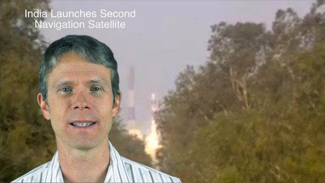
4_28 Asia-Pacific Broadcast (Great Barrier Reef, Asian Satellites, CityNext and More)
3.64K Views0 Comments0 Likes
This Asia-Pacific-focused GeoSpatial Stream broadcast discusses a new way to monitor the Great Barrier Reef from space, GLONASS updates, a new Indian navigation satellite, CityNext in Surat, the latest industry headlines, and more.
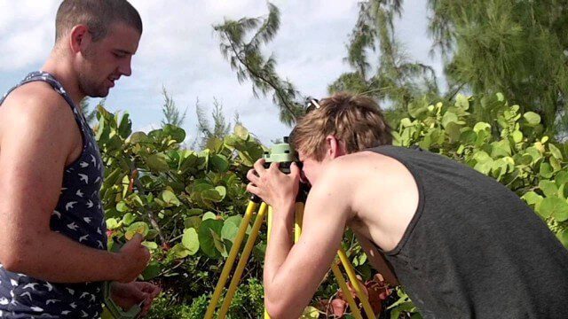
Surveying, Mapping and GIS Expedition to British Virgin Islands
1.81K Views0 Comments0 Likes
Surveying, Mapping and GIS Expedition to British Virgin Islands
Transportation Asset Management
1.77K Views0 Comments0 Likes
Asset management is a strategic and systematic approach for managing transportation assets over their whole life. Asset management helps ensure that available funding addresses our highest priorities.

4_2 Infrastructure Broadcast (Landsat and Flood Risk, Cloud-Based Tools, and More)
2.73K Views0 Comments0 Likes
This infrastructure-focused GeoSpatial Stream broadcast discusses how Landsat is helping with flood risk to infrastructure; North Carolina using cloud-based property data; a Regional Road Construction Map in Spokane; industry news from Columbia Pipeline Group, Synergis, Cityworks and Bentley Systems; surveying in the British Virgin Islands; the Technology of Walking; and more.

BeetleCam Project
2.08K Views0 Comments0 Likes
New video footage from BeetleCam in the Serengeti, plus announcing the new BeetleCam Hybrid!
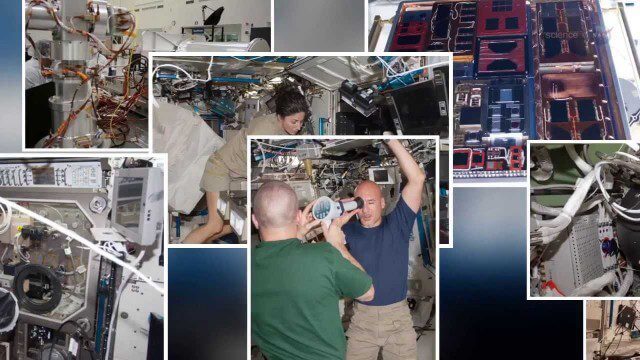
International Space Station Gets a Ten-Year Extension
1.95K Views0 Comments0 Likes


