
Browse Archives
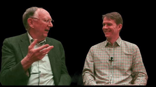
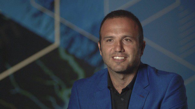
Interview with Esri President Jack Dangermond
1.36K Views0 Comments0 Likes
In November 2019, Informed Infrastructure Editorial Director Todd Danielson interviewed Esri President Jack Dangermond at the Autodesk University (AU) Conference in Las Vegas.
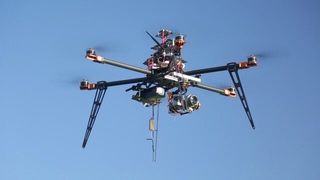
Drones for Aerial Survey and 3D Modelling Updated
2.20K Views0 Comments0 Likes
This video replaces an earlier upload demonstrating the extraction of 3D detail for buildings and/ or terrain from high resolution drone aerial photographs using photogrammetry and geo-referencing. This version includes high definition footage from a simulated autonomous circular aerial survey of an industrial asset, incorporating VidiAir's precision ground survey control points (significantly more accurate than Google Earth), EMF/ RF protection and laser range-finding with telemetry - an important consideration when flying in close proximity to structures/ obstacles, particularly in gusting winds.

RIEGL Creating 3D Data for Improved Disaster Response
2.09K Views0 Comments0 Likes
The V1 Video team interviewed James Van Rens, CEO of RIEGL USA, at the 2015 Esri User Conference in San Diego. We spoke at the 3D Mapping Forum, focusing on the need to map the shoreline for improved disaster response. The company also showcased its new RiCOPTER mapping drone.
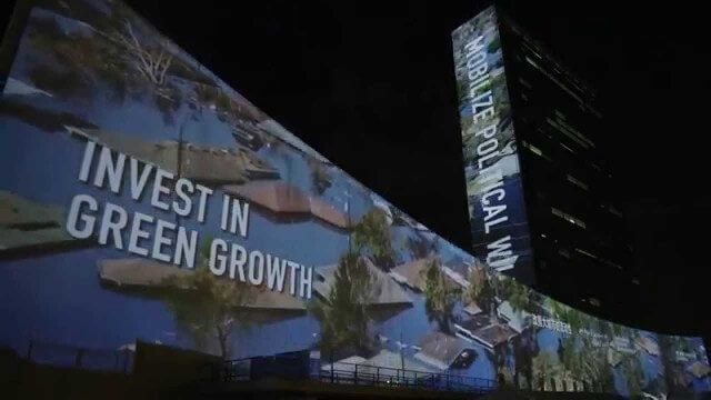
illUmiNations: Protecting our Planet
1.96K Views0 Comments0 Likes
United Nations General Assembly and Secretariat buildings lit up on Saturday night in a revolutionary call for climate action in connection with the Secretary-General's climate Summit. #climate2014. "illUmiNations: Protecting Our Planet" was collaboratively designed and produced for UNDPI by the Oceanic Preservation Society, Obscura Digital and Insurgent Media.
4_8 Precision-Agriculture Broadcast (Food and Fluorescence, Sentinel Launch, and More)
4.05K Views0 Comments0 Likes
This GeoSpatial Stream broadcast discusses how food production can be tracked via satellites; the launch of Sentinel-1A; maps of extractive industries and agriculture in Peru and Ghana; a satellite competition; industry news from URISA, Ordnance Survey, Open Geospatial Consortium and Leica Geosystems; and more.
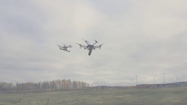
Drone With Ground Penetrating Radar (GPR)
8.11K Views0 Comments0 Likes
SPH Engineering and Radarteam Sweden AB completed combined tests of a drone equipped with ground-penetrating radar (GPR).
Ordnance Survey: Finding a Way
2.16K Views0 Comments0 Likes
Ordnance Survey is very proud to be introducing a refreshed visual identity. Take a look at how much we've changed in our 224 years.
Esri Business Summit: Axel Bedikyan, Cirque du Soleil
1.36K Views0 Comments0 Likes
Cirque du Soleil turned to ArcGIS when they needed to drive business results. This vibrant company known for its high quality entertainment feels the same care and attention to detail they put into their business is mirrored in Esri’s solutions.

6_19 Asia-Pacific Broadcast (Toxic Sites, Bird Flu Maps and More)
5.44K Views0 Comments0 Likes
This Asia-Pacific-focused GeoSpatial Stream broadcast discusses an analysis from the Global Alliance on Health and Pollution; 3D images of the Fukushima Daiichi nuclear complex; an Indonesia forestry map; bird flu maps; China's Fengyun-3C satellite; India's Bhaskaracharya Institute for Space Applications and Geoinformatics; industry headlines from AAM and JTRS Registered Surveyor, Fugro, VisionMap and Acute3D, and Supergeo; the "Poisoned Poor"; and more.

BeetleCam Project
2.08K Views0 Comments0 Likes
New video footage from BeetleCam in the Serengeti, plus announcing the new BeetleCam Hybrid!


