
Tag: Todd Danielson
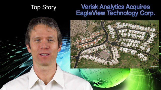
1_16 Acquisitions Broadcast (EagleView Acquired, Universe Explored, Shark Sensors and More)
2.89K Views0 Comments0 Likes
This GeoSpatial Stream broadcast examines Verisk Analytics' acquisition of EagleView Technology Corp., the size of the universe, Great White Shark sensors, contaminated water maps and more.
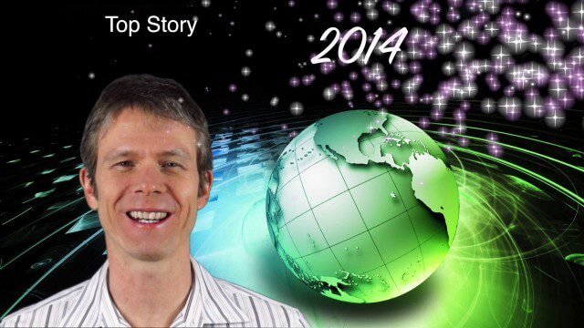
1_6 New Year Broadcast (2014 Predictions, National Map Corps, Gaofen-1 Satellite and More)
5.89K Views0 Comments0 Likes
This GeoSpatial Stream broadcast looks at predictions for 2014, the USGS National Map Corps, China's Gaofen-1 satellite, LiDAR "capturing" Billy the Elephant and more.
12_12 Broadcast (Microsatellites, Climate Models, Dinosaurs, Odysseus and more)
4.31K Views0 Comments0 Likes
This episode of GeoSpatial Stream discusses SkyBox and microsatellites, climate models, dinosaur extinction, Odysseus and more.

Conference Recap from Las Vegas (Autodesk University, Breaking News, Quadrocopters and other Innovations)
3.92K Views0 Comments0 Likes
This video was recorded in Las Vegas during the Autodesk University 2013 Conference. Topics include an extensive recap of conference events, keynotes, themes and news; the latest innovations such as quadrocopters and contour crafting; and more.

GeoSpatial Stream Adds Facebook Page
7.79K Views0 Comments0 Likes
GeoSpatial Stream introduced a new Facebook page at https://www.facebook.com/geospatialstream.

Valarm Interview at GeoDesign Summit
3.09K Views0 Comments0 Likes
Todd Danielson interviews a team from Valarm, including Lorenzo Gonzalez, CEO and Software Architect, and Edward Pultar, President and Spatial Scientist. They discuss the company's vision, its clients and how its software assimilates sensor information.
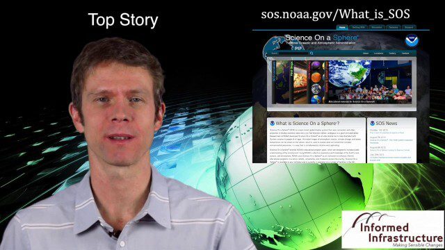
Thanksgiving Broadcast 11_25 (Science on a Sphere, JFK maps and video, nanosatellites and more)
6.91K Views0 Comments0 Likes
This Daily Digest from 11/25 covers topics such as Science on a Sphere, JFK memorial maps and video, U.S. Air Force launching 29 nanosatellites, Malaysian news and more.
GIS Day Broadcast 11_20 (Free Sentinel imagery, Czech Cadastre, Google Explore and more)
3.05K Views0 Comments0 Likes
This GeoSpatial Stream celebrates GIS Day, discusses U.S. government initiatives, the decision to release free Sentinel satellite imagery, Czech Cadastre news, Google Explore and more.
GeoSpatial Stream 11_18 (protected areas, geolocated tweets, infrastructure investment and more)
3.61K Views0 Comments0 Likes
This Daily Digest was published on 11/18/2013. Topics covered include identifying protected habitat areas, satellite imagery legislation, geolocated Tweets to reveal travel patterns, Indonesian infrastructure investment, and more.
GeoSpatial Stream Broadcast from London
3.76K Views0 Comments0 Likes
Reporting from London, Todd Danielson covers the important announcements from the Bentley Year In Infrastructure Conference, the Bentley 500 list of top infrastructure owners worldwide, Bentley's acquisition of MOSES Software, a new columnist for Sensors & Systems, and more.


