
Tag: NASA

OCO-2: NASA’s New Carbon Counter
1.92K Views0 Comments0 Likes
NASA's OCO-2 mission will shed new light on understanding carbon and its role in our planet's future.
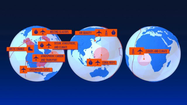
NASA Earth Expeditions: An Animated Tour
2.08K Views0 Comments0 Likes
NASA takes you on a world tour with this animation as we kick off major new field campaigns to study regions of critical change from land, sea and air.
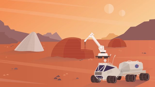
NASA’s 3-D Printed Habitat Challenge
2.14K Views0 Comments0 Likes
NASA Centennial Challenges wants YOUR help building a 3-D printed habitat on Mars. NASA and its partners are holding a $2.5 million competition to build a 3D printed habitat for deep space exploration, including the agency’s journey to Mars.

NASA NIMBUS: Recovering the Past
2.30K Views0 Comments0 Likes
50 years ago, NASA launched Nimbus to study Earth from space. Now, experts at the National Snow and Ice Data Center (part of CIRES), are recovering valuable data and images from old, long-lost film, and expanding their understanding of sea ice in the Arctic and Antarctic. Learn more from CIRES on the 1-year anniversary of Nimbus' first image:
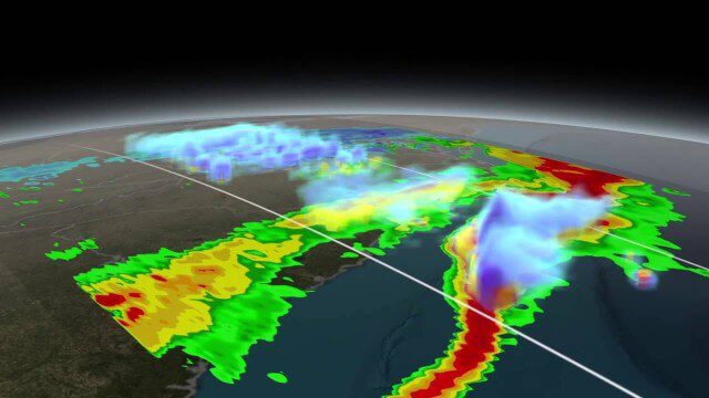
NASA Scanning a Snow Storm
2.30K Views0 Comments0 Likes
On March 17, 2014, the Global Precipitation Measurement (GPM) mission's Core Observatory flew over the East coast's last snow storm of the 2013-2014 winter season.

NASA Intro to LIDAR
2.30K Views0 Comments0 Likes
Want to know the 3D shape of terrain on another planet? Want to study the height and density of Earth's forests? An amazing tool called LIDAR can help! Learn more in this video.
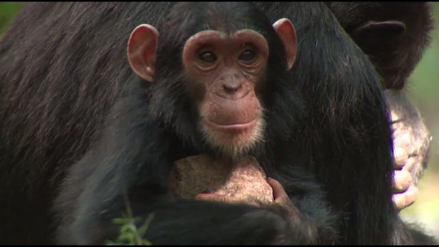
NASA Partners with Jane Goodall Institute to Protect Chimpanzees
2.45K Views0 Comments0 Likes
Data from Landsat satellites, a joint mission of NASA and the U.S. Geological Survey, have been critical to helping the Jane Goodall Institute in their work to protect chimpanzees and their habitat. In this video, Goodall and JGI scientist Lilian Pintea discuss the transformational role of seeing changing habitats from above.

6_9 Earth Imaging Broadcast (Satellite Success, Asteroid Mining and More)
2.47K Views0 Comments0 Likes
This Earth Imaging-themed GeoSpatial Stream broadcast discusses the recent streak of success at the European Space Agency, including its Sentinel and Galileo launches as well as a demonstration of the SpaceDataHighway; a NASA video about its North Atlantic Aerosols and Marine Ecosystems Study (NAAMES) mission; industry news from Merrick-Surdex Joint Venture, TerraGo, Earth-i, Teledyne Optech and Siteco Informatica; thoughts on asteroid mining and related benefits to Earth sensing; and more.
4_28 Earth Imaging Broadcast (Sentinel, Drones and More)
2.54K Views0 Comments0 Likes
This Earth Imaging-themed GeoSpatial Stream broadcast discusses the recent successful launch of the European Space Agency's Sentinel 1-B satellite; UAS (or drone) news about a 3D-printed vehicle helping ships navigate Antarctic seas as well as the economic impact of the Micro Aerial Vehicle market; a NASA study on the greening of Earth caused by increased carbon dioxide; industry news from 5D Robotics, LizardTech, the U.S. Geospatial Intelligence Foundation and Teledyne Optech; a video about the Sentinel satellites capabilities; and more.
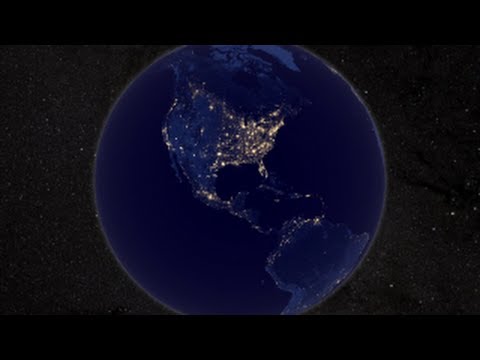
NASA Earth at Night
2.56K Views0 Comments0 Likes
In daylight our big blue marble is all land, oceans and clouds. But the night - is electric. This view of Earth at night is a cloud-free view from space as acquired by the Suomi National Polar-orbiting Partnership Satellite (Suomi NPP).


