
Tag: Daily Digests

4_2 Infrastructure Broadcast (Landsat and Flood Risk, Cloud-Based Tools, and More)
2.73K Views0 Comments0 Likes
This infrastructure-focused GeoSpatial Stream broadcast discusses how Landsat is helping with flood risk to infrastructure; North Carolina using cloud-based property data; a Regional Road Construction Map in Spokane; industry news from Columbia Pipeline Group, Synergis, Cityworks and Bentley Systems; surveying in the British Virgin Islands; the Technology of Walking; and more.

4_14 Infrastructure Broadcast (Transportation Asset Management, Water Infrastructure Needs, and More)
3.51K Views0 Comments0 Likes
This infrastructure-focused GeoSpatial Stream broadcast discusses Transportation Asset Management; a report on water infrastructure; designs to protect against hurricanes; public-transit ridership; historical map archives; private infrastructure funding; news from Bluesky and Bentley Systems; rainwater-capturing infrastructure in Rotterdam, The Netherlands; and more.
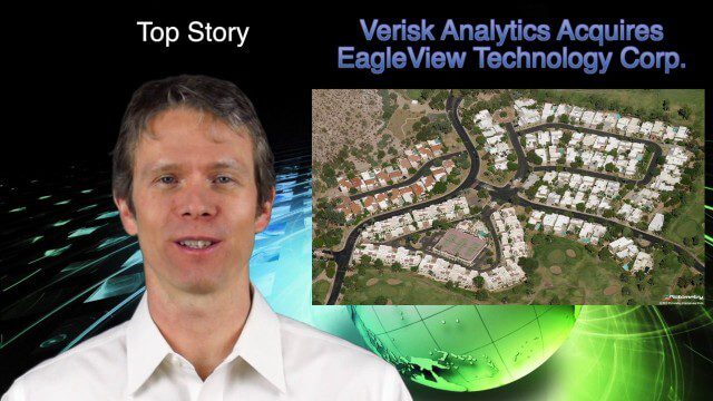
1_16 Acquisitions Broadcast (EagleView Acquired, Universe Explored, Shark Sensors and More)
2.89K Views0 Comments0 Likes
This GeoSpatial Stream broadcast examines Verisk Analytics' acquisition of EagleView Technology Corp., the size of the universe, Great White Shark sensors, contaminated water maps and more.

1_21 Open Data Broadcast (Value of Open GeoData, Bee Sensors, GPS/Silicon Valley and More)
18.06K Views1 Comments0 Likes
This GeoSpatial Stream broadcast discusses the need for governments to make geospatial data open, sensors placed on bees to improve pollination, a GPS/Silicon Valley partnership, new avalanche-monitoring software and more.
GeoSpatial Stream 11_18 (protected areas, geolocated tweets, infrastructure investment and more)
3.61K Views0 Comments0 Likes
This Daily Digest was published on 11/18/2013. Topics covered include identifying protected habitat areas, satellite imagery legislation, geolocated Tweets to reveal travel patterns, Indonesian infrastructure investment, and more.
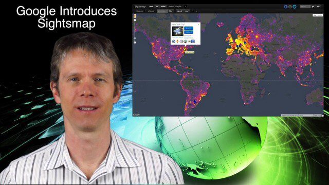
1_23 Commercial Satellite Broadcast (Google Sightsmap, Road Safety Map, Rhino Poaching and More)
4.58K Views0 Comments0 Likes
This GeoSpatial Stream broadcast investigates the commercial satellite imagery market; Google's Sightsmap; the WHO Road Safety map; Rhino poaching; business dealings of GRAPHISOFT, Trimble, Sputnik Enterprises; and more.
Las Vegas Broadcast 12_2 (Autodesk University, UAV economic impact, Great Barrier Reef map, ancient maps and more)
4.43K Views0 Comments0 Likes
This Daily Digest from 12/2 covers topics such as Autodesk University in Las Vegas, the economic impact of UAVs, ancient maps, imagery partnerships, climate change and more.

5_8 Infrastructure Broadcast (ETOD, Global Smart City Rankings and More)
3.43K Views0 Comments0 Likes
This infrastructure-focused GeoSpatial Stream broadcast discusses Equitable Transit-Oriented Development (ETOD); a Global Smart City Ranking; the King County Multi-Family Residential Parking Calculator; historic Denver Union Station's transit makeover; GEOSS; news from Bentley Systems, Esri, Leica Geosystems and Agency9; and more.
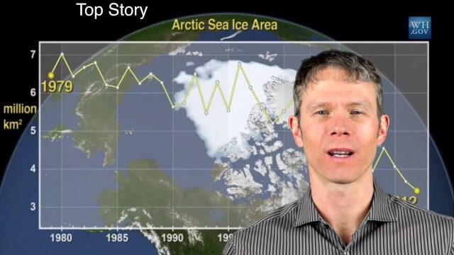
1_28 Climate Change Broadcast (Polar Vortex, China’s Pollution Plumes, Broadband Mapping and More)
10.49K Views0 Comments0 Likes
This GeoSpatial Stream broadcast examines the latest effects of Climate Change on the Polar Vortex; China's pollution plumes monitored from space; Kids Making Sense; broadband mapping; the latest announcements from Boundless, Cityworks, Fugro Pelagos and Blue Marble Geographics; and more.

1_6 New Year Broadcast (2014 Predictions, National Map Corps, Gaofen-1 Satellite and More)
5.89K Views0 Comments0 Likes
This GeoSpatial Stream broadcast looks at predictions for 2014, the USGS National Map Corps, China's Gaofen-1 satellite, LiDAR "capturing" Billy the Elephant and more.


