


Category: Esri
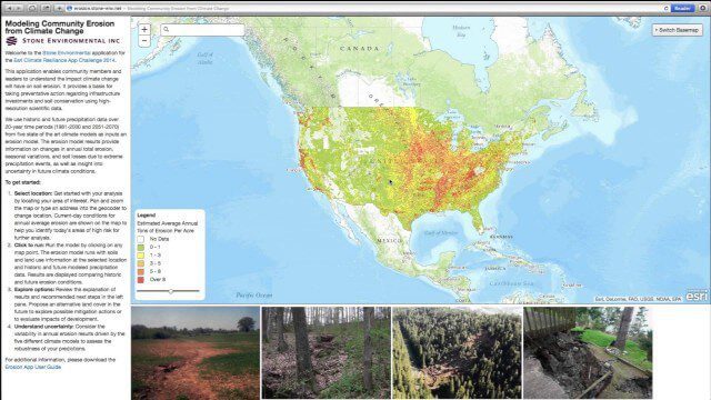
Modeling Community Erosion from Climate Change
0 Views0 Comments0 Likes
Based on modeling current and future soil erosion with high-resolution scientific data, the app allows users to locate sites that are vulnerable to erosion, predicts soil loss driven by climate change, and enables users to investigate erosion risks for future land covers.

Esri’s Geotrigger Service Explained
0 Views1 Comments0 Likes
Matt Ball spoke with Amber Case, director of Esri's R&D Center in Portland, at the Local Data Summit in Denver on Feb. 25, 2014. The conversation ranges from accessible geospatial technology, the ubiquity of mobile devices, and the connections that are made with location awareness and location-based alerts.


