


Category: Found on the Internet
CHASING A COMET – The Rosetta Mission
1.70K Views0 Comments0 Likes
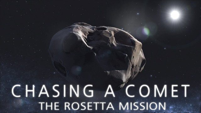
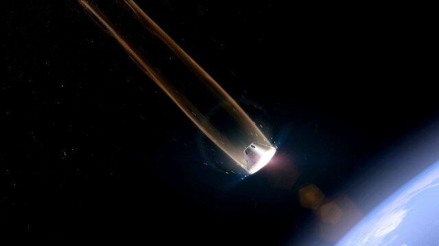
Among the most fascinating projects in the exploration of the Universe is the European Space Agency's Rosetta mission, launched in 2004 to investigate the comet 67P/Churyumov--Gerasimenko. For the first time, a spacec...

Map Survey (1965)
2.56K Views0 Comments0 Likes
"Britain is the world's greatest map making country" announces the narrator. Various shots of maps being crafted. Large optical devices are used - a camera "as big as a fair sized room" is used to take photographs of the maps. We are at the Ordnance Survey Commission headquarters. Various shots of technicians looking at the large photographs.
Earthquake Monitoring with Radar Satellites
2.25K Views0 Comments0 Likes
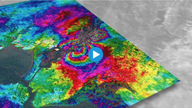
Radar satellite missions can measure millimetre-scale changes in Earth’s surface following an earthquake. On 24 August 2014, an earthquake struck California’s Napa Valley. By processing two images from the Sentinel-1A radar satellite, which were acquired on 7 August and 31 August 2014 over this wine-producing region, an 'interferogram' was generated showing ground deformation.
How DARPA Is Planning Fast, Cheap Satellite Launches
2.20K Views0 Comments0 Likes
Called the Airborne Launch Assist Space Access or ALASA program, it would be able to send satellites weighing 100 pounds or less into low-Earth orbit within 24 hours for less than $1 million per launch.
Orion: Trial By Fire
2.10K Views0 Comments0 Likes
NASA’s newest spacecraft, Orion, will be launching into space for the first time in December 2014, on a flight that will take it farther than any spacecraft built to carry humans has gone in more than 40 years and through temperatures twice as hot as molten lava to put its critical systems to the test.
Drones for Aerial Survey and 3D Modelling Updated
2.20K Views0 Comments0 Likes
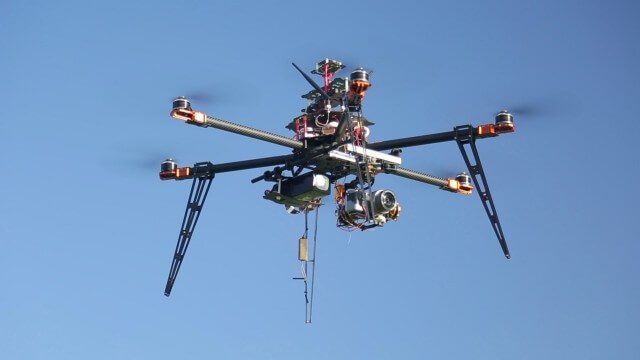
This video replaces an earlier upload demonstrating the extraction of 3D detail for buildings and/ or terrain from high resolution drone aerial photographs using photogrammetry and geo-referencing. This version includes high definition footage from a simulated autonomous circular aerial survey of an industrial asset, incorporating VidiAir's precision ground survey control points (significantly more accurate than Google Earth), EMF/ RF protection and laser range-finding with telemetry - an important consideration when flying in close proximity to structures/ obstacles, particularly in gusting winds.
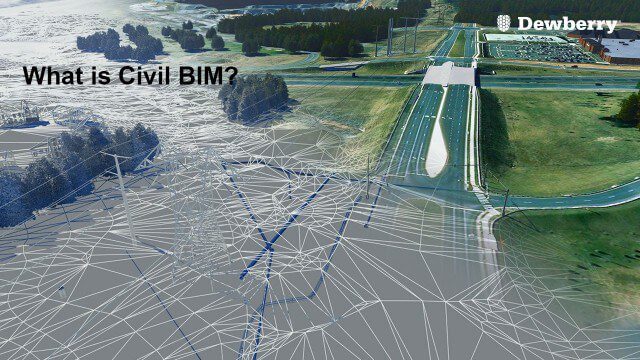
What is Civil BIM?
2.02K Views0 Comments0 Likes
Dewberry Civil Engineers Cody Pennetti and Meagan Judge, along with Senior Applications Specialist Cyndy Davenport, explain how site/civil engineers are using civil BIM to showcase complex information in a familiar way.

Ordnance Survey: Finding a Way
2.16K Views0 Comments0 Likes
Ordnance Survey is very proud to be introducing a refreshed visual identity. Take a look at how much we've changed in our 224 years.

Living History: The John Feathers Map Collection
2.43K Views0 Comments0 Likes
LAPL Map Librarian Glen Creason tells the tale of an amazing hidden map collection that doubled the library's archive in a single day. http://lareviewofbooks.org/av/
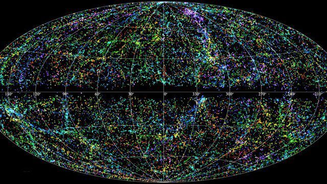
“Mapping the Universe” with Daniel Eisenstein
2.32K Views0 Comments0 Likes
Galaxies are not scattered randomly throughout the universe. Instead, they group into stringy filaments that span hundreds of millions of light-years. How did such structure evolve from the bland primordial soup that followed the Big Bang? New clues are coming from an ambitious mapping project, the Sloan Digital Sky Survey, which has measured the distance to galaxies halfway across the observable universe. Daniel Eisenstein is director of the Sloan Digital Sky Survey III (SDSS-III) and a member of the National Academy of Sciences.


