


Category: Asia-Pacific
12_18 Asia-Pacific Broadcast (Cultural Heritage, APAC LBS Market and More)
0 Views0 Comments0 Likes
This Asia-Pacific-focused GeoSpatial Stream broadcast discusses a Cultural Preservation survey project in LaoSiCheng, China; a market-research report on the APAC region's LBS market; a V1 Media interview with a Bentley Systems Year in Infrastructure award winner from China; industry headlines from Paragon Software Systems, SkyTraq Technology Inc., Supergeo Technologies and Hamon Thermal Co.; and more.

6_19 Asia-Pacific Broadcast (Toxic Sites, Bird Flu Maps and More)
0 Views0 Comments0 Likes
This Asia-Pacific-focused GeoSpatial Stream broadcast discusses an analysis from the Global Alliance on Health and Pollution; 3D images of the Fukushima Daiichi nuclear complex; an Indonesia forestry map; bird flu maps; China's Fengyun-3C satellite; India's Bhaskaracharya Institute for Space Applications and Geoinformatics; industry headlines from AAM and JTRS Registered Surveyor, Fugro, VisionMap and Acute3D, and Supergeo; the "Poisoned Poor"; and more.
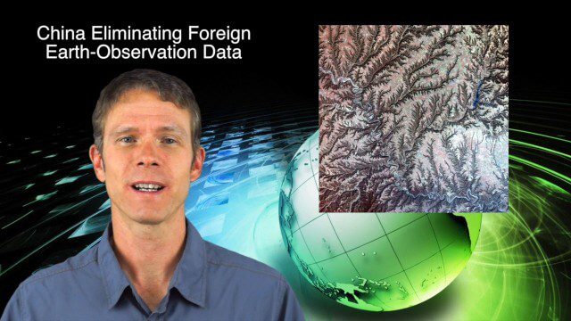
9_25 Asia-Pacific Broadcast (South China Sea, Earth Observation Data and More)
0 Views0 Comments0 Likes
This Asia-Pacific-focused GeoSpatial Stream broadcast discusses ongoing land and sea disputes in the South China Sea and how mapping is playing a role; China achieving its goal of decreasing foreign-sourced Earth-observation data; a near-miss for Vietnam's first Earth-Observation satellite; industry news from Supergeo, Esri and JSC Russian Space Systems; opinions on territorial disputes; and more.
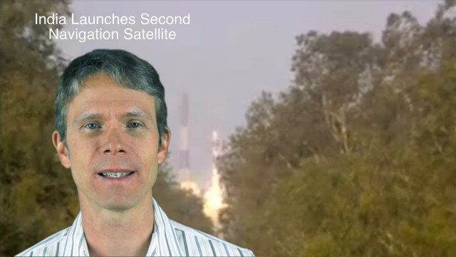
4_28 Asia-Pacific Broadcast (Great Barrier Reef, Asian Satellites, CityNext and More)
0 Views0 Comments0 Likes
This Asia-Pacific-focused GeoSpatial Stream broadcast discusses a new way to monitor the Great Barrier Reef from space, GLONASS updates, a new Indian navigation satellite, CityNext in Surat, the latest industry headlines, and more.
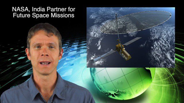
10_16 Asia-Pacific Broadcast (Tsunami Preparedness, NASA/India Partnerships and More)
0 Views0 Comments0 Likes
This Asia-Pacific-focused GeoSpatial Stream broadcast discusses several reports indicating that tsunami preparedness is improving in the region; a space-mission partnership between NASA and India's ISRO; the first images from China's Gaofen-2; a video from the University of South Australia's Global Sensor Network; industry news from MDA Information Systems, Esri, Xiaomi, Careland, Innovyze and Nobel Systems; and more.
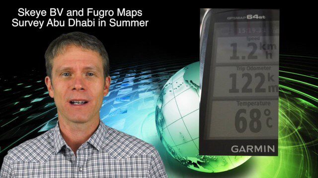
10_8 Asia Pacific Broadcast (New Satellites and Rockets, Mumbai Mapping and More)
0 Views0 Comments0 Likes
This Asia Pacific-themed GeoSpatial Stream broadcast covers several new satellites and rockets launched from Asia, including China's Pujian-1 and 20th Beidou satellites, a new Chinese Long March-6 rocket, imagery from China's TripleSat Constellation, and the Indian Space Research Organization launching another PSLV rocket carrying ASTRONAUT and six foreign satellites; Mumbai students mapping the Mithi River; Japanese scientists using laser scanning to study ancient tombs; industry news from Esri, Miyamoto International, Intergraph, Skeye BV and Fugro Maps; clips from a video about Ushahidi mapping in Semarang, Indonesia; and more.
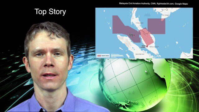
3_18 Asia-Pacific Broadcast (Malaysia Flight 370, “Smog-Busting Drones,” Shark Cameras and More)
0 Views0 Comments0 Likes
This Asia-Pacific-focused GeoSpatial Stream broadcast discusses the mysteries of Malaysia Flight 370 and geospatial technology’s role, China’s “War on Pollution” enlisting drone smog fighters, Afghanistan resource maps, a youth GIS contest, and more.

7_16 Asia Pacific Broadcast (New Satellites, Drones Catching Tax Cheats and More)
0 Views0 Comments0 Likes
This Asia Pacific-themed GeoSpatial Stream broadcast discusses new Asian geospatial satellites from India, China and Japan; V1 Media's upcoming Webcast on Earthquake safety; laser scanning to map and preserve Japanese castles and Malaysian caves; drones used in Indonesia to catch tax cheats; industry news from MDA and Google; thoughts on digital preservation; and more.

4_30 Earthquake Broadcast (Nepal Mapping, Drone Video and More)
0 Views0 Comments0 Likes
This GeoSpatial Stream broadcast focuses entirely on the Nepal earthquake of April 25, 2015, that killed more than 5,000 people. News and video cover the scope of the destruction; how governments and relief organizations are helping through mapping; industry aid from Esri, DigitalGlobe and Airbus Defence & Space; an article on how Nepal was mapped in 48 hours; a video of the Mt. Everest avalanche; and more.

7_30 Asia-Pacific Broadcast (Deforestation, Beijing Smog and More)
0 Views0 Comments0 Likes
This Asia-Pacific-focused GeoSpatial Stream broadcast discusses deforestation in Indonesia; IBM joining Beijing's fight against smog; Asian effects on mobile-device charging; Pakistan's move toward space technology; satellite imagery use in Australian vineyards; industry news from Spatial Dimensions, ScanEx, Maptek and Esri; geospatial insight into Indonesian politics; and more.


