
tdanielson / Added Videos
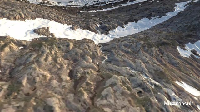
Use of InfraWorks and the Infrastructure Design Suite for a Hydropower Project in Norway
3.35K Views0 Comments0 Likes
Designing successful infrastructure projects is one thing. Communicating and demonstrating those designs to clients and other stakeholders before construction is another. Bringing a design to life for people without a civil engineering background is always a challenge, whether your goal is to sell the design or communicate its impact. - See more at: https://informedinfrastructure.com/20253/creating-real-time-navigable-3d-infrastructure-models/
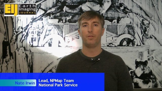
NPMap Pioneers Open and Flexible Platform
3.09K Views0 Comments0 Likes
The V1 Video team interviewed Nate Irwin, head of the NPMap team for the National Park Service, at the USFWS/USNPS Geospatial Training Workshop. NPMap is an innovative online mapping platform that helps park visitors navigate the details of national parks as well as providing a platform for parks to customize and share maps for park management.
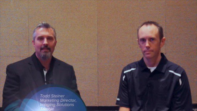
Trimble Dimensions Interview: Todd Steiner and Tim Lemmon
2.54K Views0 Comments0 Likes
At Trimble Dimensions 2014 in Las Vegas, V1 Media's Todd Danielson interviews Trimble's Todd Steiner, Marketing Director for Imaging Solutions, and Tim Lemmon, Office Software Director for Geospatial. They discuss Trimble's core history of surveying and GPS products; new visualization and imaging tools; software geared toward a variety of geospatial vertical markets; the evolving role of the surveyor; and more.
Esri Business Summit: Axel Bedikyan, Cirque du Soleil
1.36K Views0 Comments0 Likes
Cirque du Soleil turned to ArcGIS when they needed to drive business results. This vibrant company known for its high quality entertainment feels the same care and attention to detail they put into their business is mirrored in Esri’s solutions.

NASA Follows Changing Freshwater from Space
815 Views0 Comments0 Likes
The first question NASA researchers studying freshwater on Earth ask is: Where is the water?

Fully Integrated RiCOPTER UAV in Flight
3.19K Views0 Comments0 Likes
RiCOPTER is a high-performance UAV which can be equipped with the RIEGL VUX-1 survey-grade LiDAR sensor to offer a fully integrated turnkey solution and marks the first complete UAS LiDAR solution from one manufacturer.
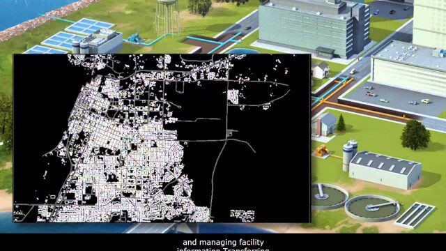
AECO Software to Manage the Urban Water Infrastructure Lifecycle
2.38K Views0 Comments0 Likes
Utilities and their consultants around the world rely on Bentley’s water solution to deliver intelligent infrastructure, ultimately providing clean water and managing sewerage and storm runoff. What architectural, engineering, construction, and operations (AECO) professionals can learn: • Maintain a centralized asset repository and manage facility information with Bentley’s integrated water and geospatial products • Model, analyze, and design water and wastewater pipe networks, using Bentley’s easy-to-use hydraulics and hydrology software • Design and build water and wastewater treatment plants in a fully-managed, collaborative team environment, using Bentley’s plant, structural, and building applications.

5_22 Remote-Sensing Broadcast (Space Symposium, WorldView-3 and More)
6.32K Views0 Comments0 Likes
This GeoSpatial Stream broadcast covers a variety of remote-sensing topics, such as the recent Space Symposium in Colorado; a preview of DigitalGlobe's WorldView-3 satellite; a special report on micro-satellites; industry news from Airbus Defence and Space, BAE Systems, Teledyne, and NASA; and more.
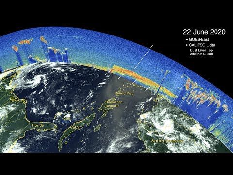
CALIPSO Observes Saharan Dust Transport
461 Views0 Comments0 Likes
The Cloud-Aerosol Lidar and Infrared Pathfinder Satellite Observations (CALIPSO) satellite—a joint venture between NASA and the French space agency, Centre National d'Etudes Spatiales (CNES)—observed the plume as it traveled across the ocean and eventually affected the mainland of the United States.

Horizons Mission Time-Lapse from USA to Africa
874 Views0 Comments0 Likes
Join ESA astronaut Alexander Gerst for a quick flight from the USA to Africa aboard the International Space Station in this time-lapse.


