
tdanielson / Added Videos

Exploring InfraWorks Vegas Style! Event (Short Version)
5.82K Views0 Comments0 Likes
This video is a short trailer of the full video recapping the Exploring InfraWorks (Vegas Style!) event that took place during Autodesk University 2013. A bus trip explored the use of Autodesk technology to model the infrastructure of the city of Las Vegas. VTN Consulting is the main contractor on the project.

BISAG GUJARAT
2.32K Views0 Comments0 Likes

6_19 Asia-Pacific Broadcast (Toxic Sites, Bird Flu Maps and More)
5.44K Views0 Comments0 Likes
This Asia-Pacific-focused GeoSpatial Stream broadcast discusses an analysis from the Global Alliance on Health and Pollution; 3D images of the Fukushima Daiichi nuclear complex; an Indonesia forestry map; bird flu maps; China's Fengyun-3C satellite; India's Bhaskaracharya Institute for Space Applications and Geoinformatics; industry headlines from AAM and JTRS Registered Surveyor, Fugro, VisionMap and Acute3D, and Supergeo; the "Poisoned Poor"; and more.
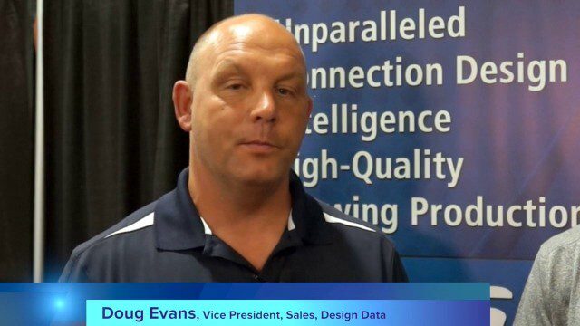
Design Data Adds Intelligence to Crane Modeling
3.60K Views0 Comments0 Likes
Todd Danielson interviews Doug Evans, Vice President, Sales, Design Data, at the HxGN LIVE event in Las Vegas, Nevada. They discuss sharing models with Intergraph software for production and manufacturing, its new SDS/2 Erector product that adds intelligence to crane modeling and building, and more.
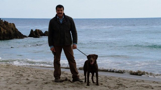
Weather Versus Climate Change
2.05K Views0 Comments0 Likes
Neil deGrasse Tyson breaks down the difference between weather and climate change.

Hexagon’s Schmidt Discusses Water Solutions
2.95K Views0 Comments0 Likes
Todd Danielson interviews Justin Schmidt, Executive Manager, Hexagon Solutions, at the HxGN LIVE event in Las Vegas, Nevada. They discuss the Hexagon Smart H2O Solution (the foundation for Hexagon Solutions), complete water systems and their challenges, dam monitoring and failures, and more.
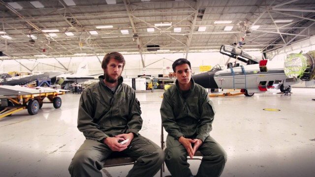
Project Tango: NASA SPHERES
2.17K Views0 Comments0 Likes
Since the summer of 2013, the Project Tango team has been working closely with a team at the NASA Ames Research Center. The goal: to integrate a Project Tango prototype onto a robotic platform, called SPHERES, that flies inside the International Space Station.

INTERGEO Conference Integrates Geoinformation with Modern Infrastructure
3.77K Views0 Comments0 Likes
This year’s conference at the 20th INTERGEO will be taking a close look at crucial social and political topics set within the framework of increasing global digitization. A whole series of events and forums will offer in-depth discussions on shaping and developing our living environment.

6_12 HxGN LIVE Broadcast (Conference Recap, NASA News and More)
3.66K Views0 Comments0 Likes
This GeoSpatial Stream broadcast includes a recap of the recent HxGN LIVE conference in Las Vegas, and discusses NASA's upcoming carbon dioxide satellite; a deadly and massive Colorado mudslide; industry news from Skybox Imaging and Google, Sokkia, and Esri; Google's Tango Project; and more.
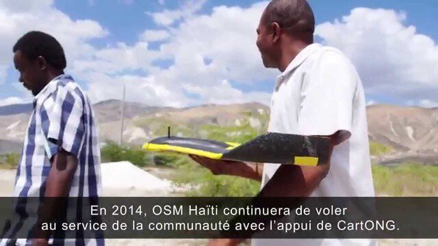
Drone Mapping Haiti (French)
1.77K Views0 Comments0 Likes


