
Monthly Archives: June 2015

Pioneering LiDAR Adoption in China
1.47K Views0 Comments0 Likes
Informed Infrastructure interviewed Yanjing Liu, CEO of Five Star Electronic Technology, at the RIEGL LiDAR Conference in Guangzhou, China. Liu left his academic position at Virginia Tech and companies he founded in the United States to pioneer the use of LiDAR in China. We spoke about the hard work needed to set up this capacity as well as some landmark projects, including 3-D mapping of the Great Wall.
Processing and Visualizing Seamless Mobile LiDAR Point Clouds
1.49K Views0 Comments0 Likes
Informed Infrastructure spoke with Mika Salolahti, Business Development Manager at Terrasolid, about the processing and visualization of high-quality LiDAR point clouds. The visualization of tramlines in Helsinki, including overhanging wires, proves a powerful tool for asset management, maintenance and planning.

Promoting the Value of 3-D Data for the Nation
1.55K Views0 Comments0 Likes
Informed Infrastructure spoke with Jim Van Rens, CEO of RIEGL USA, at the company’s user conference in Hong Kong. Jim is actively involved in helping promote the U.S. Geological Survey’s 3D Elevation Program (3DEP) that aims to map the country in high-resolution 3-D using LiDAR and aligned technologies.

Single-Rotor Camcopter Extends Range and Flight Times
1.68K Views0 Comments0 Likes
Informed Infrastructure spoke with Anna Katharina Hoefler, program manager at SCHIEBEL, at the RIEGL LiDAR Conference in Hong Kong. The rugged and large-scale single-rotor CAMCOPTER has a flight time of greater than six hours and a range from 50-200 kilometers.
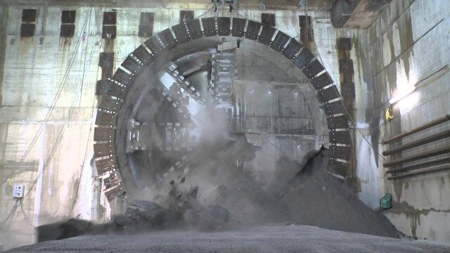
Crossrail Tunnelling: Drone’s Eye View of Crossrail’s Completed Rail Tunnels
1.94K Views0 Comments0 Likes
The Prime Minister and Mayor of London Boris Johnson celebrated the completion of Crossrail’s tunnels by going 40 metres below the capital to thank the men and women who are constructing the new £14.8 billion east-west railway.
Value Engineering for Site Planning and Preparation
2.10K Views0 Comments0 Likes
Informed Infrastructure spoke with Michael Kissinger, senior engineer and Land Development Division Manager at Pennoni Associates, and Steve Lewis, single point of contact for Pennoni’s Bentley SITEOPS business. We touched on their creative use of the SITEOPS site-planning tool on a variety of projects to win and retain business.

The Algorithm Marketplace
2.55K Views0 Comments0 Likes
The Algorithm Marketplace provides automated analysis of aerial data acquired by UAVs (Unmanned Aerial Vehicles). Using sophisticated algorithms, drone operators no longer need a background in geographic information system (GIS) or remote sensing to interpret their aerial data; instead, the marketplace provides an action-based report to improve management of assets.
Platform Interoperability for Project Improvement
2.68K Views0 Comments0 Likes
Informed Infrastructure spoke to Huw Roberts, vice president of platform marketing at Bentley Systems, at the company’s CONNECTION Event roadshow kickoff in Philadelphia. We touched on the next era of project workflows, with greater integration across processes and analytics for better outcomes.
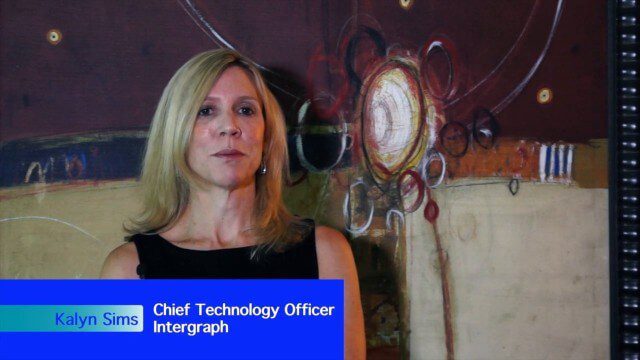
Intergraph Integrates Public-Safety Technology
3.01K Views0 Comments0 Likes
V1 Media and GeoSpatial Stream attended HxGN Live, Hexagon's annual user conference, at the MGM Grand in Las Vegas from June 1-4, 2015. They interviewed Kalyn Sims, Chief Technology Officer at Intergraph, who discussed modern computer-aided dispatch, Intergraph's public-safety technology ecosystem, Big Data challenges, evolving patrol work and the rise of UAVs.

Hexagon Mining Creating Solutions for “Life of Mine”
3.15K Views0 Comments0 Likes
V1 Media and GeoSpatial Stream attended HxGN Live, Hexagon's annual user conference, at the MGM Grand in Las Vegas from June 1-4, 2015. They interviewed Hélio Samora, President of Hexagon Mining, who discussed the company's "life of mine" strategy, sensor and system integration, mine safety and synergy at Hexagon.


