
Monthly Archives: March 2015
The Nature Conservancy’s Zach Ferdaña and Coastal Resilience at the Geodesign Summit
0 Views0 Comments0 Likes
Zach Ferdaña is Lead Coastal Resilience Manager at The Nature Conservancy. The Coastal Resilience program is an array of projects using online decision support tools to promote the role of coastal habitats in hazard mitigation, restoration and resilience planning. On behalf of V1 Media, Informed Infrastructure and GeoSpatial Stream, Todd Danielson interviewed Ferdaña at the Geodesign Summit 2015 in Redlands, Calif.
Joe Minicozzi Underscores Financial Consequences at the Geodesign Summit
0 Views0 Comments0 Likes
Joe Minicozzi is the principal of the econometric consulting firm Urban3 (U3), which looks at the financial aspects and consequences of urban design choices. On behalf of V1 Media, Informed Infrastructure and GeoSpatial Stream, Todd Danielson interviewed Minicozzi at the Geodesign Summit 2015 in Redlands, Calif.
3_5 Earth Imaging Broadcast (DigitalGlobe, LiDAR and More)
0 Views0 Comments0 Likes
This GeoSpatial Stream broadcast discusses the public release of 30-centimeter-resolution satellite imagery from DigitalGlobe and the company's partnership with the United Nations; the National Ecological Observation Network's new LiDAR data; an award for the Orion Space mission; industry news from exactEarth, Esri, Google, and the U.S. EPA and NOAA; a recap of the recent International LiDAR Mapping Forum in Denver; and more.
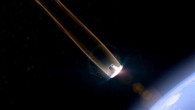
Orion: Trial By Fire
0 Views0 Comments0 Likes
NASA’s newest spacecraft, Orion, will be launching into space for the first time in December 2014, on a flight that will take it farther than any spacecraft built to carry humans has gone in more than 40 years and through temperatures twice as hot as molten lava to put its critical systems to the test.
Ulf Mansson Moving Geodata to Minecraft
0 Views0 Comments0 Likes
Ulf Mansson, senior project manager for SWECO, has more than 20 years of experience in the geospatial industry. In 2013, he invented a method to stream geodata into the game Minecraft. On behalf of V1 Media, Informed Infrastructure and GeoSpatial Stream, Todd Danielson interviewed Mansson at the Geodesign Summit 2015 in Redlands, Calif.
Carl Steinitz Discusses Increased Dangers and Urgency at the Geodesign Summit
0 Views0 Comments0 Likes
Carl Steinitz is an Emeritus Professor at the Harvard University Graduate School of Design and one of the true pioneers and visionaries of geodesign, with 50 years of experience. On behalf of V1 Media, Informed Infrastructure and GeoSpatial Stream, Todd Danielson interviewed Steinitz at the Geodesign Summit 2015 in Redlands, Calif.
3_19 Asia Pacific Broadcast (Malaysia Airlines Search, India Water Tool and More)
0 Views0 Comments0 Likes
This Asia-Pacific-themed GeoSpatial Stream broadcast discusses Geoscience Australia's seafloor mapping efforts in the continued search for Malaysia Airlines Flight 370; India mapping schools and water; surveyors measuring the height of New Zealand's tallest peak, Mount Cook; industry news from Esri India, Locate15, ISRO and Google; powerful maps created by children in India of the slums they live in and how they'd like to see them rebuilt; and more.
InsiteVR Takes Virtual Reality Beyond Gaming, into Design
0 Views0 Comments0 Likes
InsiteVR helps viewers better understand a variety of designs by experiencing them from a realistic perspective. On behalf of V1 Media, Informed Infrastructure and GeoSpatial Stream, Todd Danielson interviewed Angel Say and Russell Varriale, co-founders of InsiteVR, at the Geodesign Summit 2015 in Redlands, Calif.
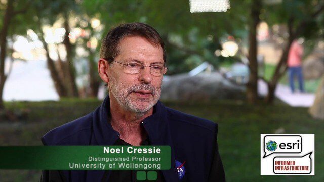
Noel Cressie Talks Spatial Statistics at the Geodesign Summit
0 Views0 Comments0 Likes
Noel Cressie is a Distinguished Professor, National Institute for Applied Statistics Research Australia (NIASRA), University of Wollongong, Australia. He delivered the keynote speech at the Geodesign Summit 2015 in Redlands, Calif., discussing spatial statistics and their role in modern analysis and design. On behalf of V1 Media, Informed Infrastructure and GeoSpatial Stream, Todd Danielson interviewed Cressie at the Summit.
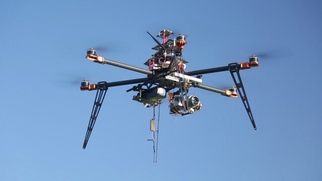
Drones for Aerial Survey and 3D Modelling Updated
0 Views0 Comments0 Likes
This video replaces an earlier upload demonstrating the extraction of 3D detail for buildings and/ or terrain from high resolution drone aerial photographs using photogrammetry and geo-referencing. This version includes high definition footage from a simulated autonomous circular aerial survey of an industrial asset, incorporating VidiAir's precision ground survey control points (significantly more accurate than Google Earth), EMF/ RF protection and laser range-finding with telemetry - an important consideration when flying in close proximity to structures/ obstacles, particularly in gusting winds.


