
Monthly Archives: February 2015
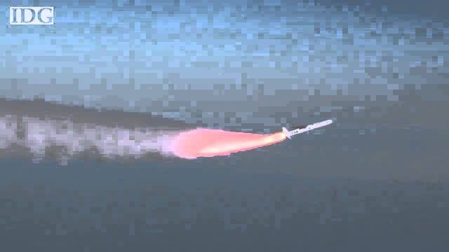
How DARPA Is Planning Fast, Cheap Satellite Launches
0 Views0 Comments0 Likes
Called the Airborne Launch Assist Space Access or ALASA program, it would be able to send satellites weighing 100 pounds or less into low-Earth orbit within 24 hours for less than $1 million per launch.

Landing on a Comet – The Rosetta Mission
0 Views0 Comments0 Likes
After a 10-year journey of some seven billion kilometres, the Rosetta mission is now heading towards its next major milestone – setting the lander Philae on a comet. On 12 November 2014, a lander is scheduled to touch down on a comet for the first time in the history of spaceflight. “We don’t know exactly what awaits us there,” says lander Project Manager Stephan Ulamec from the German Aerospace Center (Deutsches Zentrum für Luft- und Raumfahrt; DLR).

Map Survey (1965)
0 Views0 Comments0 Likes
"Britain is the world's greatest map making country" announces the narrator. Various shots of maps being crafted. Large optical devices are used - a camera "as big as a fair sized room" is used to take photographs of the maps. We are at the Ordnance Survey Commission headquarters. Various shots of technicians looking at the large photographs.
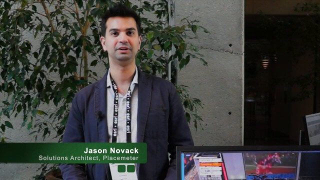
Placemeter Building Real-Time Dynamic Data Layer
0 Views0 Comments0 Likes
Placemeter collects and serves up-to-the-minute information such as how crowded a place is, how long the wait is, and whether it will get more or less crowded in the next hour. On behalf of V1 Media, Informed Infrastructure and GeoSpatial Stream, Todd Danielson interviewed Jason Novack, solutions architect at Placemeter, at the Geodesign Summit 2015 in Redlands, Calif.
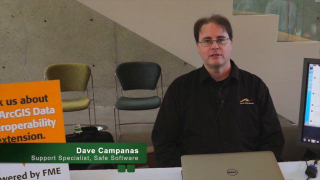
Safe Software Bringing Data Translation to Geodesign
0 Views0 Comments0 Likes
Safe Software is the maker of FME and a global leader in spatial data transformation technology. On behalf of V1 Media, Informed Infrastructure and GeoSpatial Stream, Todd Danielson interviewed Dave Campanas, software support specialist at Safe Software, at the Geodesign Summit 2015 in Redlands, Calif.
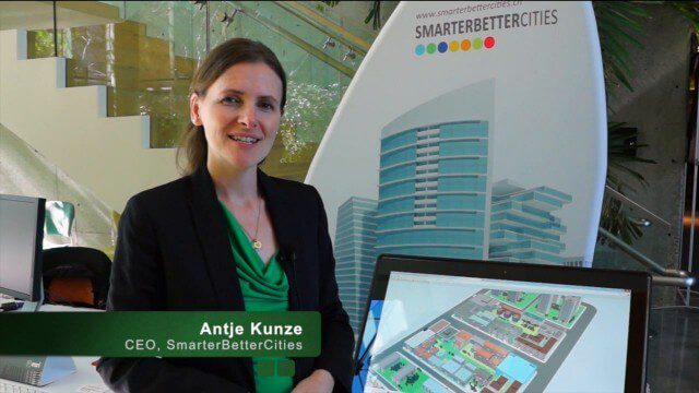
SmarterBetterCities Returns to Geodesign Summit
0 Views0 Comments0 Likes
SmarterBetterCities uses innovative Web-based tools, such as Cloud Cities and 3D Cities Libraries, that allow users to create 3D content and scenarios for urban planning. On behalf of V1 Media, Informed Infrastructure and GeoSpatial Stream, Todd Danielson interviewed Antje Kunze, CEO of SmarterBetterCities, at the Geodesign Summit 2015 in Redlands, Calif.


