
Monthly Archives: October 2014
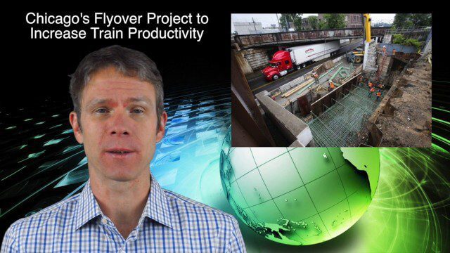
10_30 Infrastructure Broadcast (Green Buildings, Bridge Construction and More)
4.35K Views0 Comments0 Likes
This GeoSpatial Stream broadcast discusses infrastructure news and videos, including a report on Green Buildings; the new Englewood Flyover train project in Chicago; a smart traffic-light network; accelerated bridge construction in Rhode Island; industry news from Esri Canada, Innovyze, Maptek and Autodesk; the upcoming Trimble Dimensions conference in Las Vegas; and more.
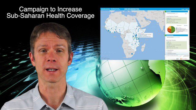
10_23 Europe/Africa Broadcast (INTERGEO, African Health Coverage and More)
4.05K Views0 Comments0 Likes
This GeoSpatial Stream broadcast discusses geospatial news and videos related to Europe and Africa, including the recent INTERGEO conference in Berlin; the One Million Community Health Workers Campaign in Sub-Saharan Africa; a European Commission commitment to invest in the data sector; industry news from Gfk, Euroconsult, Airbus Defence and Space and Spectrum Geo, and Headwall Photonics; images from the International Space Station; and more.

Kleinfelder Interview – Mark Colsman, Environmental Chemist and Project Manager
3.49K Views0 Comments0 Likes
Informed Infrastructure spoke with Mark Colsman, environmental chemist and project manager, at the opening of Kleinfelder’s new office in downtown Denver. The conversation about the environmental-remediation work that Kleinfelder is involved in covered their development of Conceptual Site Models with considerable data collection for decision making about the issues on the site. Increasingly, they are using real-time data sensors and data feeds to better understand underground processes.
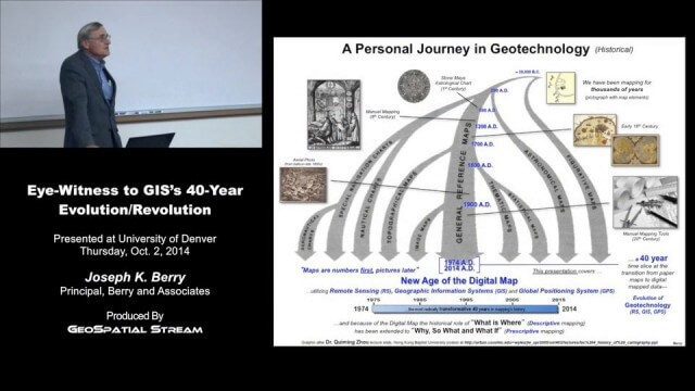
Joe Berry’s “Eye-Witness to GIS’s 40-Year Evolution/Revolution” Presentation
3.25K Views0 Comments0 Likes
In the 40 years since the development of the digital map, what a map is (and isn’t) has greatly evolved. This presentation describes Joe Berry’s personal journey in geotechnology as a student, professor, consultant, software developer and entrepreneur. The insight is as relevant for the next generation of GIS’ers as it is to GIS cohorts who moved beyond mapping to “thinking with maps” and the boundless opportunities for integrating the new spatial paradigm into science, workplaces and daily lives.

Fully Integrated RiCOPTER UAV in Flight
3.19K Views0 Comments0 Likes
RiCOPTER is a high-performance UAV which can be equipped with the RIEGL VUX-1 survey-grade LiDAR sensor to offer a fully integrated turnkey solution and marks the first complete UAS LiDAR solution from one manufacturer.
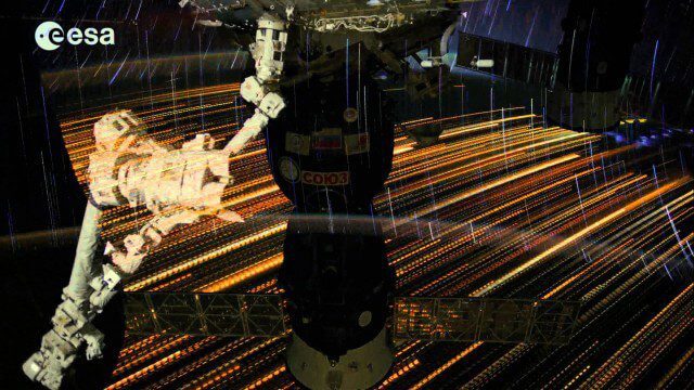
Earth Images from ESA Astronaut Alexander Gerst
3.07K Views0 Comments0 Likes
This timelapse video was made from images taken by ESA astronaut Alexander Gerst orbiting Earth on the International Space Station. The video is offered in Ultra High Definition, the highest available to consumers. Be sure to change the settings in YouTube if your computer or television can handle it for the full effect. The montage is made from a long sequence of still photographs taken at a resolution of 4256 x 2832 pixels at a rate of one every second. The high resolution allowed the ESA production team to create a 3840 x 2160 pixel movie, also known as Ultra HD or 4K. Playing these sequences at 25 frames per second, the film runs 25 times faster than it looks for the astronauts in space. The artistic effects of the light trails from stars and cities at night are created by superimposing the individual images and fading them out slowly. Alexander Gerst is a member of the International Space Station Expedition 40 crew. He is spending five and a half months living and working on the ISS for his Blue Dot mission.

The Global Sensor Network – University of South Australia
2.47K Views0 Comments0 Likes
Australia has a combined land and sea territory of more than 8 million square kilometers. Yet most of this is currently out of the reach of affordable communication. Now the University of South Australia's Institute for Telecommunications Research has turned this on its head, with the development of the Global Sensor Network. The Global Sensor Network is an innovative signal processing system which provides low cost, two-way, simultaeneous satellite communications to multiple users.
Make It Wearable Finalists: Meet Team Nixie
2.32K Views0 Comments0 Likes
Team Nixie (http://flynixie.com) is developing the first wearable drone camera, which can be worn around your wrist. The team will be presenting their prototype for the Intel Make It Wearable Challenge Finale on November 3, 2014 in San Francisco. Learn more about Make It Wearable and follow the race to the finish line at http://makeit.intel.com. To find out more about Team Nixie, see their work at http://flynixie.com or follow them on https://www.facebook.com/flynixie.
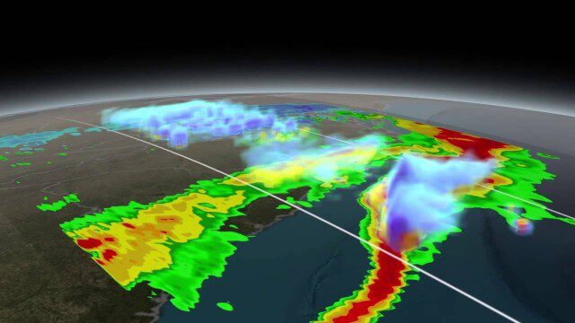
NASA Scanning a Snow Storm
2.30K Views0 Comments0 Likes
On March 17, 2014, the Global Precipitation Measurement (GPM) mission's Core Observatory flew over the East coast's last snow storm of the 2013-2014 winter season.
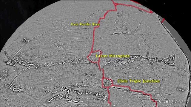
Draining the Ocean Basins with CryoSat-2
2.28K Views0 Comments0 Likes
This is the supplementary video for the scientific article "New global marine gravity model from CryoSat-2 and Jason-1 reveals buried tectonic structure". The full paper is available at: sciencemag.org/content/346/6205/65


