
Monthly Archives: July 2014
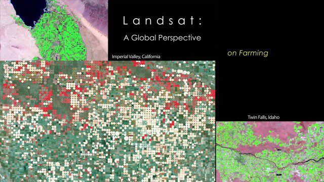
NASA | Landsat’s Global Perspective
2.14K Views0 Comments0 Likes
On July 23rd, 1972, the first Landsat spacecraft launched into orbit. At the time, it was called "Earth Resources Technology Satellite," or ERTS, and was the first satellite to use a scanning spectrophotometer. Previous satellites relied on film cameras (ejecting the exposed film to be caught by planes) or transmitted the signal from television cameras. The scanning sensor and its successor sensors on subsequent Landsat satellites revolutionized how we study our home planet. Celebrating this anniversary, this video is a "greatest hits" montage of Landsat data. Throughout the decades, Landsat satellites have given us a detailed view of the changes to Earth's land surface. By collecting data in multiple wavelength regions, including thermal infrared wavelengths, the Landsat fleet has allowed us to study natural disasters, urban change, water quality and water usage, agriculture development, glaciers and ice sheets, and forest health.

7_1 Drones Broadcast (SPOT 7, Minerals Cadastre and More)
3.43K Views0 Comments0 Likes
This GeoSpatial Stream broadcast discusses the banning of drones from U.S. National Parks; the launch of SPOT 7; a Tanzanian effort to improve its mining cadastre; the first private Russian remote-sensing satellite; industry news from IMAGINiT Technologies, GeoVille, CartoDB, Esri and Boundless; an article in Sensors & Systems; and more.
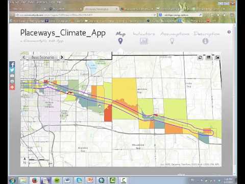
CommunityViz Web App
3.08K Views0 Comments0 Likes
Providing users with the ability to open new opportunities for education, citizen engagement, and policy change, the app enables users to quickly share their analysis results—such as energy and greenhouse gas generation and possible energy futures—with their ArcGIS Online organization, select groups, or the general public.


