
Tag: infrastructure
Working from Reality Capture to Modeling to Consumption
3.61K Views0 Comments0 Likes
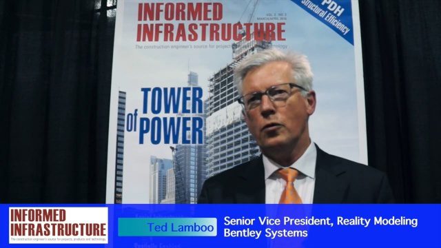
The V1 Video team interviewed Ted Lamboo, Senior Vice President of Reality Modeling for Bentley Systems, at the 2016 SPAR 3D Expo and Conference, held April 11-14 in The Woodlands, Texas. He discusses reality modeling and the full cycle from capture to modeling to consumption, Bentley products used in that cycle such as ContextCapture, and examples of such use in highway design and substation modeling.
6_16 Infrastructure Broadcast (PDH Credit, HxGN Live and More)
2.49K Views0 Comments0 Likes
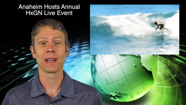
This Infrastructure-themed GeoSpatial Stream broadcast discusses the latest issue of Informed Infrastructure, including an article on Treasure Island bridge design, PDH credit for an Autodesk benchmark study, and new Web site features and interviews; video clips from the recent HxGN Live event covering Hexagon's latest technologies and direction; industry news from Hexagon, CINTEC America, Contech Engineered Solutions and CoreLogic; thoughts on an upcoming road trip across America's infrastructure; and more.

OcuTech 360 Video Mapping
3.65K Views0 Comments0 Likes
OcuTech 360 is an inclusive provider of 360 degree visual technologies that are applied in geospatial mapping. Thanks to state of the art hardware and software, you can now digitize infrastructure and interact with data in 3D space, take 3D measurements, and annotate. For more info, please visit ocutech360.com or contact [email protected].

Capturing the Iconic Red Rocks Park and Amphitheater
9.96K Views1 Comments0 Likes
The V1 Video Team made a site visit to Red Rocks Amphitheater and Park to capture video interviews and witness an ambitious drone-based reality-capture exercise to photograph and model the mountain park. The visualization team from engineering firm Kimley-Horn captured the area for the City and County of Denver, which owns and maintains the park. Autodesk and its partner 3D Robotics were on hand to demo their collaboration on SiteScan, which creates an automated workflow from drone capture to use within Autodesk’s modeling software. The mission had many purposes, including historical archiving of the park, modeling stormwater erosion, tracking trail maintenance, and building acoustics and lighting models for the amphitheater.
St. Anthony Regional Stormwater Treatment and Research System
1.30K Views0 Comments0 Likes
An estimated 169 million gallons of polluted stormwater runoff will be captured and treated each year by this underground facility on the border of Minneapolis and St. Anthony Village. It is projected to cut pollution levels by more than half for stormwater runoff flowing from the southern half of St. Anthony Village to the Mississippi River. Learn more at http://mwmo.org/sav

8_4 Infrastructure Broadcast (TIGER Grants, Transit Tech and More)
2.29K Views0 Comments0 Likes
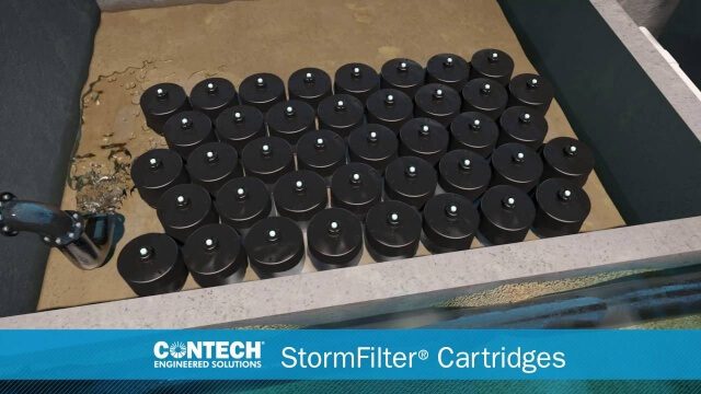
This Infrastructure-themed GeoSpatial Stream broadcast discusses $500 million in grants from the USDOT's TIGER program; highlights from the latest issue of Informed Infrastructure magazine; new virtual reality technology to promote transit; industry news from Pix4D, Thinkbox Software and the Global Infrastructure Hub; a video from the Mississippi Watershed Management Organization about a stormwater filtration system recently installed near Minneapolis; and more.
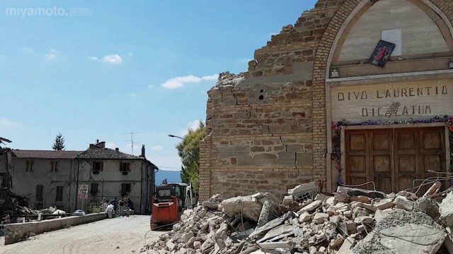
Italian Village Damaged by Earthquake Assessed by Engineers
1.40K Views0 Comments0 Likes
Miyamoto International performs damage assessments throughout the areas affected by the earthquake.

Software Aids Stormwater and Sewage Infrastructure Design
1.36K Views0 Comments0 Likes
Urbano software is used for the design of sewage and water distribution networks. Urbano Canalis is the module used for design of storm and sanitary sewage systems. You can create complete storm and sanitary sewage system designs, starting from the initial network definition to the analysis of hydraulic results.
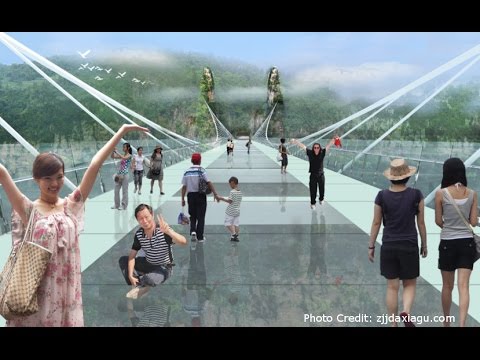
Safety Test of World’s Longest Glass Bridge
1.60K Views0 Comments0 Likes
The world's highest and longest glass bridge, Zhangjiajie Grand Canyon Glass Bridge, opened to the public on Aug. 20, 2016. It offers a way to enjoy a panoramic view of the stunning Zhangjiajie Grand Canyon — if you dare to walk on it!
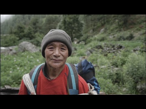
Engineers Analyze Post-Earthquake Conditions in Himalayas
1.26K Views0 Comments0 Likes
Following the M-7.8 earthquake here in April 2015, Dr. Kit Miyamoto and an assessment team traversed the Himalayas, analyzing post-earthquake conditions on popular trekking trails.


