
Tag: GeoSpatial Stream

Jack Dangermond Implores GIS Community to Get Involved to Make a Difference (4 of 4)
16.75K Views0 Comments0 Likes
In the final of four installments, Todd Danielson interviews Jack Dangermond, President and Founder, Esri, at the 2014 Esri User Conference in San Diego. Jack talks about his passion to solve problems, sometimes at a global scale, and enabling the next generation to help tackle the world's problems. He also encourages the GIS community to "move out and play at 100 percent."

7_23 Esri UC Broadcast (Video Recap, Exhibitor News and More)
5.86K Views0 Comments0 Likes
This GeoSpatial Stream broadcast covers news and events from the recent Esri User Conference in San Diego, including a video recap of speakers and topics; news from Esri on the Special Achievement in GIS Awards, its Tapestry Segmentation system and a partnership with European Schoolnet; exhibitor news from Topcon Positioning Group, Airbus Defense and Space, LizardTech and Scene Sharp; a clip from an interview with Jack Dangermond, Esri's president and founder; and more.

Topcon Products Enable Mapping from Ground, Air and Vehicles
4.49K Views0 Comments0 Likes
Todd Danielson interviews Barbara McInerney, Product Marketing Manager, Topcon GeoPositioning Solutions Group, at the 2014 Esri User Conference in San Diego. They discuss Topcon's GIS and mapping solutions in three main areas: from the ground, from the air and in a vehicle.

Esri’s Director of Solutions Discusses Apps, Simplicity and Passion
7.55K Views0 Comments0 Likes
Todd Danielson interviews Damian Spangrud, Director of Solutions, Esri, at the 2014 Esri User Conference in San Diego. They discuss what it's like working at Esri, the tools needed to create a public-facing GIS app and "never underestimating how simple things need to be."

GEO Looking to Increase Partnerships with the Private Sector
4.58K Views0 Comments0 Likes
Matt Ball interviews Barbara Ryan, Director, Group on Earth Observations (GEO) Secretariat, at the 2014 Esri User Conference in San Diego. Ryan discusses her role at GEO; a key meeting in Geneva, Switzerland; the next 10 years at the organization; and its growth in partnering with the private sector.

ikeGPS Demonstrates New Spike Device at Esri UC
4.03K Views0 Comments0 Likes
Brian Soliday, Senior VP of Sales, ikeGPS, demonstrates the company's new Spike measurement device at the 2014 Esri User Conference in San Diego. Featuring a laser, accelerometer and 3-D compass, combined with a camera and GPS, Spike provides and quick and easy way to "measure the world around you."

Spike Kickstarter Video from ikeGPS
3.86K Views0 Comments0 Likes
Spike is the world’s first laser accurate Smartphone measurement solution enabling you to safely and accurately measure an object up to 600 feet (200 m) away. With a simple snap from your Smartphone, you can measure height, width, and area from a photo, and capture target location. Measurement and location are saved with the picture, and can be easily shared via email as a PDF or Spike File (XML).

7_30 Asia-Pacific Broadcast (Deforestation, Beijing Smog and More)
4.57K Views0 Comments0 Likes
This Asia-Pacific-focused GeoSpatial Stream broadcast discusses deforestation in Indonesia; IBM joining Beijing's fight against smog; Asian effects on mobile-device charging; Pakistan's move toward space technology; satellite imagery use in Australian vineyards; industry news from Spatial Dimensions, ScanEx, Maptek and Esri; geospatial insight into Indonesian politics; and more.
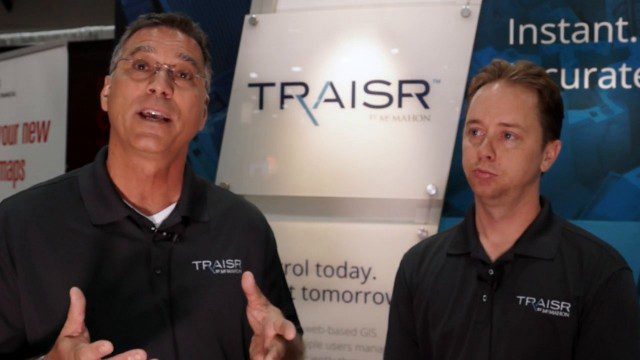
Traisr Makes Asset Management Simple, Safe and Secure
5.23K Views0 Comments0 Likes
Todd Danielson interviews John DePalma, Principal, and Brian Berdel, Chief Information Officer, McMahon Associates Inc., at the 2014 Esri User Conference in San Diego. They discuss the company's new product, Traisr, which integrates with multiple platforms to monitor fixed and mobile assets as well as deliver consumer Web portals.
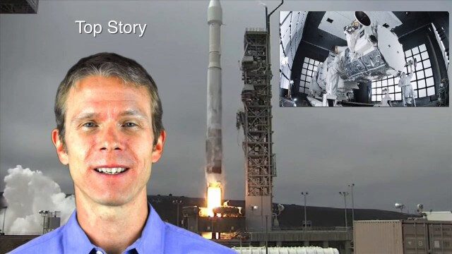
8_14 Remote-Sensing Broadcast (WorldView-3 Launch, NASA Satellites and More)
4.24K Views0 Comments0 Likes
This remote-sensing themed GeoSpatial Stream broadcast discusses the launch of DigitalGlobe's WorldView-3 satellite and its implications; NASA's carbon dioxide- and weather-monitoring satellites; an award for NGA Director Letitia Long; industry news from Esri and CartoDB; the Center for Satellite-Based Crisis Information; and more.


